Forecast for the Uintas Area Mountains

Issued by Craig Gordon on
Sunday morning, January 28, 2018
Sunday morning, January 28, 2018
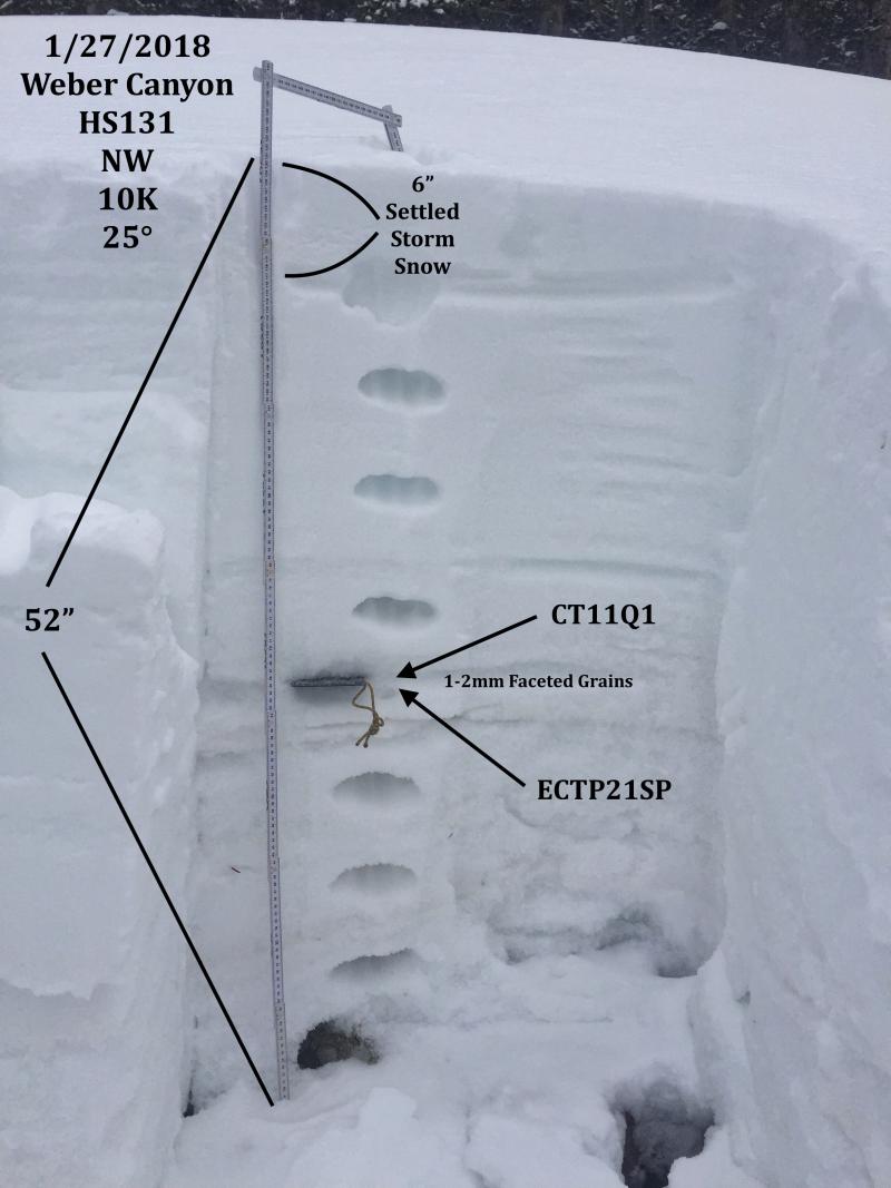
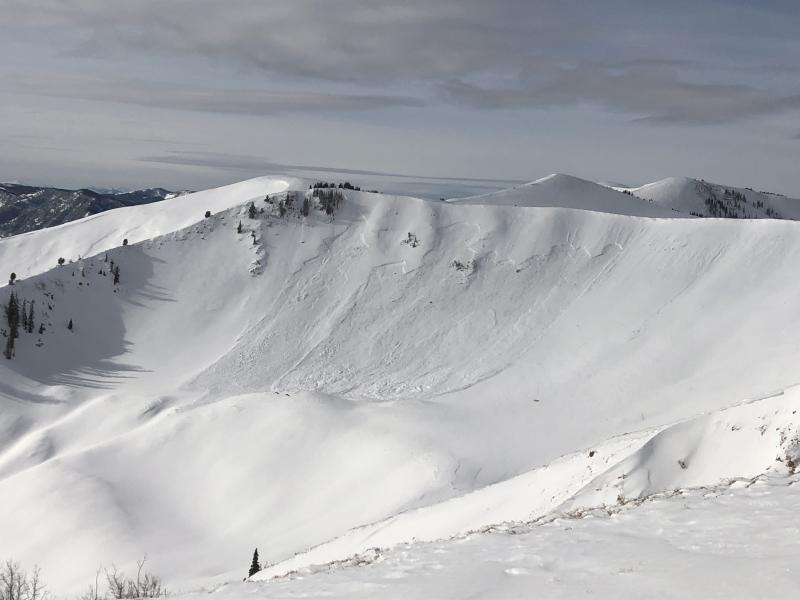
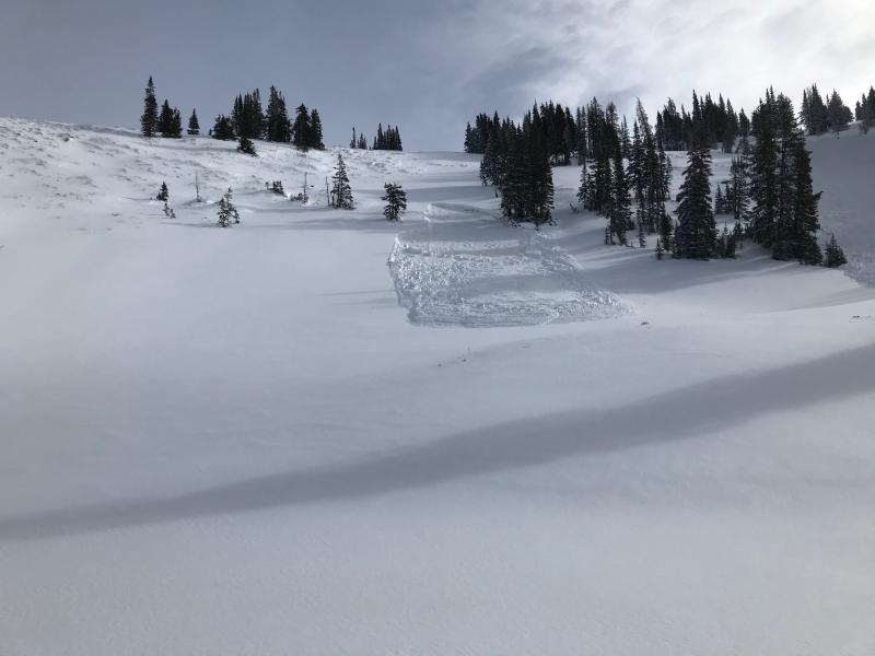
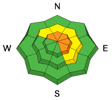
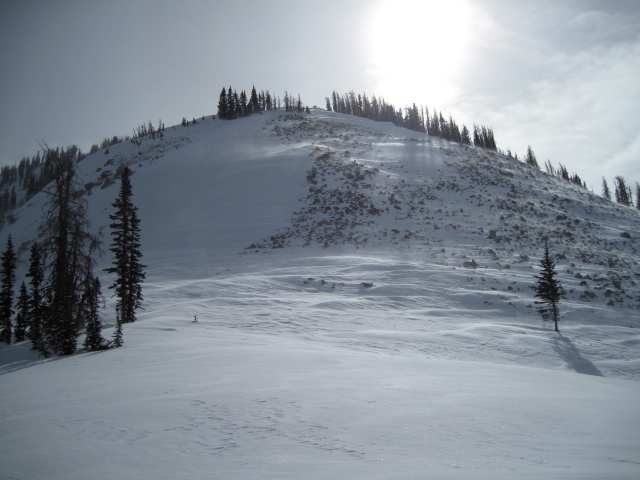
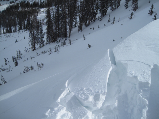
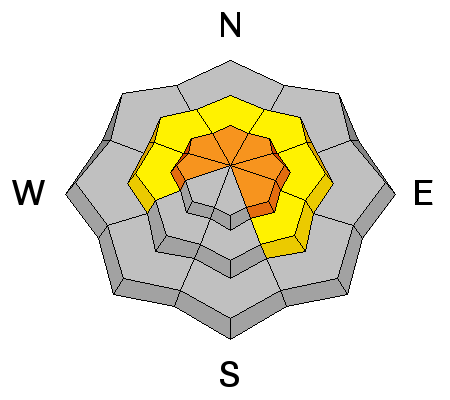
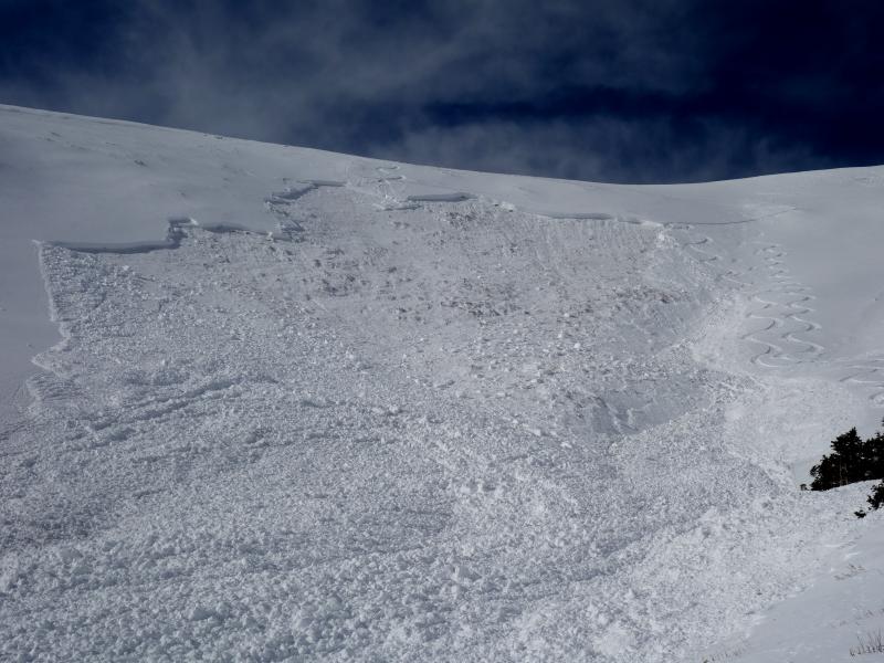
While not widespread and limited to terrain in the wind zone at and above treeline, the avalanche danger is CONSIDERABLE. Human triggered avalanches are likely on steep, wind drifted slopes, especially those facing the north half of the compass and particularly those with an easterly component to their aspect. Once triggered, today's avalanches can quickly get out of hand if they break into weak layers of snow now buried several feet deep in our snowpack.
Mid elevation terrain offers MODERATE avalanche danger and human triggered avalanches are possible on steep leeward slopes with recent deposits of wind drifted snow.
Most wind sheltered mid and low elevation terrain, especially south facing slopes offer generally LOW avalanche danger.
Low
Moderate
Considerable
High
Extreme
Learn how to read the forecast here