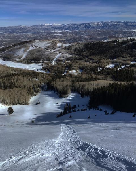
Progression of danger roses and overall hazard rating from 12/29 - 1/4. (Click on the day of the week for the archived forecast for that day.)
| Friday | Saturday | Sunday | Monday | Tuesday | Wednesday | Thursday | |
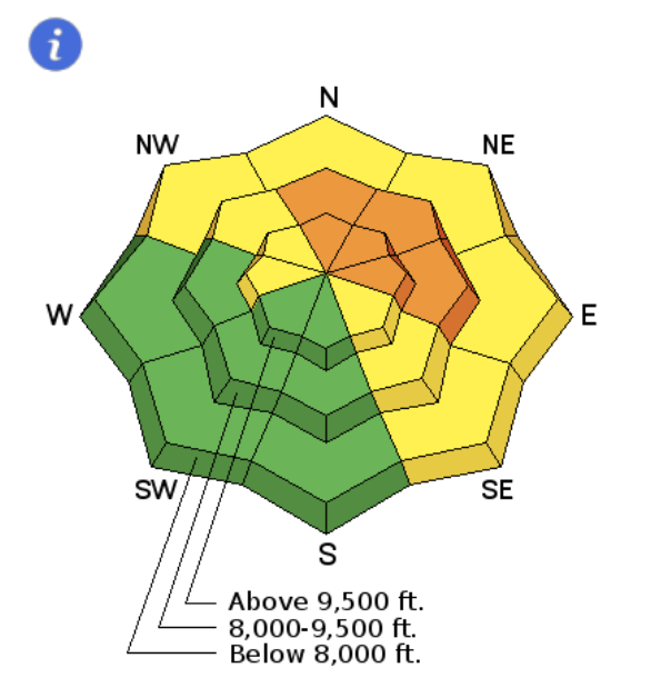 | 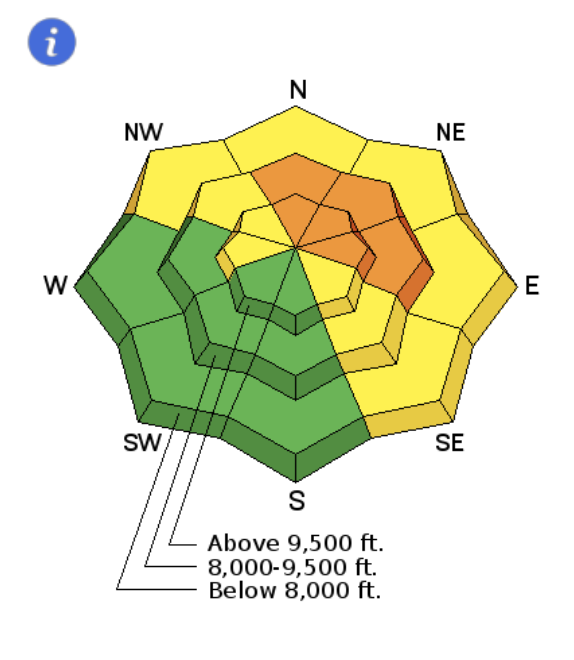 | 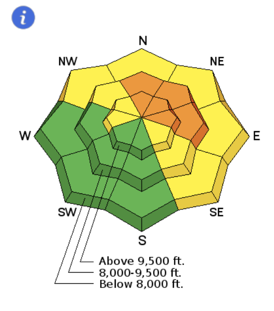 |  |  |  | | |
| Considerable | Considerable | Considerable | Considerable | Moderate | Moderate | Moderate |
Friday December 29: A skier-triggered avalanche occurred in Dry Fork. This avalanche was 2.5' deep and 100' wide, running 400' vertical. It was a persistent slab avalanche, failingin faceted snow that formed during the earlier part of the winter. Trent produced the excellent video below, describing the avalanche, as well as the overall persistent slab problem.
Saturday December 30 - Thursday January 4: Our continued pattern of no storms with mostly clear skies. Moderate west/northwest winds were observed, particularly early in the week, but they only produced small pockets of unrepsonsive wind-slabs. Observers reported continued collapsing in the snowpack, but much less common than over the week between Christmas and New Years. The clear skies have helped to weaken the snowpack, especially at the surface, as pro observer Mark White's photo of sluffing in the weak surface snow illustrates: