Forecast for the Ogden Area Mountains

Wednesday morning, December 20, 2017
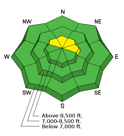
As the storm moves in today, the avalanche danger will rise to MODERATE and heightened avalanche conditions will exist. Human triggered avalanches will be possible as strong southwest winds and moderate snowfall will form wind slabs in high elevation terrain facing northwest through east today. Evaluate snow and terrain carefully - avoid steep slopes with freshly wind drifted snow.
Loose dry snow avalanches and storm slabs will also be possible in sheltered high elevation terrain as new snow lands on the weak existing surface snow. If we experience stronger winds or more than expected snowfall, there is a chance the danger will rise to Considerable with the potential for natural avalanche activity.
Very thin snow cover exists across the zone so even getting caught in a small avalanche could drag you over rocks, stumps and other barely buried hazards.