

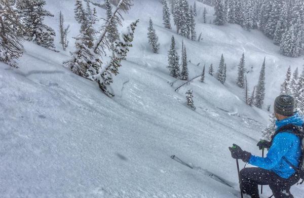
This past week has been highlighted by the see-sawing of storm and bluebird days, with avalanche activity ranging from storm and wind slabs during stormy periods, to predictable wet activity on sunny days.
A weak storm on Saturday delivered 4-6" by late in the day in the central Wasatch. Sunday started cool & clear, but the strong March sun brought the usual round of shallow wet loose activity by mid-day.
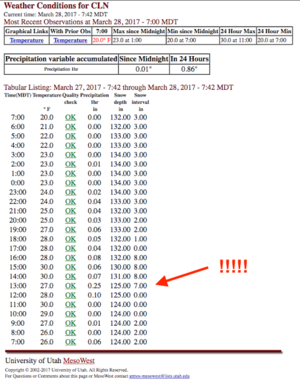
Monday was a classic March storm, with snow totals ranging from 6-13" during the day. A particular highlight was Alta recording 7" of snow from noon - 1 pm.
Jim Steenburgh has a nice write up of this phenomenon on his classicWasatch Weather Weeniespage. During the day Monday there were widespread sensitive storm snow instabilities, including a natural cycle during the height of precipitation intensity.
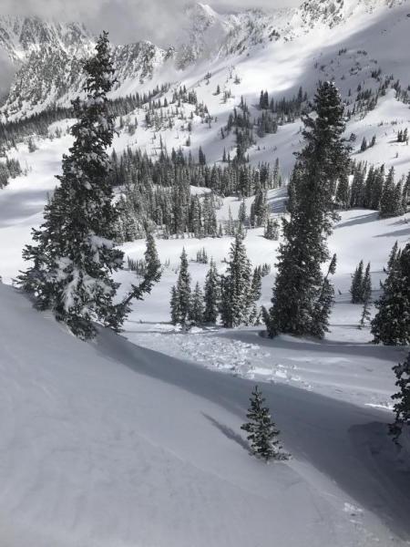
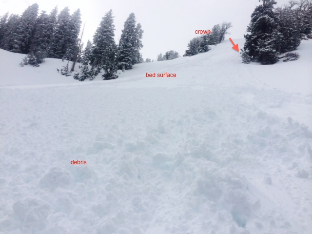
Tuesday was a transition day with both wet slab activity, as well as sensitive wind slabs in the upper alpine regions, reported.
By Wednesday, warm and clear conditions signaled the return to loose wet activity, especially on steep southerly aspects.
Thursday flipped back to unsettled weather as a modest storm entered the region, depositing 5-8" across the Salt Lake and Park City mountains by Friday morning.


