Skies are clear and mountain temperatures this morning are in the low 40's F. in the Provo mountains. Winds are light and out of the west, gusting to less than 10 mph.
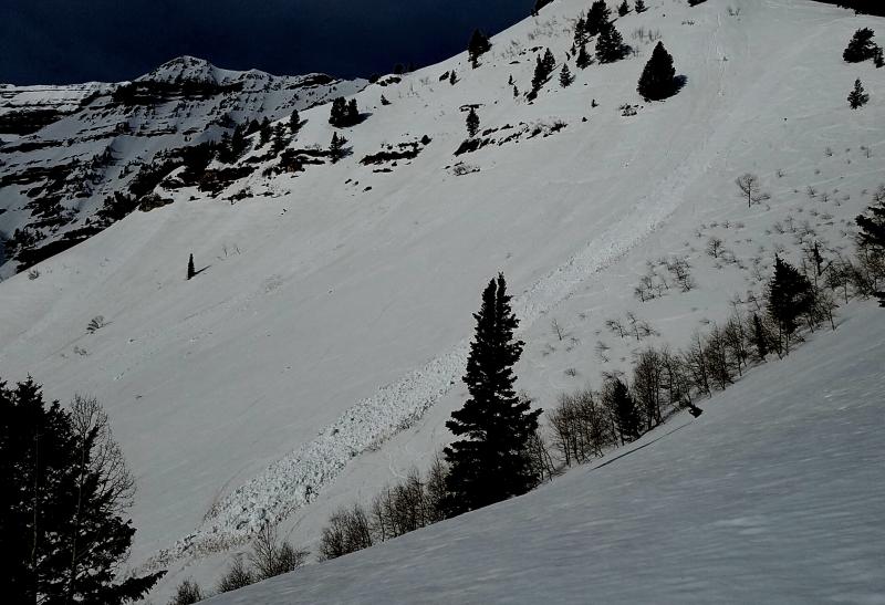
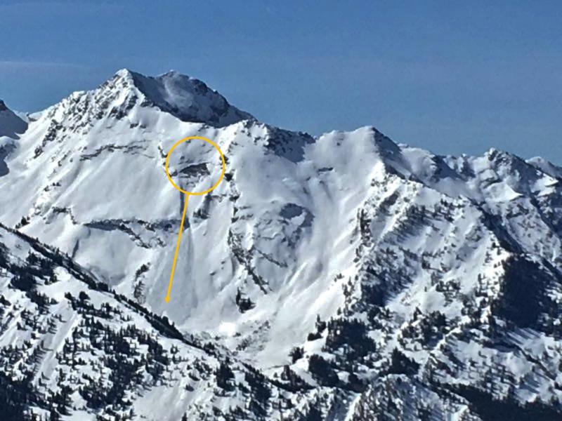
Very few observations from Thursday, although we received an excellent observation from the Provo mountains from Joey Dempster.
For those who enjoy non-fiction horror, the week in review appears below, and more details can be found here.
Week in Review:
The most dominant ridging pattern of the otherwise excellent 2016/17 winter season has placed a stranglehold on the Wasatch. High and low temperatures observed this week at Alta guard station at 8800' in Little Cottonwood Canyon:
Saturday 3/11 46/28
Sunday 3/12 40/29
Monday 3/13 50/29
Tuesday 3/14 52/33
Wednesday 3/15 54/37
Thursday 3/16 51/34
As can be seen, it has been several days without below freezing temperatures. Other stations recorded much higher maximum and minimum temperatures throughout this period, reaching the upper 50's at many mountain locations, with overnight lows only dropping into the upper 30's and low 40's.
South facing aspects began getting active with wet loose naturals on Tuesday. The waterfall coming out of White Pine Canyon in Little Cottonwood also began flowing on Wednesday. Despite the heat, wet activity began to settle down by Wednesday, an indication the snowpack has adjusted to the warming.
The only activity reported from Thursday were small, loose wet sluffs and a small natural cornice fall in Dry Fork in American Fork Canyon.