Forecast for the Skyline Area Mountains

Issued by Brett Kobernik on
Monday morning, February 20, 2017
Monday morning, February 20, 2017
The majority of the terrain has a LOW avalanche danger today. Watch for "pockety" areas of fresh wind drifted snow along the higher ridges. Natural avalanches are quite unlikely but there's a slight chance a person might find a small wind slab to release.
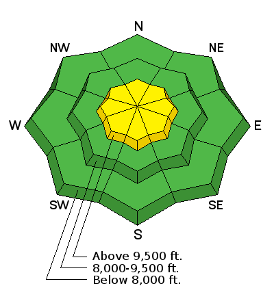
Low
Moderate
Considerable
High
Extreme
Learn how to read the forecast here