Forecast for the Uintas Area Mountains

Craig Gordon
Issued by Craig Gordon for
Thursday, January 26, 2017

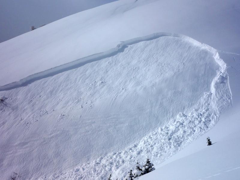
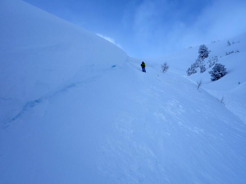
Heads up... avalanche conditions will be changing the next few days as the snow sees it's first glimpse of sun and warming temperatures.

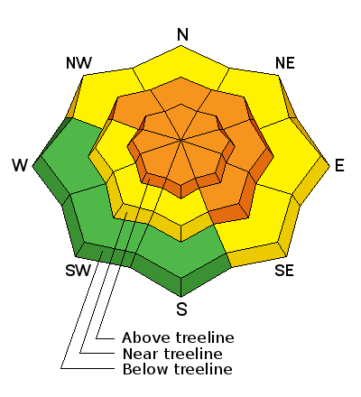
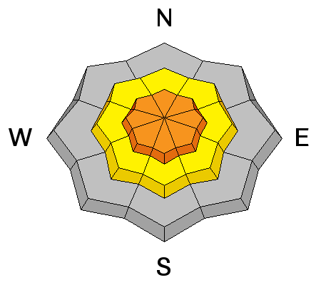
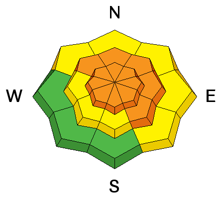
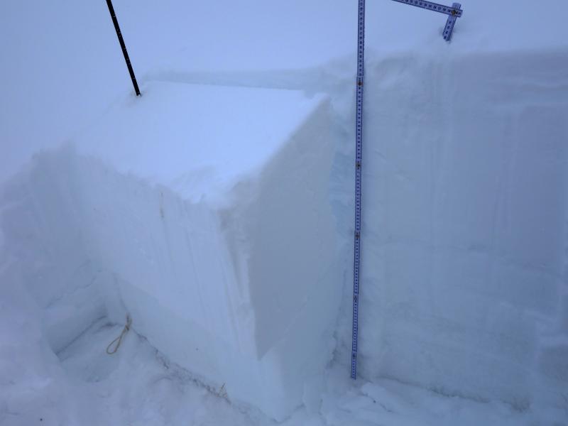
In mid and upper elevation terrain, at and above treeline, the avalanche danger is CONSIDERABLE. Human triggered avalanches are LIKELY on steep slopes, especially those on the leeward side of upper elevation ridges and particularly those with an easterly component to their aspect. Remember- any avalanche that breaks to weaker snow, now buried deep in the snowpack will get out of hand quickly, resulting in a dangerous slide.

A MODERATE avalanche danger is found on steep, lower elevation terrain and human triggered avalanches are POSSIBLE on steep, shady slopes.

Most low elevation slopes facing the south half of the compass offer LOW avalanche danger.

Low
Moderate
Considerable
High
Extreme
Learn how to read the forecast here
Special Announcements

Huge thanks to the crew from Cycle City for hosting last nights avy awareness presentation and also to everyone who came out to support our gig and create a great vibe. As mentioned last night, we still have a few spots open for our sled specific avy and riding skills work shop. Details are found here.

Weather and Snow

Under a cold, moist, northwesterly flow, a few flurries are in the air and temperatures remain in the icebox... hovering near and just below zero degrees. In the past 24 hours a couple inches of chin tickling, ultra-light, Utah fluff has fallen. Along the high ridges, west and northwest winds picked up late yesterday are currently blowing 15-25 mph producing a wind chill of -25 degrees. Of course, you'll forget about the cold in a hurry, because the riding and turning conditions are about as good as it gets.


Real time wind, snow, and temperatures for the Uinta's are found here

Another beautiful JG pit profile clearly illustrating our current snowpack setup. JG was in the Hoyt Peak environs and his take on things is found here.

Snowpack observations and trip reports are found here.

Recent Avalanches


Our light fluffy snow is consolidating and reacting more like a slab. Dave and his partner remotely triggered this 3' deep slab yesterday on an upper elevation, southeast facing slope. Dave's got a great write-up here. (Kikkert photo)

A full list of Uinta avalanche activity is found here.

Ad
Avalanche Problem #1
Wind Drifted Snow
Type
Location
Likelihood
Size
Description

Our manageable avalanche problem today are fresh drifts along the leeward side of mid and upper elevation ridges and it doesn't take much wind to blow the recent light density snow around and form drifts sensitive to our additional weight. Todays soft slabs are manageable because they'll break at or below our skis, board, or sled. However, once triggered any avalanche can grow into a bigger problem if it breaks into weaker snow now buried several feet deep in the snowpack. You're best bet right now is to avoid steep wind drifted slopes. Give the big bowls a few more days and let them get comfortable in their own skin.

Avalanche Problem #2
Persistent Weak Layer
Type
Location
Likelihood
Size
Description

Our unmanageable avalanche problem is harder to detect unless we spend a little time and dig into the snow to investigate. What you'll find with minimal effort are weak, sugary, near surface facets and surface hoar. These notoriously tricky and persistent weak layers are now buried a couple feet deep in our snowpack and until recently, have been in their happy place and live is good. However, now that the storm snow is starting to consolidate and settle, these dormant layers are coming back to life. Adding to the complexity is that many slopes avalanched naturally during our recent storm cycle, but there's still plenty more that just need a trigger like us to come along and knock the legs out from underneath them. It's a tricky setup for sure, but it doesn't have to be a roll of the dice and the solution for the next couple of days is easy. Either do a little homework, dig around and identify slopes that have a suspect snowpack or simply avoid being on, under, or connected to steep slopes, especially those facing the north half of the compass and particularly those with an easterly component to their aspect. Remember- any avalanche that breaks into weak layers buried deep in the snowpack will be dangerous.


Above... this is the kind of avalanche dragon we're dealing with today.

With a little homework you can clearly identify the weak snow. In this pit, clean shears reveal a persist buried weak layer.

Additional Information

A cold, moist, northwest flow continues across the region today with occasional light snow showers. Under mostly cloudy skies, high temperatures barely reach into the mid teens during the day and dip into negative territory tonight. Northwest winds blow 15-25 mph along the high ridges. The flow veers around to the north tonight and northeasterly on Friday, ushering in a strong drying and warming trend. Dry and warm for the weekend.

General Announcements

Remember your information can save lives. If you see anything we should know about, please participate in the creation of our own community avalanche advisory by submitting snow and avalanche conditions. You can call me directly at 801-231-2170, email [email protected]

The information in this advisory is from the US Forest Service which is solely responsible for its content. This advisory describes general avalanche conditions and local variations always occur.

The information in this advisory expires 24 hours after the date and time posted, but will be updated by 7:00 AM on Friday January 27th.