Forecast for the Skyline Area Mountains

Issued by Brett Kobernik on
Monday morning, December 26, 2016
Monday morning, December 26, 2016
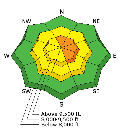
The avalanche danger is CONSIDERABLE on the very steep north through south east slopes above 9500' where the wind has been drifting snow. There is a MODERATE avalanche danger in the mid elevations where the wind has drifted snow. Human triggered avalanches are possible today. The snowpack should stabilize fairly quickly but don't just jump into the big terrain right away. Look for recent avalanches. Use steep "test slopes" with no consequences to see if you can initiate any cracking.
Low
Moderate
Considerable
High
Extreme
Learn how to read the forecast here


