Forecast for the Skyline Area Mountains

Tuesday morning, February 23, 2016
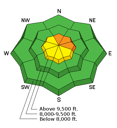
The 4 to 6 inches of new snow coupled with some stronger wind along the highest terrain has increased the avalanche danger to CONSIDERABLE on specific slopes. Today and Wednesday are the most likely days to trigger an avalanche that breaks to the ground. Areas of concern are north through east facing slopes approaching 40 degrees in steepness which have already avalanched earlier this season and are filled back in. The additional weight of the new wind blown snow will make these slopes more sensitive again. Out of the described terrain the avalanche danger is generally LOW to MODERATE. Slopes under 35 degrees in steepness are also much safer.


