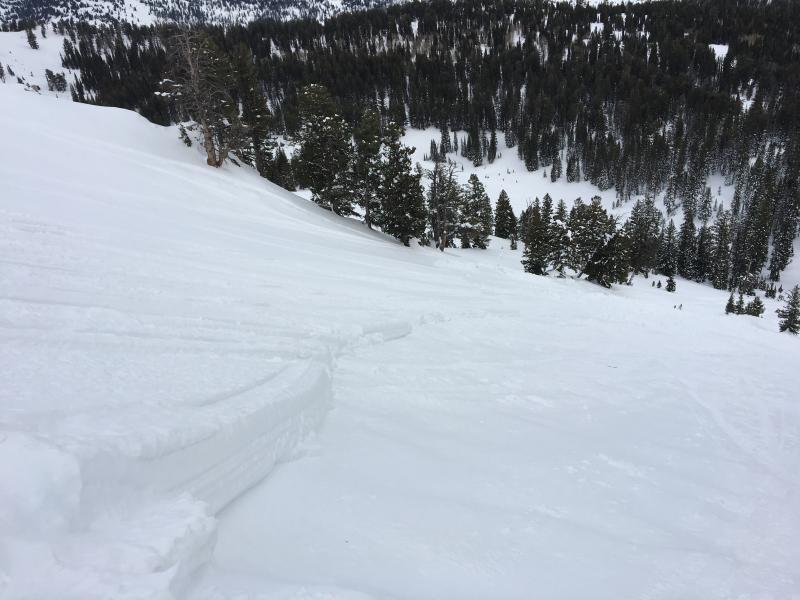
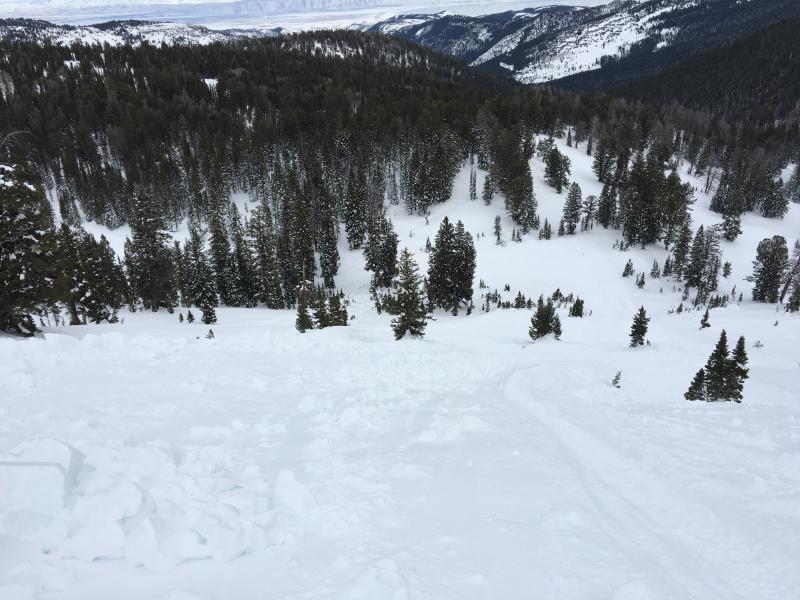
When a party of four riders entered the bowl from the top it was completely untracked and nice smooth powder. The east facing slope south of Saint Charles Peak is committing because there is no good way to ride out the bottom, so you have to come back up the hill in order to exit the drainage. The party played around on adjacent slopes and two had successfully climbed back out of the 36 degree slope a few times.
The slope had several tracks in it at the time of the avalanche. One rider climbed to the saddle on the top and watched, and a second was at the bottom also watching as the third attempted the climb. On the second attempt, the 47-year-old rider's sled did not have quite enough power to make the climb, and he turned near the top of the slope. The snow on the slope fractured even as the rider guided his sled in a rightward arc back down the hill.
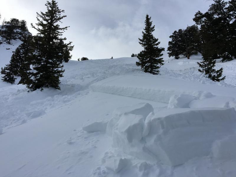
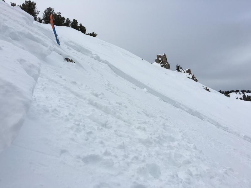
The avalanche caught rider and sled near the south flank and a large rock held up the sled for a bit while the rider was carried (he mentioned using swimming motions) to near the toe at the bottom of the avalanche, ending up about 150' below his sled, face-down and partially buried in the debris. The fourth rider was below on the slope and heading up when the slope fractured. He decided to keep his sled pointed up the hill and rode on top of the slab, the throttle pegged, track spinning like a treadmill as the slab ran underneath, leaving him safely on the bed surface.
The other riders were able to get down to the lucky survivor and had him out of a face-down partial burial quite quickly. He was quickly spotted by his companions, and they had him out of the debris in "really only a couple minutes." Thankfully, now He is mainly only shaken, and recovering from minor injuries. The sled was damaged in the avalanche, but the party repaired it in the field the next day and rode it out of the hole.
This slope has a particularly notable history of avalanche accidents. It is the site of an epic January 11, 2014 rescue, where a rider was fully buried, suffered a double femur fracture, and had to be hauled up 1600' by rope. The rescue ended up going on well into the night, and involved about 50 rescuers from Cache, Franklin, and Bear Lake Counties. Read Report
The same slope was the site of a tragic fatality on February 19, 2000. Read Report
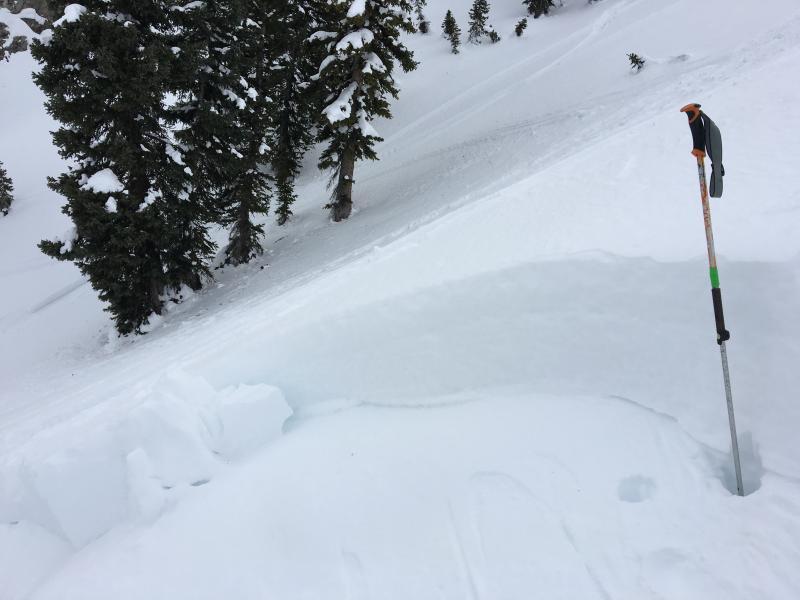
The avalanche occurred on a mostly east facing slope and started at around 9200' in elevation. The toe of the avalanche was at around 8700'. The slope measures only about 36 degrees in steepness in the steepest area, and I measured the Alpha angle of this avalanche at 25 degrees.
Profile from south side of crown, but snow structure was quite similar through the entire crown
I could not produce a failure on the failing layer in tests near the crown and south flank, but it's a few days later, and the entire slope obviously collapsed during the event, causing the avalanche. I did produce an ECTP (27) result, with failure on basal facets well below the 12/8-9/15 rime-crust.

It looks like a sledder got caught and carried in this large avalanche, but I don't know the scary story, The sustained 36 degree slope in the starting zone is not extremely steep, but the avalanche was pretty large. Tracks and evidence of excavation in the huge debris pile tell the story of a close call and I'd love to hear what actually happened.
