Forecast for the Provo Area Mountains

Tuesday morning, November 3, 2015
Winter is on the way, and we will issue intermittent avalanche forecasts as conditions warrant.

Winter is on the way, and we will issue intermittent avalanche forecasts as conditions warrant.

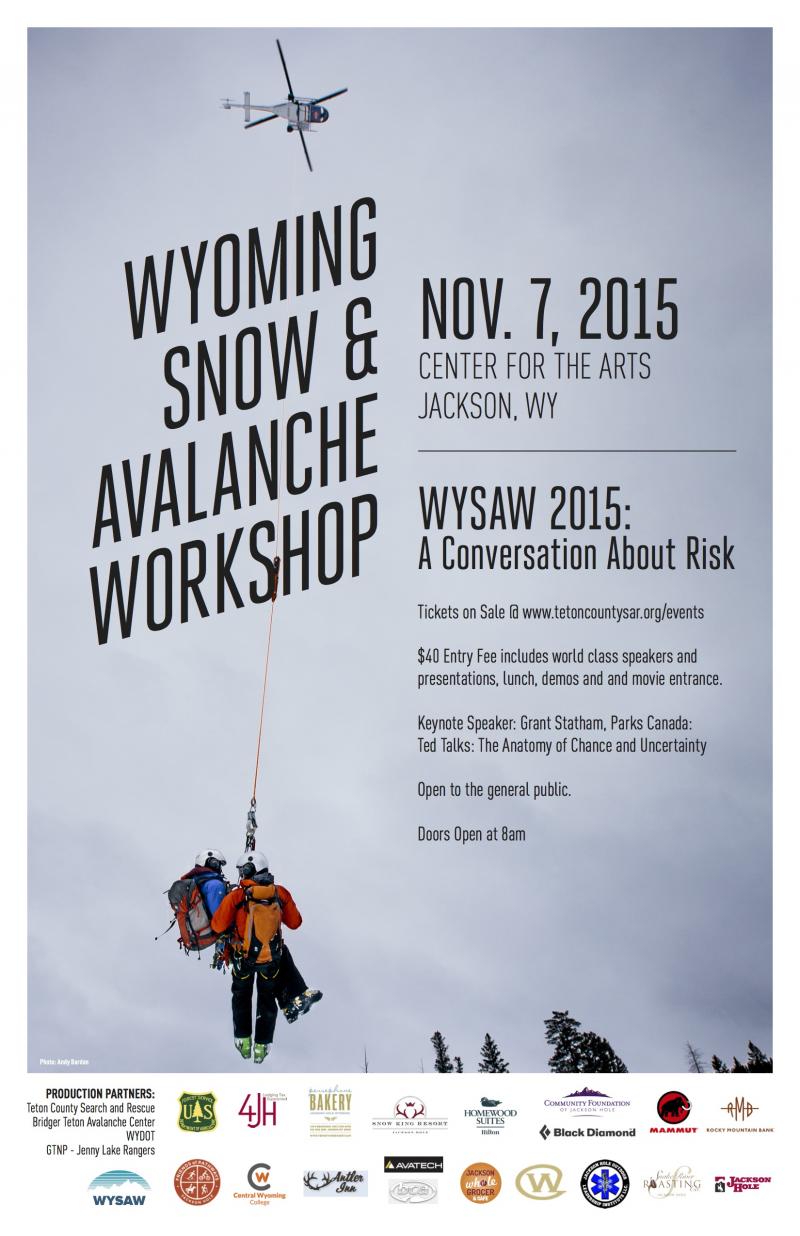
If you enjoyed the Utah Snow and Avalanche Workshop, head north to Jackson this weekend (Saturday/Nov 7) for the inaugural Wyoming Snow and Avalanche Workshop (WYSAW). I'll be chairing a panel in the afternoon on RISK as it relates to decision making in the wintertime alpine and backcountry environment. Hope to see you there -
Panelists include
Renny Jackson (retired head of Teton NP climbing rangers and just returned from a climbing trip in the Himalayas)
Evelyn Lees (yes, our very own Evelyn Lees - long time UAC forecaster and chief guide of Exum Mountain Guides in the Tetons)
Don Carpenter (owner of American Avalanche Institute)
Grant Statham (long-time Avalanche Risks Specialist for Parks Canada)
Molly Absolon (long time skier/climber and writer on Risk)
Jamie Yount (head avalanche forecaster for Wyoming DOT)
Ron Johnson (long time avalanche forecaster for the Gallatin Avalanche Center and Jenny Lake Ranger, Grand Teton National Park).
Tom Kimbrough may make a special guest appearance as well.
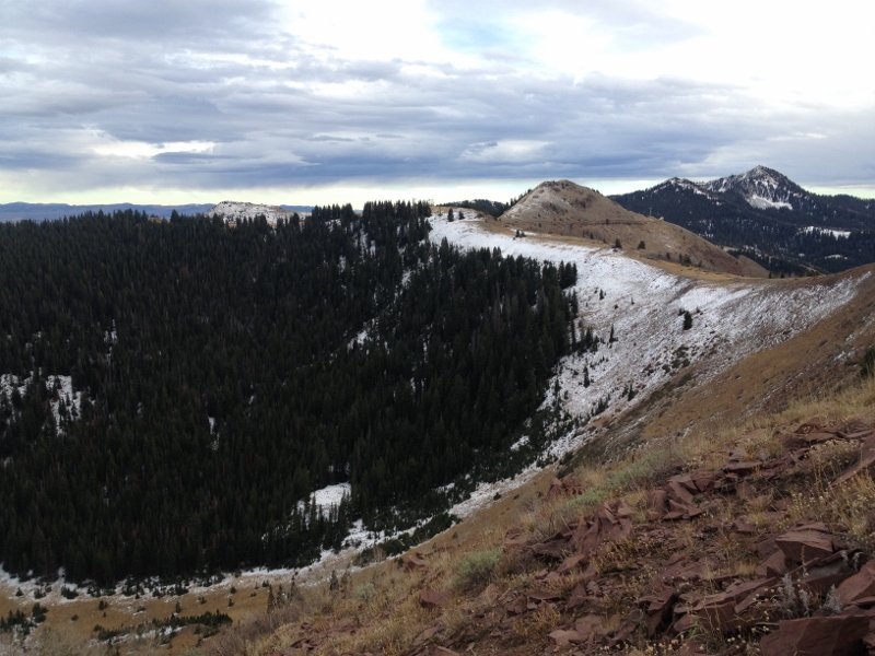
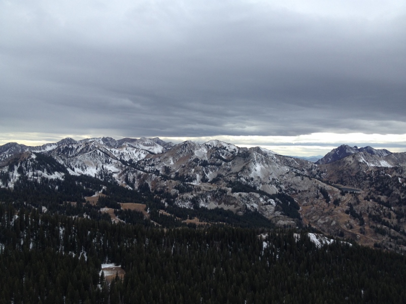
Pre-frontal news centers on the strong southerly winds (gusting into the 50s & 60s) and slightly cooling temps (currently upper 20s/mid 30s). Dribs and drabs of 1-3" fell sideways during the day but I'm not hanging my hat on this current storm to provide much of a base to get out and about. Only a few moth-eaten mostly damp inches of snow remain from the mid to late October "storms" and are patchy at best on the northerly aspects above about 9500'. And that may be a liberal estimate after running from 10,420' along the Wasatch Crest to West Monitor. (Check out Steve Achelis's WBSkiing map or - better yet - app). Photos by Z. Wilson below of South Monitor and the upper reaches of the Cottonwoods.
As Evelyn detailed a couple days ago, it's worth taking a look at the old snow distribution ahead of the storm. Any new snow will bond to the melted-away southerly and off-aspects; any new snow should bond well to the damp and warm snow surfaces lingering in the northerly terrain. It just looks like the bulk of the storm dives to the south.
Remember in this early season you must the mountain resorts as having a backcountry snowpack - we often have early season accidents each season.
Please check in as different mountain resorts have different uphill policies. You can see the uphill travel policy for each resort here.
We need your observations from the backcountry. See or trigger an avalanche? Shooting cracks? Hear a collapse? It's simple. Go here to fill out an observation.
Hate to use the S word (split storm), so I'll just carry on. Winds will really die down as they shift west and then northerly as the trof axis moves by. Much cooler air will filter into Utah and we'll see mountain temps drop into the low 20s and then mid-teens by Thursday. We may see another couple inches tonight and again tomorrow. Look for some clouds again Thursday night as a clipper moves by to the north. High pressure kicks in for the weekend with another better looking system on tap for Monday night into Tuesday. Stay tuned.

Remember your information can save lives. If you see anything we should know about, please participate in the creation of our own community avalanche advisory by submitting snow and avalanche conditions. You can also call us at 801-524-5304, email by clicking HERE, or include #utavy in your tweet or Instagram.
If you trigger an avalanche in the backcountry - especially if you are adjacent to a ski area – please call the following teams to alert them to the slide and whether anyone is missing or not. Rescue teams can be exposed to significant hazard when responding to avalanches, and do not want to do so when unneeded. Thanks.
Salt Lake and Park City – Alta Central (801-742-2033), Canyons Resort Dispatch (435-615-3322)
Snowbasin Resort Dispatch (801-620-1017), Powder Mountain Dispatch (801-745-3772 x 123).
Sundance Dispatch (801-223-4150)
EMAIL ADVISORY If you would like to get the daily advisory by email you will need to subscribe here.
DAWN PATROL Hotline updated daily by 5-530am - 888-999-4019 option 8.
Twitter Updates for your mobile phone - DETAILS
UDOT canyon closures: LINK TO UDOT, or on Twitter, follow @UDOTavy, @CanyonAlerts or @AltaCentral
Utah Avalanche Center mobile app - Get your advisory on your iPhone along with great navigation and rescue tools.
Wasatch Powderbird Guides Blog/Itinerary for the Day.
Lost or Found something in the backcountry? - http://nolofo.com/
To those skinning uphill at resorts: it is your responsibility to know the resort policy on uphill travel. You can see the uphill travel policy for each resort here. IMPORTANT: Before skinning or hiking at a resort under new snow conditions, check in with Ski Patrol. Resorts can restrict or cut off access if incompatible with control and grooming operations.
Benefit the Utah Avalanche Center when you shop from Backcountry.com or REI: Click this link for Backcountry.com or this link to REI, shop, and they will donate a percent of your purchase price to the UAC. Both offer free shipping (with some conditions) so this costs you nothing!
Benefit the Utah Avalanche Center when you buy or sell on ebay - set the Utah Avalanche Center as a favorite non-profit in your ebay account here and click on ebay gives when you buy or sell. You can choose to have your seller fees donated to the UAC, which doesn't cost you a penny.
This information does not apply to developed ski areas or highways where avalanche control is normally done. This advisory is from the U.S.D.A. Forest Service, which is solely responsible for its content. This advisory describes general avalanche conditions and local variations always exist.