Join us for the 17th Annual Professional Snow and Avalanche Workshop (PROSAW) on November 4 - Purchase tickets here!

Forecast for the Logan Area Mountains

Toby Weed
Issued by Toby Weed on
Sunday morning, January 18, 2015

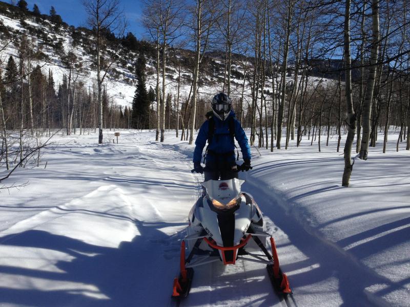
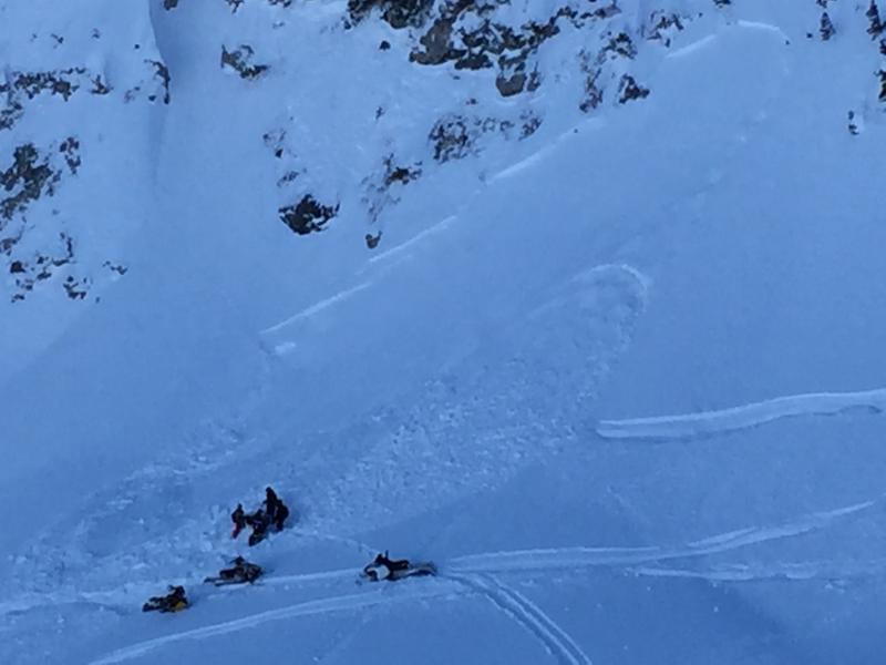
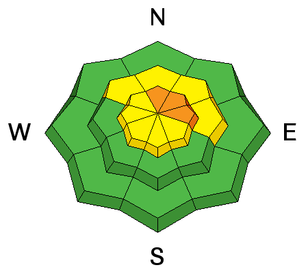
Heightened wind slab conditions exist and there's a MODERATE (level 2) avalanche danger in the backcountry. Conditions are more dangerous in some areas, and pockets with a CONSIDERABLE (level 3) danger likely exist on some drifted upper elevation slopes. Triggered wind slab avalanches 1 to 2 feet deep remain probable.

  • Evaluate the snow and terrain carefully.
  • Avoid wind deposited snow on slopes steeper than about 30 degrees.
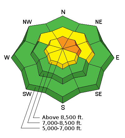
Low
Moderate
Considerable
High
Extreme
Learn how to read the forecast here
Special Announcements

Special thanks to Buttar's and ArcticCat for hooking us up with the light and powerful M8000. This machine will make our field days more fun, safe, and productive and will significantly boost our outreach and education efforts.

We picked up and tried out the new sled last week.


The sled in action included in our new Practicing Companion Rescue video.........HERE

Weather and Snow

The 8400' Tony Grove Snotel reports a couple more inches overnight and there's 61 inches of total snow containing 118% of average water for the date, and its 19 degrees this morning. The UDOT Hwy 89 Logan Summit weather station reported west winds in the mid-teens overnight. You can find nice settled shallow powder conditions in sheltered terrain and riding is easy across the zone on mostly supportable snow.


Recent Avalanches
  • I ran into a nice fresh natural wind slab on Friday in western Dry Canyon. The hard slab avalanche on a seriously drifted north facing slope at 8600' was a bit bigger than I expected to see, 1 to 3 feet deep and 400 to 500' wide. ***1-16-15 Video Observation .......HERE
  • On Saturday, 1-17-15, a rider was caught, carried, and partly buried by a small avalanche near Naomi Peak. Accident Report... HERE
  • We received a FB photo of another nice sled triggered avalanche yesterday, but we're not sure of the location. Please give a shout if you can fill us in...

.

A rider and his sled were caught and partly buried in a small avalanche near Naomi Peak yesterday. (1-17-15)


Visit our Backcountry Observations Page for more information from across the state and local.

Ad
Avalanche Problem #1
Persistent Weak Layer
Type
Location
Likelihood
Size
Description

Heightened conditions exist and triggered wind slab avalanches 1 to 3 feet deep are possible on some drifted upper elevation slopes. Wind slabs built up on weak near surface facets, and in some cases, preserved surface hoar. An existing persistent weak layer, means it'll take more time for the instability to heal. A buried rime-crust in the central Bear River Range could make things even more interesting.

  • Fresh wind slab avalanches are possible in exposed terrain near ridge-lines and also on drifted slopes lower down on the slope.
  • Watch for and avoid cornices and wind drifts in and around terrain features like gullies and cliff bands, or cross-loaded into scoops and sub-ridges.
  • Fresh drifts and wind slabs should be fairly obvious, consisting of stiffer snow, rounded, chalky looking, and perhaps hollow sounding, but a couple new inches from overnight might make them a bit harder to see.
Additional Information

Looks like it'll be mostly cloudy, mild, and breezy in the mountains. Expect a high temperature of 38 degrees at 8500', and west-southwest winds averaging in the mid twenties, and snow, but little in the way of accumulation. Another inch or so may accumulate tonight.

Check out our one-stop weather page........HERE

General Announcements

You can now receive advisories by email for each region in the state including Logan. Go here for details.

Get your advisory on your iPhone along with great navigation and rescue tools....... Utah Avalanche Center mobile app

Please submit snow and avalanche observations from your ventures in the backcountry HERE. You can call us at 801-524-5304 or email HERE, or include #utavy in your Instagram or Tweet us @UAClogan. To report avalanche activity in the Logan Area or to contact the local avalanche forecaster call me, Toby, at 435-757-7578.

I'll regularly update this advisory on Monday, Wednesday, Friday, and Saturday mornings by about 7:30. This advisory is produced by the U.S.D.A. Forest Service, which is solely responsible for its content. It describes only general avalanche conditions and local variations always exist.