
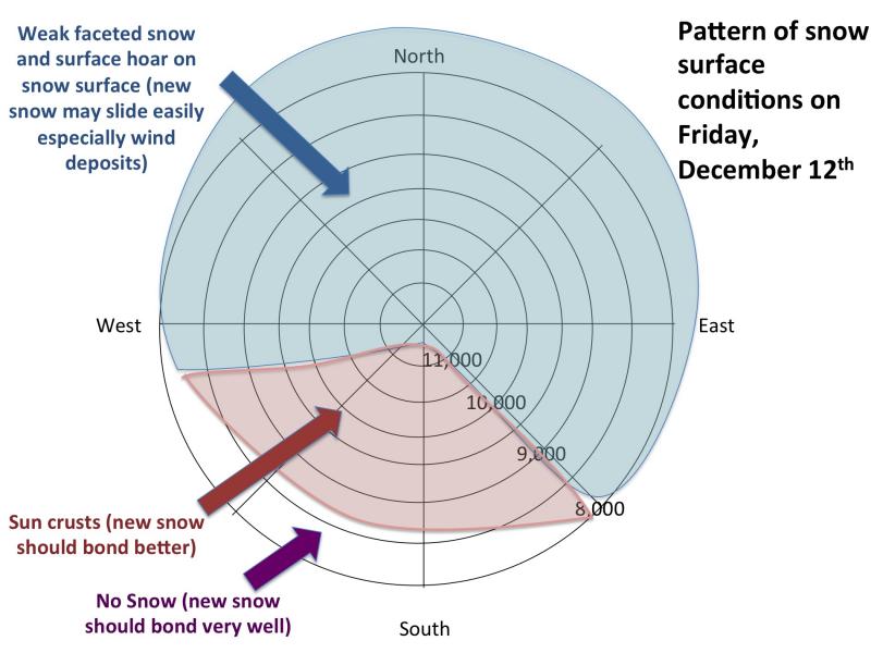
With a storm coming in for the weekend, it's extremely important to map the pre-existing snow to know if the eitherwind blown snow and new snow will overload any weak layers. In this case, the weak layer will be the present snow surface. The long period of clear skies this past week or more has created very weak snow on the surface, which we call near-surface faceted snow as well as surface hoar. The strong sun created slick sun crusts on the sun exposed slopes. So here is the general snow surface pattern by aspect and elevation:
Here's a good recent video from Brett Kobernik:
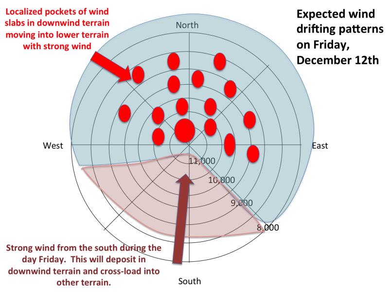
Yesterday, the wind began to blow hard from the south and very quickly began to build wind slabs, which were very sensitive because the dense slabs were deposited on top of the very weak facetedsnow and surface hoar. Wind slabs deposited on persistent weak layers like this we call persistent slabs because they act differently than normal wind slabs. They are more sensitive, last longer and more subject to remote triggers. As the wind continues to blow hard from the south today, you can expect to see patterns like this by aspect and elevation:
The bottom line is to avoid any recent deposits of wind drifted snow on steep slopes. They're easy to recognize and avoid. They look smooth and rounded and sometimes sound hollow like a drum and feel "slabby".
Unfortunately, this looks like a huff-and-puff-and-not-much-fluff storms. Lots of wind and not much snow (3-5 inches maybe). So the wind slabs will likely be our largest concern because wind can deposit snow rapidly and the resulting slab is dense, heavy and propagates a fracture very well. The trouble with thenew snow expected to startfalling on Friday night, it will conceal the fresh wind drifts so the new snow will make things quite tricky. It will probably not weigh enough to overload the weak surface snow but it will be "sucker snow" which entices you to have fun until you find one of the buried wind slabs that shatters like glass underneth you.
A skier took a ride in a wind slab yesterday in Mineral Fork. Although the wind slab was quite shallow, just 1-3inches deep, as it descended it stepped down into the deeper depth hoar weak layer near the ground, which made a much larger avalanche that caught the skier. He was OK and was able to eventually dig into the bed surface and stop. Click on the photo to read their full observation.
We will likely see a lot more wind slabs like this by mid day Friday when the wind will increase before the cold front arrives Friday night.
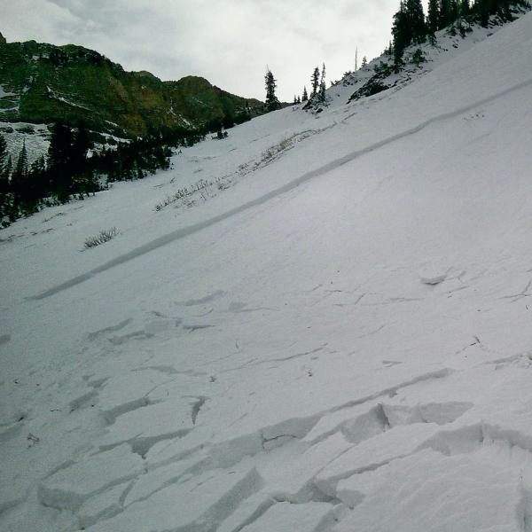

A great photo from yesterday by Johnathan Spitzer of strong wind erosion and deposition in Maybird.


