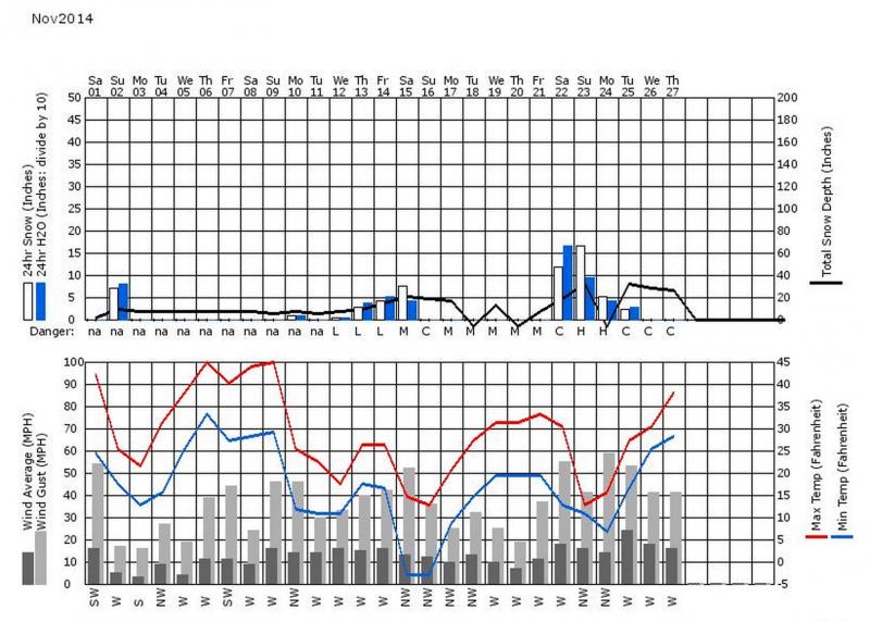
Wow, it's been an exciting week. Last weekend, the largest storm of the year so far slammed down 3 feet of snow in the upper Cottonwood Canyons, which easily overloaded the extremely fragile layer of depth hoar near the ground. Then on Tuesday, a warm and windy event capped the powder with dense wind deposits. A number of both natural and remotely triggered avalanches broke deep and wide.
This is an aspect-elevation rose of the avalanche activity from the last week. You can see that all the avalanches have been on elevations above 9,000' and on slopes facing northwest, north andnortheast. As usual, northeast is always a popular aspect with faceted snow because it's cold and the predominant west winds load easterly-facing slopes.
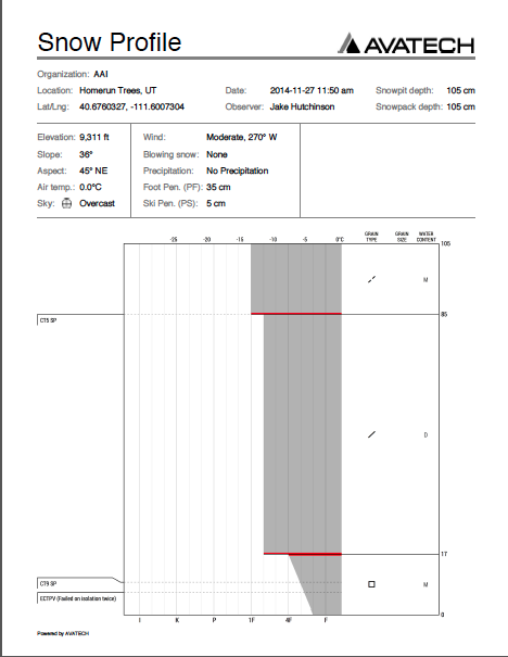
Here is the generalsnowpacksetup by Jake Hutchinson and Dylan Freed in the backcountry near Canyons Resort. You can see a thin layer of very weak depth hoar near the ground has a big, strong, stiff slab on top of it. This is both good news and bad news. The good news is that as the slab continues to gain strength, it will help bridge a person's weight outward and it will be harder to trigger a slab. The bad news is that with stiff slabs, the avalanches are more unpredictable, tests and observations are less reliable, they can be triggered remotely and once they break they can be very wide and cross terrain features.
Here is a couple videos from fieldwork on Thursday and Friday:
And finally, the weather chart for the past month: