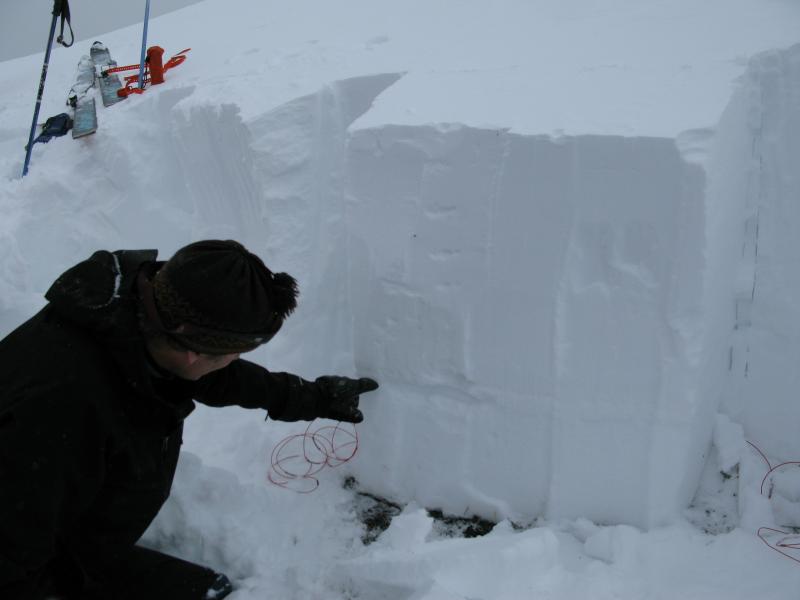
Forecast for the Uintas Area Mountains

Craig Gordon
Issued by Craig Gordon for
Wednesday, December 12, 2012

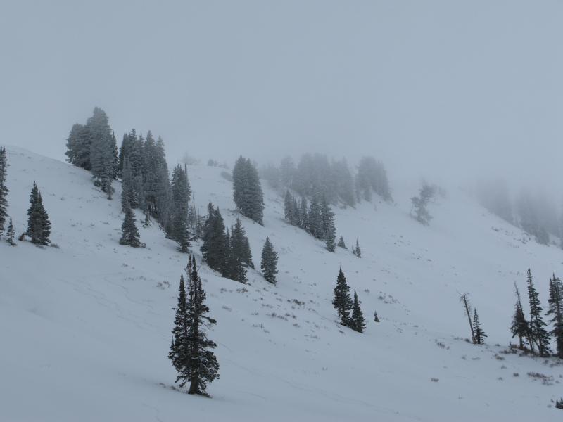
Terrain to avoid- upper elevation leeward slopes, especially those with an easterly component to their aspect. While not widespread and relegated to a small portion of the terrain available to ride today, a CONSIDERABLE danger exists on steep wind loaded slopes and human triggered avalanches are probable.

Mid elevation, wind drifted slopes offer a MODERATE avalanche danger and human triggered slides are possible.

LOW avalanche danger exists on wind sheltered slopes.

Low
Moderate
Considerable
High
Extreme
Learn how to read the forecast here
Special Announcements

Mirror Lake Highway is closed and plowing is done for the season. Wolf Creek Pass remains open and is probably a bit of a mess this morning, but don't let the easy access to nearby terrain lull you into a false sense of security. Be prepared for your own self rescue. Wear and know how to use a beacon, shovel, and probe.

Weather and Snow

Under partly cloudy skies, temperatures are in the low to mid 20's. Southerly winds picked up yesterday afternoon and have steadily increased overnight and into the morning hours with averages in the 30's and gusts in the 60's and 70's along the high peaks. While the eastern front remains a bit on the thin side, good creamy snow can be found on wind sheltered, shady slopes.

The North Slope remains thin and brushy with total snow depths averaging around two feet in depth.

Recent snow and avalanche observations can be found here.

Wondering why last winter was so crazy? Click here to watch the 2011-12 Utah Winter Review... an excellent recap of last years conditions.

Recent Avalanches

No new avalanches to report, but yesterday we experienced plenty of loud booming collapses, particularly on recently wind loaded slopes.

Ad
Avalanche Problem #1
Persistent Weak Layer
Type
Location
Likelihood
Size
Description

Winds are starting to change the landscape and increase the avalanche danger. West and southwest winds are forecast to remain strong throughout the day and I suspect you'll find drifts forming lower downslope than you might anticipate. In addition, look for and avoid, fat rounded pillows of snow on the leeward side of ridges and around chutes and gullies. Today's shallow wind drifts could easily break deeper than you might expect, quickly getting out of hand once they start descending the slope.

Avalanche Problem #2
New Snow
Type
Location
Likelihood
Size
Description

The late November dry spell created a layer of weak facets and now those sugary crystals are getting put to the test. Recent winds have been busy at work forming a cohesive slab, which now rests on top of this sugary mess. Yesterday we found this layering to be reactive to our additional weight and to our snowpit tests. While we didn't see or trigger any slides, the basic structure of the snowpack had us tip-toeing around. What's most apparent however, is avalanche conditions are becoming increasingly complex and tricky. If you're getting onto steep, upper elevation slopes, especially those with an easterly component to their aspect, carefully assess the snowpack and think about the consequences of triggering a slide. Click here to view our observations along with a short video explaining what we're seeing.

Ted points to our problem child... a layer of weak snow now buried a couple feet deep in our snowpack.

Additional Information

The storm track is diving south of us and we should clouds and wind with just a few off and on flurries. West and southwest winds will be a nuisance, blowing in the 30's and 40's with gusts in the 60's along the high ridges and peaks. Temperatures are going to reach into the low 30's and dip into the low 20's overnight. We might see a better chance of light snow late Thursday into Friday as the storm system pushes northward... accumulations will be negligible. A series of weak systems follows for the weekend, but timing and strength are uncertain at the moment. I hope to have a better handle on the weather for Saturday's update.

General Announcements

Remember your information can save lives. If you see anything we should know about, please participate in the creation of our own community avalanche advisory by submitting snow and avalanche conditions. You can call me directly at 801-231-2170, email [email protected], or email by clicking HERE

This is a great time of year to schedule a free avalanche awareness presentation for your group or club. You can contact me at 801-231-2170 or email [email protected]

Donate to your favorite non-profit –The Friends of the Utah Avalanche Center. The UAC depends on contributions from users like you to support our work.

The information in this advisory is from the US Forest Service which is solely responsible for its content. This advisory describes general avalanche conditions and local variations always occur.

The information in this advisory expires 24 hours after the date and time posted, but will be updated by 7:00 AM Saturday December 15th.