UDOT PLANNED AVALANCHE CLOSURES!!

Forecast for the Uintas Area Mountains

Craig Gordon
Issued by Craig Gordon for
Sunday, April 9, 2023
Heads up... avy danger gets tricky this week as the snowpack reacts to sweltering temperatures and a big tug off the Vitamin D jug. If you're feeling like an ant under a magnifying glass.... so is the snow.
For today-
While not widespread, pockets of MODERATE avalanche hazard are found in the wind zone above treeline, where a lingering wind drift or two reacts to our additional weight. Human triggered avalanches are POSSIBLE on steep wind drifted slopes, especially those facing the north half of the compass.
Strong April sun and warming temperatures deliver damp snow on sunny slopes. The avalanche danger rises to MODERATE and human triggered avalanches are POSSIBLE especially during the heat of the day, on all steep, sun exposed, mid and low elevation slopes.

Low
Moderate
Considerable
High
Extreme
Learn how to read the forecast here
Special Announcements
My personal March Madness journey brought me to the Final Four of the avalanche forecast season and the shot clock is down to the last few seconds. I'm wrapping up and issuing my final avy forecast today, Sunday April 9th. For me, it simply means I'll be taking a step back from snow and onto a sunny beach that leads me to my annual spring surf trip to Mexico :)
But don't let your heart be troubled... you'll still be able to tap into Uinta forecast info from the crew that Keeps You On Top of the Greatest Snow on Earth (we've got ya covered).
Weather and Snow
Nowcast- It's o'dark thirty and high, thin clouds drift through northern Utah early this morning, keeping a lid on overnight low temperatures which currently register in the mid 20's from tip to tail. West and southwest winds are reasonable, blowing 10-20 mph near the high peaks. Riding and turning conditions are hit or miss... the snow continues taking on heat and there's some hot pow up high and not quite corn yet down low. In-between, sunny slopes are shrink-wrapped, offering a Gore-Tex tearing, breakable heat crust. However, don't get bummed at the trailhead, because this is the time of year the Uinta's shine. On a go-anywhere base, and while it's still supportable, get out and get after it!
Forecast- A beautiful day is on tap with mostly sunny skies, light westerly winds, and temperatures climbing into the mid 40's. With clear skies overhead, overnight low temperatures dip into the mid 20's.
Futurecast- High pressure takes up residency to kick off the work week and we'll see sunny skies and very warm temperatures soaring into the upper 40's. Overnight lows hover right around freezing from Monday through at least Wednesday. It looks like colder air and unsettled conditions roll into the Uinta zone Thursday and Friday.
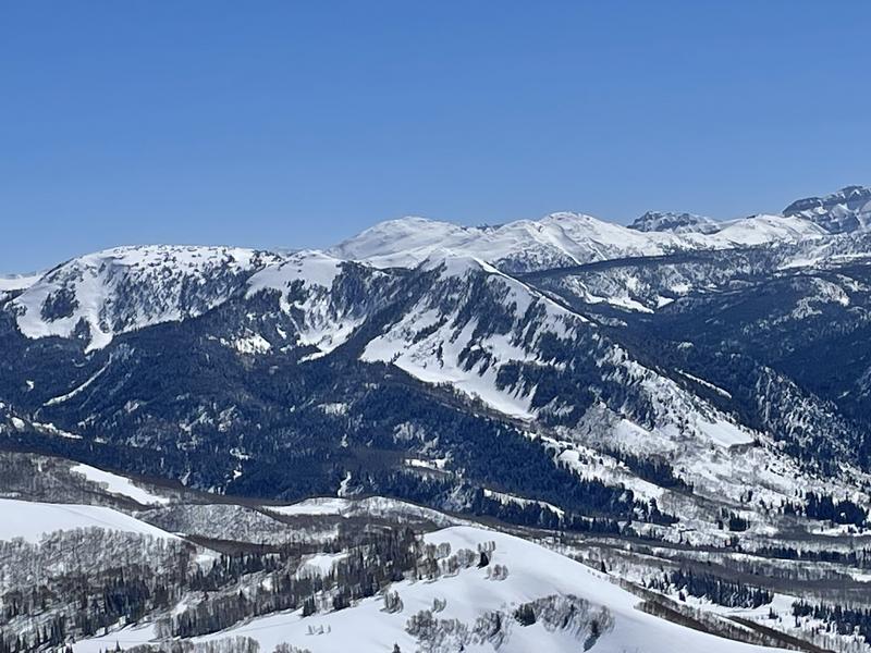
There's a good chance we never see this kind of snowpack again in our lifetime... the Uinta's are remarkably phat and white, offering endless possibilities and unique objectives.
Trip Reports-
Mark reports a thick, deep snowpack in Gardner Fork Friday.
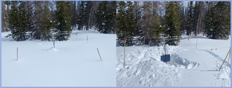
Detailed trip reports and recent obs are found HERE.
Recent Avalanches
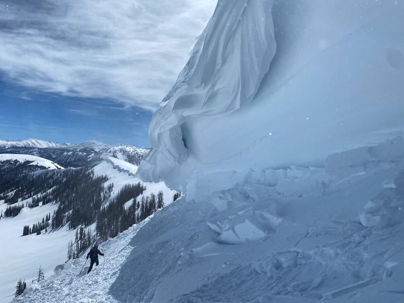
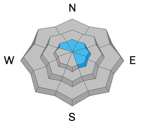
Snow-Pro-Bo (Torrey :) with a dispatch from Upper Weber Canyon Friday where he reports corni... ginormi! "Recent cornice fall triggered avalanches on north and east aspects near & above-treeline. The cornice gouged into the recent storm snow and entrained a large debris pile."
No other significant avalanche activity to report, but there's plenty of avy activity to peruse if ya wanna geek out. Click HERE to track this years slide activity throughout the range.
Ad
Avalanche Problem #1
Wind Drifted Snow
Type
Location
Likelihood
Size
Description
Wind drifts like this one triggered Thursday in Upper Humpy Basin, aren't particularly widespread, but could offer an unwelcome surprise on steep, leeward slopes in the wind zone.
We're getting close to the sing along, "ride it if it's white" portion of the show, but there's a caveat to the set-list... I bet if you wanted to trigger an avalanche, there's a steep, leeward, upper elevation slope with your name on it. The good news is... there's plenty of terrain you can ride today and not have any issues. In fact, you can have a great day of riding by avoiding steep, wind drifted terrain and by steering clear of fat and rounded pieces of snow or slopes that sound hollow like a drum.

Avalanche Problem #2
Wet Snow
Type
Location
Likelihood
Size
Description
The sun is high in the sky and it's penetrating all aspects and nearly all elevations, except for high north. As the snowpack takes a big gulp of Vitamin D it'll take on heat, so you'll wanna consider getting off of and out from under steep, sun baked slopes, especially during the heat of the day.
Additional Information
Weather stations-
Huge thanks to PC Cats and the Herculean efforts by Bo Torrey and Andy Nassetta helping dig out and get the Humpy Creek snow sensor back online!
And... rime events from January's atmospheric rivers severely crippled the Uinta weather station network. I'm working to get it back up and running, but a few stations are found HERE (click weather stations, and then on the Western Uinta tab)
Observations-
Your observations are important, so please let me know what you're seeing... click HERE and contribute to this amazing community-based program
General Announcements
Issued at 03:23 on Sunday April 9th this forecast expires 24 hours after the date and time posted, but will be updated by 07:00 Monday April 10th 2023.
Before it gets too crazy, now is the time to book an avalanche awareness presentation for your group, club, or posse. You can reach Craig directly at 801-231-2170 or [email protected].

This forecast is from the U.S.D.A. Forest Service, which is solely responsible for its content. This forecast describes general avalanche conditions and local variations always occur.