Forecast for the Uintas Area Mountains

Craig Gordon
Issued by Craig Gordon for
Tuesday, April 9, 2019
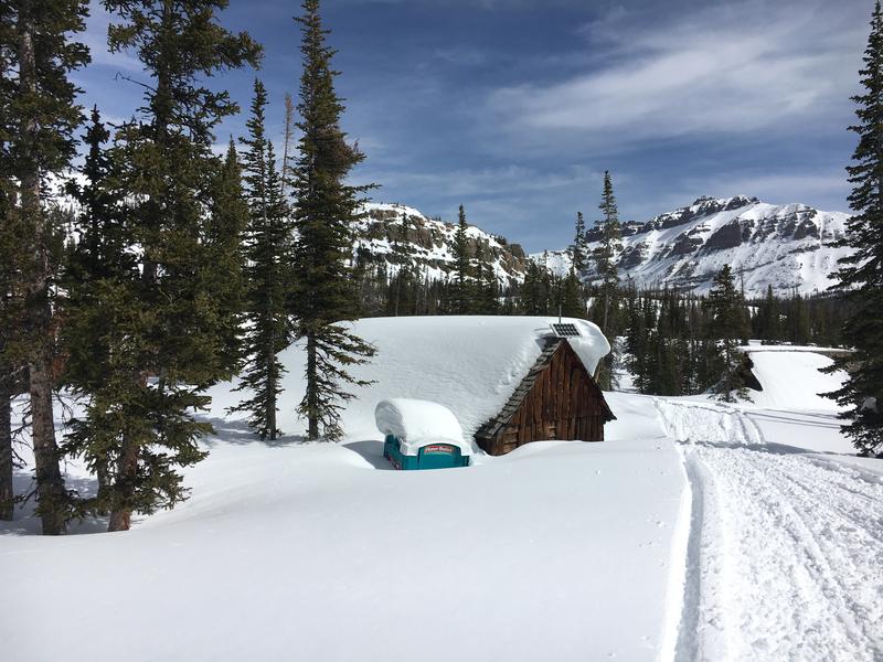
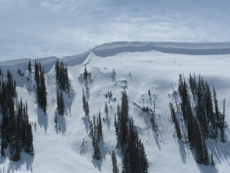
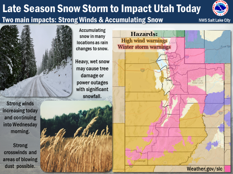
HEADS UP.... expect changing avalanche conditions as our big spring storm materializes later today and overnight.
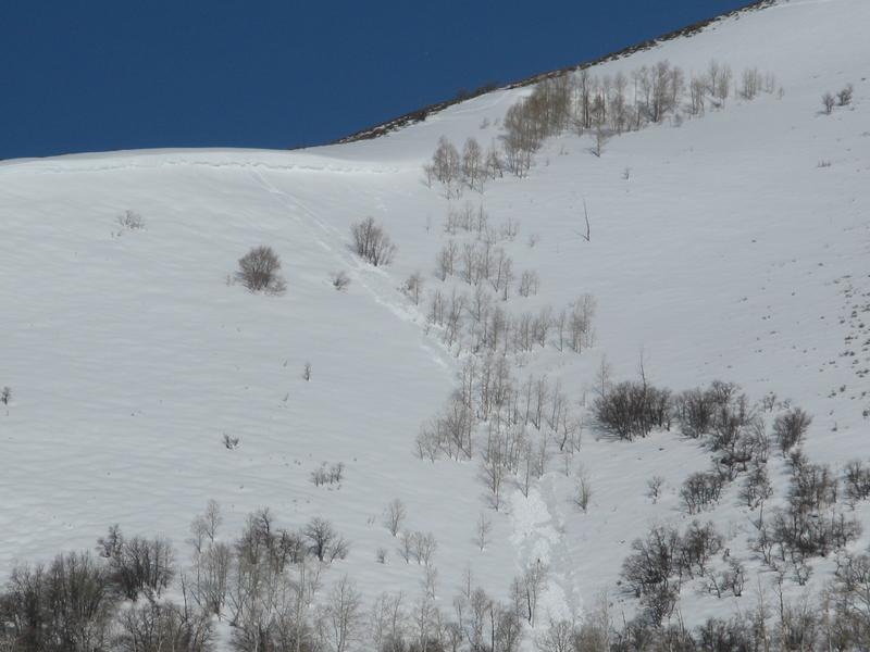
With a marginal overnight refreeze the danger of WET slides, sluffs, and slabs starts as MODERATE this morning. Human triggered wet avalanches are POSSIBLE on all steep slopes, especially as fresh snow starts stacking up later today.
Low
Moderate
Considerable
High
Extreme
Learn how to read the forecast here
Special Announcements
Regularly scheduled daily western Uinta avalanche forecasts will be issued through Sunday April 14th.
Weather and Snow
The warm before the storm. High clouds drifted into the region overnight, southwest winds are blowing in the 30's, and temperatures are downright balmy as they hover in the mid 30's. Get your projects done today... a good looking winter storm is on the way and by tomorrow morning the range will be blanketed with a fresh coat of white paint.
Here's how it plays out... clouds thicken throughout the day and southerly winds ramp up into the 50's and 60's along the high peaks. High temperatures climb into the 40's before an afternoon cold front slides through the region like a crossfire hurricane. Heavy snow develops overnight with a foot quickly stacking up by about midday Wednesday.
Above is hourly snow data from Trial Lake (9,945')
And Lofty Lake Peak (11,186')
To view more regional weather stations click here.
A room with a view. The Camp Steiner environs are deep, phat, and white.... buried by this winters big snow and water.
Recent Avalanches
No significant avalanche activity to report from yesterday.
Recent trip reports and avy activity found HERE.
Ad
Avalanche Problem #1
Wet Snow
Type
Location
Likelihood
Size
Description
A marginal overnight refreeze has us starting behind 8 ball and the surface snow is damp and manky right out of the gates. Often starting as a small point release, wet slides and sluffs can fan out and entrain large amounts of damp surface snow as they descend a slope. (like in the image above). No mystery here, this is a pretty-straight-forward avalanche problem to avoid by simply getting off of and out from under steep slopes, especially if the snow surface you're riding feels saturated, manky, or punchy like a trap door. In addition, as fresh snow falls later today, it'll insulate the warm snow surface and damp avalanches involving several layers of snow can conspire against us to pile up cement-like, bone snapping avalanche debris. You'll want to think about your travel plans and remember to avoid terrain traps like gullies and road cuts where avalanche debris can stack up very deeply.
And remember-
Warm temperatures are going to make the massive cornices more tender and reactive to our additional weight, breaking further back than expected. You definitely wanna give these large, unpredictable pieces of snow the respect they deserve and not ruin someones day below by inadvertently knocking a boxcar size piece of snow down on them.
Avalanche Problem #2
Wind Drifted Snow
Type
Location
Likelihood
Size
Description
As the storm materializes, strong winds and intense snowfall may quickly build fresh drifts sensitive to our additional weight, especially by days end. The days are long and it stays light... late. So if you're headed out later today look for and avoid windloaded leeward slopes, especially if they look fat, pillowy, or rounded.
Additional Information
A strong, cold, and moist storm system brings significant snow to the area through Thursday. Rain and snow showers are expected to precede the strong cold front which crosses the area this afternoon. Thunderstorms are possible and snow levels fall rapidly. A moist northwest flow then settles into the area late tonight, through tomorrow and into Thursday keeping unsettled weather rolling through the end of the week.
General Announcements
The information in this advisory expires 24 hours after the date and time posted, but will be updated by 7:00 AM Wednesday April 10th, 2019.
If you're getting out and about, please let me know what you're seeing especially if you see or trigger and avalanche. I can be reached at [email protected] or 801-231-2170
It's also a good time to set up one of our very popular avalanche awareness classes. Reach out to me and I'll make it happen.
This information does not apply to developed ski areas or highways where avalanche control is normally done. This advisory is from the U.S.D.A. Forest Service, which is solely responsible for its content. This advisory describes general avalanche conditions and local variations always occur.