Forecast for the Uintas Area Mountains

Craig Gordon
Issued by Craig Gordon for
Friday, April 5, 2019
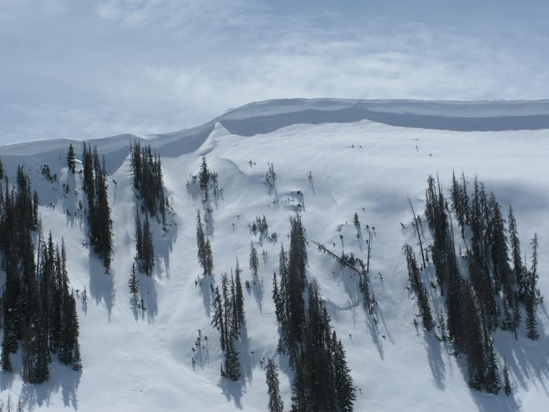
While there may still be a rogue drift or two on steep northerly slopes in the wind zone that'll react to our additional weight, the vast majority of terrain available to ride in today offers LOW avalanche danger. Both human triggered and natural avalanches are UNLIKELY.
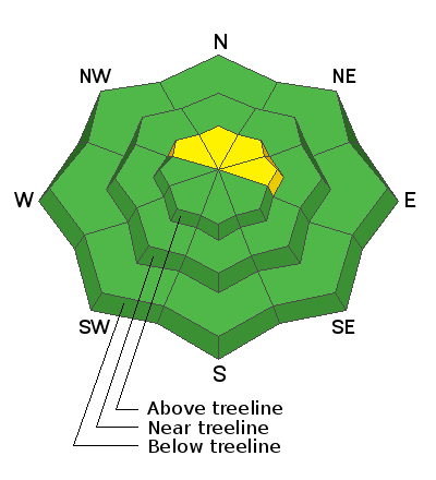
Low
Moderate
Considerable
High
Extreme
Learn how to read the forecast here
Special Announcements
When the forecasting ends, the UAC’s work keeps going strong. Summer is a busy time for the UAC. During the summer we are working hard on our fall and winter planning; putting together the Fall Fundraiser and USAW; updating our awareness and education programs; this summer we will be finishing up the website redesign project. Your donation shows you’re invested in this community all year round! You can still be part of the UAC’s success in 2019. Consider making a donation HERE by April 8.
Weather and Snow
Partly cloudy skies this morning along with warm air filtering into the region kept temperatures quite balmy overnight, currently hovering in the upper 20's and low 30's. Southerly winds began ramping up around 9:00 last night and have blown 30-40 mph since. Riding and turning conditions have taken a bit of a hit the past few days and powder riding is an elusive commodity. However, you might be able to squeak out an early morning corn harvest on low elevation sunny slopes. Or you can get your chores done today, wait for the Saturday storm to stack up some fresh snow, and redeem your guilt free, mountain riding hall pass for this weekend :)
Above is hourly snow data from Upper Moffit Basin (9, 126')
And Windy Peak (10,662')
Doing some weather station maintenance Monday... you know it's a big year when the snow depth site in Upper Moffit Basin is nearly buried.
To view more regional weather stations click here.
Recent Avalanches
No significant avalanche activity to report from yesterday.
Recent trip reports and avy activity found HERE.
Ad
Avalanche Problem #1
Wind Drifted Snow
Type
Location
Likelihood
Size
Description
Recent warm temperatures essentially shrink-wrapped the midweek storm snow and most slopes are welded in place. However overnight, ridgetop winds increased and may have found enough lose snow to blow around, whipping up a rogue drift or two that'll react to our additional weight. If you're getting into steep, technical terrain, look for and avoid any fat, rounded piece of snow, especially if it sounds hollow like a drum. The good news... this is an easy avalanche problem to avoid and you can still have blast by simply steering clear of steep, wind drifted, upper elevation terrain.
In addition-
Cornices are ginormous and may break back further than you might expect. You definitely wanna give these large, unpredictable pieces of snow a wide berth and not ruin someones day below by inadvertently knocking a boxcar size piece of snow down on them.
Additional Information
Expect partly to mostly cloudy skies today with a passing snow shower or two along with temperatures climbing into the 40's. Southwest winds blow in the 30's and 40's this morning, mellow out midday, and then increase again late in the day ahead of a weak storm slated to slide over the region today and Saturday. We might be able to squeak 3"-5" of snow from this system before high pressure builds for Sunday and Monday, with a stronger storm on tap for midweek.
General Announcements
The information in this advisory expires 24 hours after the date and time posted, but will be updated by 7:00 AM Saturday April 6th, 2019.
If you're getting out and about, please let me know what you're seeing especially if you see or trigger and avalanche. I can be reached at [email protected] or 801-231-2170
It's also a good time to set up one of our very popular avalanche awareness classes. Reach out to me and I'll make it happen.
This information does not apply to developed ski areas or highways where avalanche control is normally done. This advisory is from the U.S.D.A. Forest Service, which is solely responsible for its content. This advisory describes general avalanche conditions and local variations always occur.