Forecast for the Uintas Area Mountains

Mark Staples
Issued by Mark Staples for
Thursday, April 13, 2023
Today the avalanche danger is MODERATE as a cold front will bring cooler temperatures that should put the brakes on snowmelt and lower the likelihood of wet avalanches. Cornices still remain a major hazard and can fall unpredictably.
Low
Moderate
Considerable
High
Extreme
Learn how to read the forecast here
Special Announcements
The final UAC report for the Upper Weber Canyon avalanche accident on March 9 has been published and is available HERE. The UAC would like to thank Park City Powder Cats for sharing information about the timeline of the accident and allowing UAC staff access to the avalanche after the incident.
Weather and Snow
Another night with above-freezing temps but that will change rapidly today. This morning, temps are mostly in the low 40s F and it's windy. Upper elevation winds are cranking from the south at 42 mph gusting to 57 mph.
Today, temperatures will drop as a cold front crosses the area bringing temperatures just below freezing for the mountains. Only an inch or two of snow may fall today.
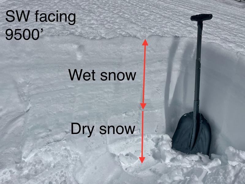
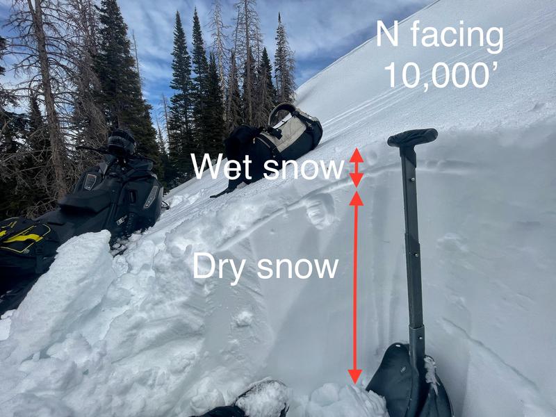
Snow conditions should still be wet and soft this morning, but I think the snow surface may freeze today putting an ice crust on top of some warm wet snow.
Recent Avalanches
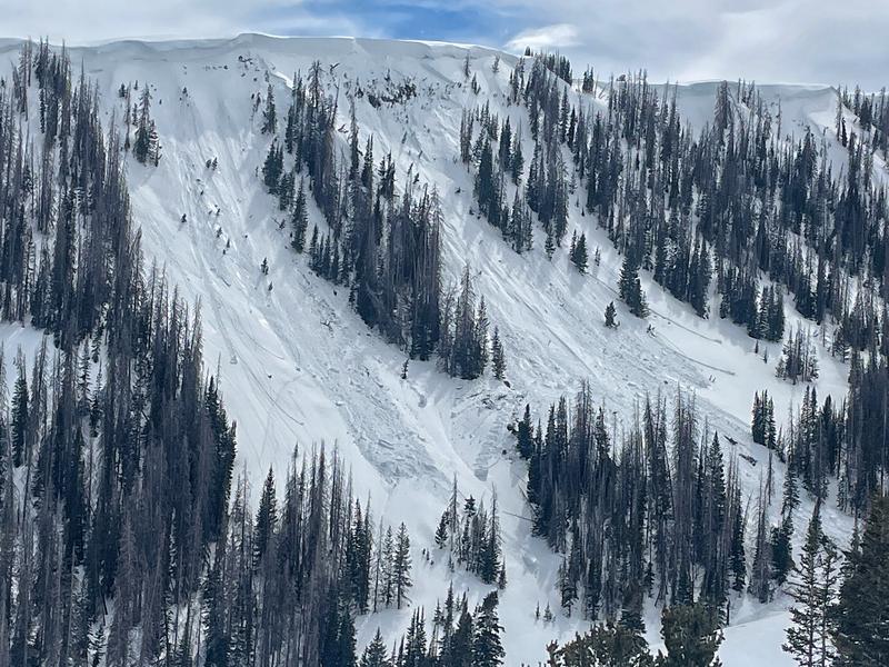
Yesterday I looked at a slide reported by a group in Super Bowl on Tuesday. It was triggered by a falling cornice on a north facing slope at 10,400'
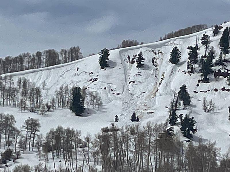
I spotted this wet slab on a south-southeast facing slope at 9200'. I suspect there may have been a few more of these throughout the Uintas but only in isolated locations.
Ad
Avalanche Problem #1
Cornice
Type
Location
Likelihood
Size
Description
With so much snow this winter, cornices have become massive. They are totally unpredictable in when and how they break because each cornice has a totally different structure based on the underlying ridgeline and the wind patterns that form it. Being so big, they are a hazard by themselves if they fall down on you. They are also a good trigger for avalanches.
The main ones to avoid are ones that overhang the slope below. Stay away from these beasts.
Avalanche Problem #2
Wet Snow
Type
Location
Likelihood
Size
Description
Yesterday I went for a quick spin through upper Weber Canyon and Moffit Basin. There was some wet snow avalanche activity, but overall it seemed limited. The Uintas seem to have stayed a bit cooler than the Wasatch which is fairly normal. I did spot one recent wet slab avalanche and several wet loose avalanches.
With cooling temperatures and cloudy skies today, I don't expect any naturally occurring wet avalanches. Human triggered wet slides will remain possible at low elevations and on E, W, and S facing slopes where the snow surface may refreeze today, but it will remain warm and wet underneath. Slopes with the most wet snow will be ones where wet avalanches (mainly loose wet) are the most likely. You can gauge this by stepping off your sled or out of your skis and seeing how far your boots sink into the snow.
General Announcements
This forecast is from the U.S.D.A. Forest Service, which is solely responsible for its content. This forecast describes general avalanche conditions and local variations always occur.