Forecast for the Uintas Area Mountains

Craig Gordon
Issued by Craig Gordon for
Sunday, April 10, 2022
If you're looking for LOW avalanche danger you came to the right place. Green Light conditions blanket the danger rose, suggesting human triggered avalanches are unlikely on all aspects and elevations. Sure, most terrain is good to go... but if you're stepping into a big, committing line take a second or two and think about the consequences of triggering even a small avalanche that could knock you off your feet and instantly throw a curve ball at your day.

A robust storm is on tap for next week, changing the landscape and the avalanche hazard. Of course, we've got yer back and will keep you posted as the storm materializes.
Low
Moderate
Considerable
High
Extreme
Learn how to read the forecast here
Weather and Snow
NOWCAST-
Yesterday's mostly dry cold front lived up to its name and its expectations, delivering a couple traces of snow whilst over-achieving in the cold air department. With mostly clear skies over the region, temperatures crashed into the teens and single digits overnight, which is nearly 20 degrees colder than at this time yesterday morning. West and northwest winds blow 30-50 mph near the high ridges, creating a wind chill that registers to -22 degrees. The corn harvest is gonna be a bit slow to come on today as the snowpack is locked up and rock hard this morning, but will soften on sunny slopes later in the day as strong spring sunshine works its magic.
FORECAST-
Expect a beautifully crisp day with mostly sunny skies and temperatures barely climbing into the low 30's. Gusty northwest winds blow in the 50's this morning along the high ridges, but mellow as the day progresses. Overnight lows dip into the teens.
FUTURECAST-
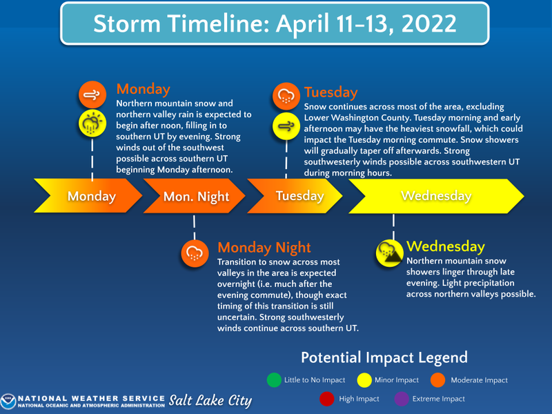
The band plugs into a stack of Marshall Amps and takes center stage with a good looking storm slated to to kick off a multi-day gig. Strong winds develop Monday with snow showers likely by early afternoon. The storm kicks into gear Monday night and hits its stride Tuesday, delivering a solid shot of snow lingering into Wednesday. Storm totals in the 10"-20" range by Thursday seem reasonable. The graphic above illustrates the timing and setlist.
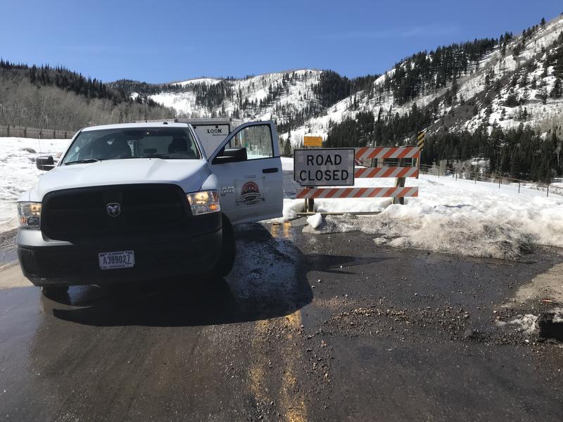
Andy and I grabbed the Are You Beeping sign and Beacon Park from Nobletts Friday and found a lot of pavement between the Road Closed sign and contiguous strips of ridable snow.
Trip reports and snowpack observations are found HERE.

Looking for real-time temps, snow, or wind? Click HERE and then on the "western Uinta" tab for western Uinta specific, weather station network.
Recent Avalanches
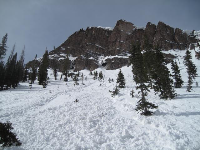
Ted was on the east side of the range yesterday near Whiskey Creek. He found this wet sluff that dribbled out of a steep, rock chute and entrained a healthy dose of snow as it fanned out on the slope below.
No other significant avalanche activity to report.
An archive of recent slides is found HERE.

Your input is vital and we're interested in what you're seeing. Please contribute to this great community resource and go here to fill out an observation.
Ad
Avalanche Problem #1
Normal Caution
Type
Location
Likelihood
Size
Description
With a stable snowpack, a go anywhere base, and green light avy conditions, you'll probably wanna stretch your wings today and soar into big terrain like Notch Mountain pictured above... and you should! However, be aware that recent winds transformed the snow surface on north facing slopes into very hard, wind pressed snow, especially in big, open alpine terrain above treeline. On the other side of the compass, sunny slopes have a stout melt-freeze crust on them. In either case, travel is easy and the main hazard for skis, boards, or a sled is an uncontrollable slide for life, which simply means... sliding downhill and not being able to stop.
Additional Information
Your observations are important, so please let me know what you're seeing... click HERE and contribute to this amazing community based program
General Announcements
The information in this forecast expires 24 hours after the day and time posted, but will be updated by 07:00 Monday, April 11th.
Before it gets too crazy, now is the time to book an avalanche awareness presentation for your group, club, or posse. You can reach me directly at 801-231-2170 or [email protected]
This forecast is from the U.S.D.A. Forest Service, which is solely responsible for its content. This forecast describes general avalanche conditions and local variations always occur.