Nowcast - Overnight we received our first "substantial" snowfall since the first week of March. As of 0500, under southwesterly flow the range received 2-5" with nearly .5" of SWE. Winds are a bit all over the map, but generally blow from the southwest averaging 10 MPH gusting up to 30 MPH. Many places kicked off as rain below 9,500' but it looks like the line is slowly creeping down in elevation.
Forecast - For today, expect mild temperatures and snow to continue to pile up, with an additional 3-6"of dense, heavy snow possible by dinner time. Winds look to bump and veer to the northwest, averaging 15 MPH with gusts getting into the mid-30's near upper elevation ridges and peaks.
Futurecast - Things shift to a northwesterly flow, and the second bout from this system arriving tomorrow should be colder, bringing additional accumulating snowfall to both the mountains and the valley. On the high end, we could see upwards of 1-2' of snow with over 1.5" of SWE by the end of the week.
Travel Conditions - I wouldn't go as far as to say we are back yet, but conditions are improving! A late start today should bring about the best chance for good, surfy conditions with substantial snow stacking up by the end of the day. Remember, all this new snow will be falling on a variety of firm, old surfaces, and it will take a little while till we stack up a nice cushion, especially for the sled. With my human-powered hat on today, I am seeking moderate slope angles where new snow is not sluffing or sliding, and I am not feeling the old snow surface on every single turn.
No new avalanche activity has been reported from across the range in the past 24 hours. But John C was out and about near Hayden on Monday noting some old wet snow activity and providing a great write up on his travels -- Check it out, here.
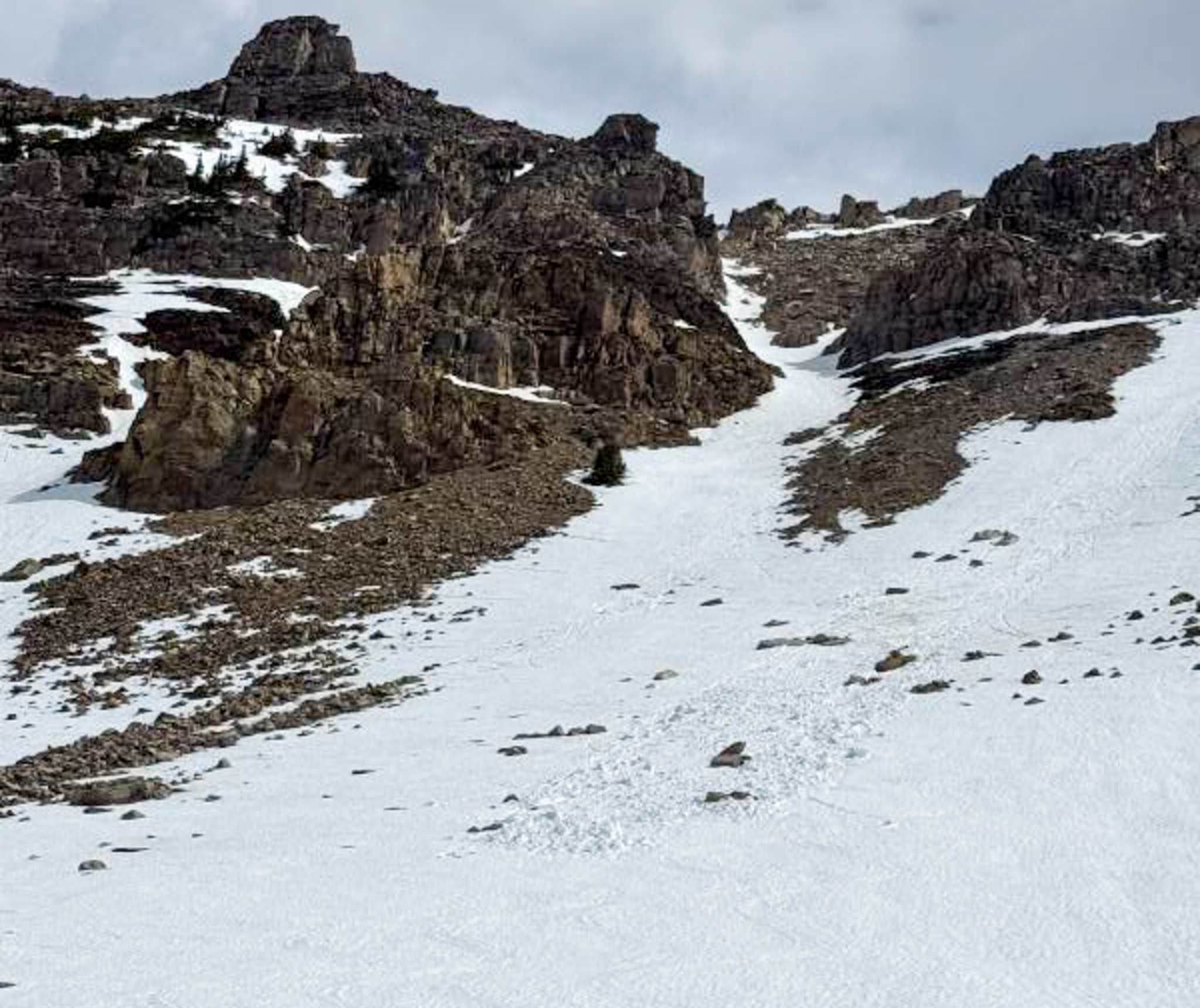 John C was out and about around Hayden, noting old wet snow activity and providing great insight to our current snowpack set-up (via John C.)