March Kicks Off Our Spring Campaign- Donate Now to Support Forecasting

Forecast for the Uintas Area Mountains

Craig Gordon
Issued by Craig Gordon on
Thursday morning, April 1, 2021
Today's avalanche danger is pretty straight-forward and easily managed with terrain choices-
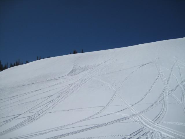
While the avalanche danger is generally LOW across the range, there are isolated places where you could trigger an old wind drift, especially in steep terrain above treeline in the wind zone. And here's something to consider... if you're getting into steep, technical terrain, even a small slide can knock you off your ride, slam you into a tree, and boss you around.
Also, the snowpack is locked in place and the danger of wet avalanches should remain in the LOW category. However, if the snow you're riding on becomes damp or unsupportable, simply switch to a cooler aspect.
A bigger hazard is an unexpected fall and subsequent slide for life on a steep, frozen slope.
Low
Moderate
Considerable
High
Extreme
Learn how to read the forecast here
Special Announcements
Thank you to everyone who helped make our Spring Campaign a huge success. We are grateful for your donations and what they will allow us to accomplish next season. We look forward to continuing to serve you with our forecasting, education, and awareness programs in new and exciting ways.
Weather and Snow
Nowcast-
Skies are clear and it's warm with slightly inverted temperatures. Ridgelines clock in at 27 degrees, whilst valley bottoms register in the teens. Winds switched to the southwest around noon yesterday and currently blow 10-20 mph near the high peaks. A few patches of soft snow exist, but they're elusive and supportable melt-freeze surfaces are your best bet. Remember- the key to a productive corn harvest is to follow the sun, tagging the snow as it warms and becomes more user friendly, but knowing when it's time to leave before the bottom falls out. And while it's not quite like slack-lining, it is a curious balancing act.
Forecast-
High pressure delivers sunny skies with temperatures quickly climbing into the upper 40's later today. Southwest winds remain reasonable and blow in the teens and 20's along the high ridges.
Futurecast-
Look for lots of sun and very warm temperatures. The heat is on for the weekend and we should see nearly record breaking highs by Saturday.
Looking for real-time temps, snow, or wind?
Click HERE and then on the "western Uinta" tab for western Uinta specific, weather station network.
Recent Avalanches
Avy pro extraordinaire Ted Scroggin was out and about in Whitney Basin yesterday and found a tired, old wind slab on a steep, leeward slope in the alpine. More on his travels and great insight found HERE.
Otherwise no significant avalanche activity to report

Observations, trip reports, and avalanches found here.
Ad
Avalanche Problem #1
Normal Caution
Type
Location
Likelihood
Size
Description
A few considerations for today...
Dry snow avalanches-
Isolated to steep, leeward terrain in the wind zone, there might be a lingering wind drift or two that'll react to our additional weight. Not particularly widespread, but remember... if you're tagging steep, technical terrain, be aware that even a small slide could knock you off your feet and boss you around. So, the ticket to riding safely today is simply look for and avoid any fat, rounded piece of snow, especially if it sounds hollow like a drum
Wet snow avalanches-
If your objectives include steep south facing slopes, slide-for-life conditions definitely exist this morning. And while the pack experienced a deep, solid refreeze earlier this week, should the snow you're riding on become damp, manky, or unsupportable, simply switch to a cooler aspect or call it a day and move on to other activities.
Additional Information
The trailheads are taking a hard hit and mud season is in full swing.
I will update this forecast by 7:00 AM tomorrow, Friday, April 2nd.
Your observations are important, so please let me know what you're seeing... click HERE and contribute to this amazing community based program
General Announcements
If you see or trigger an avalanche or just wanna let me know what you're seeing you can reach me directly at 801-231-2170 or [email protected]
This forecast is from the U.S.D.A. Forest Service, which is solely responsible for its content. This forecast describes general avalanche conditions and local variations always occur.