Nowcast - As of 0500, mild temperatures in the 20's°F are paired with clear skies and calm winds from the north around 15 MPH near 10,000'.
Forecast - Another stunner of a day, as skies should be spotless with plenty of blue to go around. We will feel similar temperatures to yesterday, around a high of 35°F at 9,000'. Winds will be light to moderate, from the north with a few hints blowing from the northwest and northeast.
Futurecast - High pressure sits strong through tomorrow with gusty westerly winds expected to develop across northern Utah mountains Tuesday. Warmer than usual mid-week temperatures hit us later this week and will give our snowpack a solid hit.
Travel Conditions - Across the Uinta's snow depths range from 0-4', with little to no coverage at most of our trailheads to some of the best riding of the season in upper elevation terrain. The North Slope won this past weeks storm and stacked up the most snow, with a settled 10-15", and closer to 5-10" down on the South Slope. Solar aspects and windward terrain are cooked and wind scoured leaving behind a mixed back of sastrugi, crusts, wind-board and wind-pack in exposed areas. But get high, orient yourself to the north, and you will be met with stellar riding conditions no matter where your off to today.
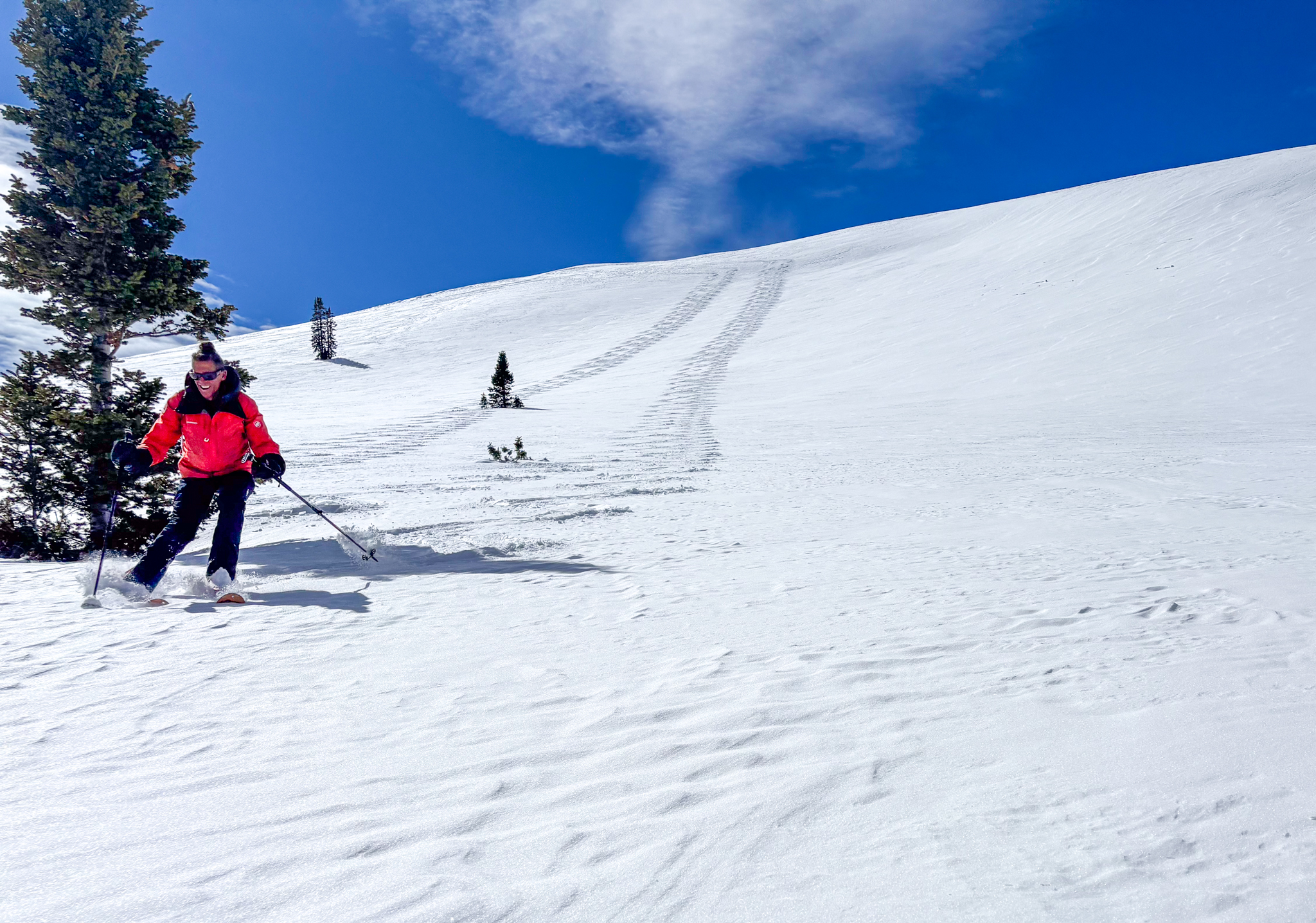
Craig and I stepping-out yesterday, with caution, into bigger terrain on the north half of the compass. Not only did it feel good under our rigs, but the snowpack structure beneath the surface is also showing signs of strengthening and beginning to adjust to its current state of being.
Yesterday was quiet across the range, but a few avalanches were observed, one of them failing into old snow from out January Drought Layer. This tells me that our weak layer of facets is getting comfortable, but we are still not all the way there.
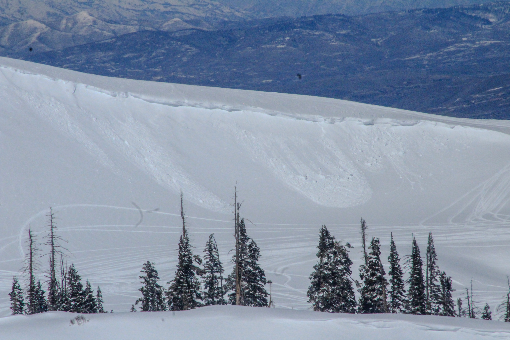
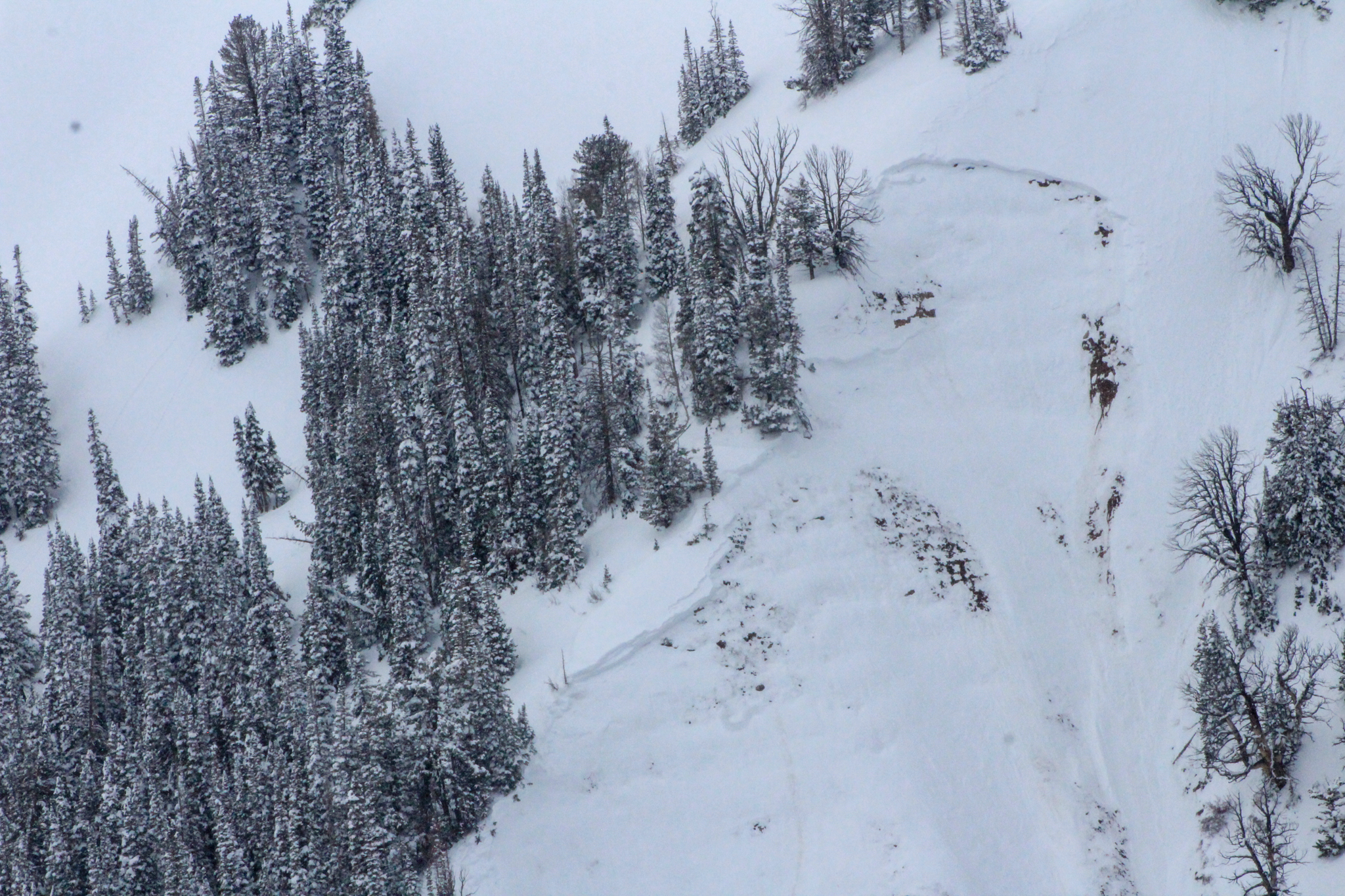 Near Chalk Creek, on an east facing slope near 10,800' a natural, hard-slab avalanche failed mid-day and was 2' deep, 300' wide, running nearly 500' vertically -- Check out more on this chunk, here.


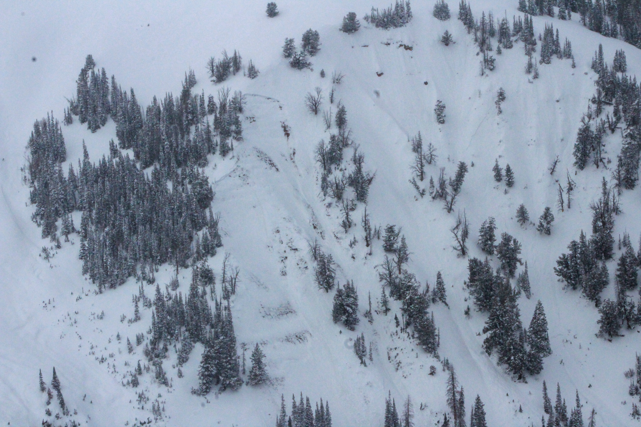

 Yesterday, near Tower Mountain, multiple small, D1 wind slabs were observed on northeast through southeast aspects at upper elevations. Maybe not big enough to bury you, but enough to knock you off your rig and take you for a ride.


