Forecast for the Uintas Area Mountains

Issued by Craig Gordon on
Thursday morning, March 4, 2021
Thursday morning, March 4, 2021
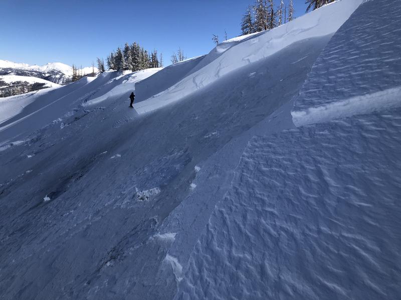
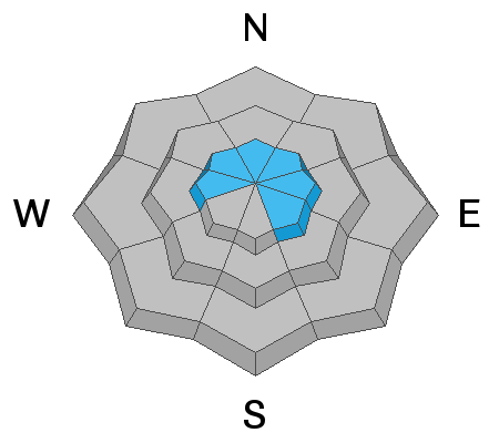
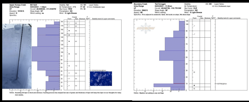
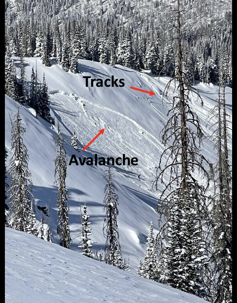
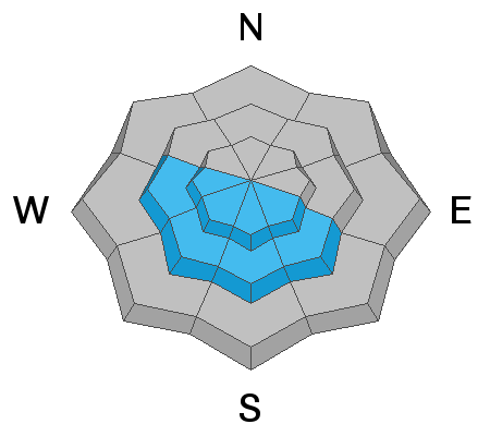
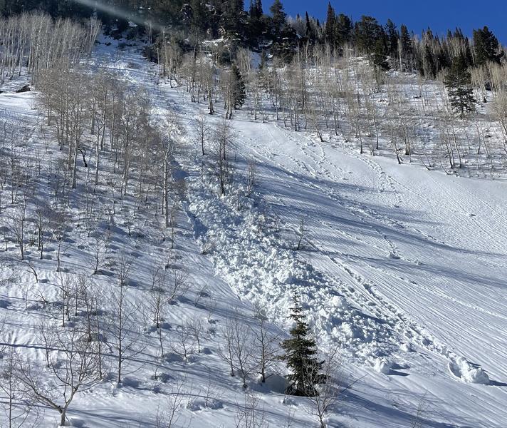
Today you'll find MODERATE avalanche danger above treeline in upper elevation terrain, especially in the wind zone. While more the exception than the rule, human triggered avalanches breaking into old snow near the ground are POSSIBLE, particularly on steep, wind drifted slopes facing the north half of the compass and especially in terrain with an easterly component to its aspect. Remember- any avalanche that breaks to weak layers of snow near the ground will result in a deep, dangerous avalanche that'll instantly ruin your day.
Steep, sunny terrain will take on heat fast today and the danger for wet slides and sluffs rises to MODERATE with daytime heating. Human triggered wet snow avalanches are POSSIBLE during the heat of the day.
Below treeline the avalanche danger is LOW and human triggered avalanches are UNLIKELY. Low danger does not mean "no danger". Avalanches can still happen which is why we always carry avalanche rescue gear and expose only one person at a time to avalanche terrain. To avoid avalanches completely, take advantage of all the terrain in the Uintas that is less than 30 degrees in steepness where avalanches don't happen.

Low
Moderate
Considerable
High
Extreme
Learn how to read the forecast here