Forecast for the Uintas Area Mountains

Craig Gordon
Issued by Craig Gordon for
Thursday, March 31, 2022
Please bear with us as we recalibrate winter-
Recent cold temperatures locked up the snowpack, but human triggered avalanches failing on the midwinter drought layer (PWL) and breaking several feet deep remain POSSIBLE, especially on slopes facing the north half of the compass. In steep terrain near and above treeline, a MODERATE avalanche danger is found.
If you're looking for LOW avalanche danger, simply lose elevation or swing over to slopes facing the south half of the compass where new snow rests on a variety of old, melt-freeze snow surfaces.

Scroll to the bottom for a note on slope angle and how to have a blast without entering avalanche terrain.
Low
Moderate
Considerable
High
Extreme
Learn how to read the forecast here
Special Announcements
Two generous UAC supporters are challenging the community to invest in the future of the UAC’s forecasting program during the 2022 Spring Campaign. They will match your donation, dollar for dollar, up to $10,000. Donate today to support avalanche forecasting! Click HERE for more deets.
Weather and Snow
NOWCAST-
A few high clouds drift in and out of the region and current temperatures register in the low to mid 20's. Northerly winds are light, blowing just 10-15 mph even near the high peaks. Tuesday's storm delivered close to 10" of snow, vastly improving the riding and turning conditions.
FORECAST-
A weak storm slides into the region later today and we should see increasing clouds and light snow developing as the day progresses. Not a big storm, but a couple inches is a good bet. High temperatures climb into the mid 30's and overnight lows dip into the upper teens. West and northwest winds remain reasonable, blowing in the teens and mid 20's.
FUTURECAST-
A break in the action rounds out the work week with storminess returning for late in the weekend.
One track mind... Ted found great riding conditions yesterday during his travels around Ruth Lake and has a very informative trip report found HERE.
Trip reports and snowpack observations are found HERE.

Looking for real-time temps, snow, or wind? Click HERE and then on the "western Uinta" tab for western Uinta specific, weather station network.
Recent Avalanches
No significant avalanche activity to report in the past few days.
An archive of recent slides is found HERE.

Your input is vital and we're interested in what you're seeing. Please contribute to this great community resource and go here to fill out an observation.
Ad
Avalanche Problem #1
Persistent Weak Layer
Type
Location
Likelihood
Size
Description
Ted's pit profile from yesterday near Camp Steiner reveals a 24 hour turn around. Ted says... "Still not sure I would get out onto steep terrain with the current snow pack, although at this elevation I was a little more encouraged to see a slightly stronger set up."
Short term pain for long term gain-
The huge warm up last week definitely rocked our snowpacks world and we saw riding conditions crater as the bottom fell out. But that short term pain has been followed by long term gain as temperatures dip into the 20's, essentially tightening the snowpack and helping our mid winter weak layers to once again retreat towards dormancy. But just like the kids in the back seat asking... "Are we there yet?" Well, I think we're getting closer, but I'm gonna slowly dip a few toes in the water before diving in head first. Remember that we're dealing with a persistent weak layer (PWL) that took months to form, so it's not just going to disappear overnight.
Where does the PWL exist?
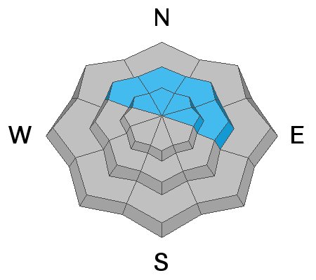
It's widespread on wind sheltered, NW-N-NE-E facing slopes near and slightly below treeline. What makes this setup so tricky? This is exactly the type of "go to terrain" we ride when we're starting to step out and get a handle on avy conditions. Above treeline in alpine terrain, the old weak snow distribution is more pockety.
Where and how to ride?
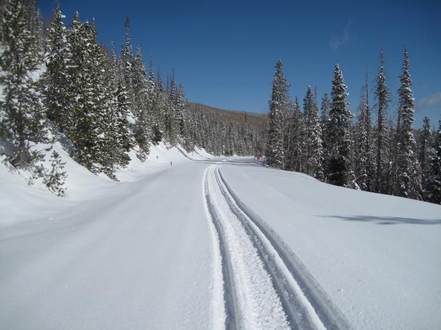
It's been an unusual run of weird weather, it's an atypical snowpack, and that means we need to gather some solid snow beta before comfortably getting after it and into big terrain. During your ride today, tweak small test slopes and see how they're reacting. Is your track gouging into weak, sugary snow or if you step off your machine do you sink into an unsupportable mess of damp snow. If that's case then we still need to allow some time for the snowpack to come around and gain some strength. Remember... change happens quick in the spring and I think a little patience now will deliver solid returns in the near future.
Additional Information
AVALANCHE TERRAIN:
Slope angle determines where avalanches can happen and where they can't. Generally, any slope steeper than 30 degrees is where avalanches occur. This means all you need to do is ride slopes less than 30 degrees in steepness and you'll never have to deal with avalanches.
There's a catch! You can't be underneath slopes steeper than 30 degrees either, even if you're on a flat slope, because avalanches can crash down on you. It turns out that skiing or riding slopes about 25 degrees in steepness is really fun and even more fun because there's no worry of avalanches. Unfortunately, it takes a lot of practice to estimate slope angles with your eyes alone. The way to get practice and the only way to know for sure is to measure slope angles with slope measuring tool shown in the photo below, and Toby describes it in this video. There are also many apps so that you can use your phone in a similar manner.

Your observations are important, so please let me know what you're seeing... click HERE and contribute to this amazing community based program
General Announcements
The information in this forecast expires 24 hours after the day and time posted, but will be updated by 07:00 Friday, April 1st.
Before it gets too crazy, now is the time to book an avalanche awareness presentation for your group, club, or posse. You can reach me directly at 801-231-2170 or [email protected]
This forecast is from the U.S.D.A. Forest Service, which is solely responsible for its content. This forecast describes general avalanche conditions and local variations always occur.