If you rely on the UAC forecasts each day you get out, consider making a donation during our
Spring Awareness Campaign to help us continue providing the avalanche forecasts and education you rely on.
The UAC encourages everyone to follow direction from federal, state, city and county officials. The following is from Joe Dougherty, spokesman for the
Utah Division of Emergency Management:
Though outdoor recreation is still permitted under the governor’s Stay Safe/Stay Home directive, we recommend that people maintain a distance of at least 6 feet.
Be extra cautious to avoid injuries outdoors. We are working with our hospital systems to conserve as much personal protective equipment as possible in case of hospitalizations.
Most outdoor injuries can be prevented. Know the conditions and know your limits so you don’t end up in a hospital.
Currently-
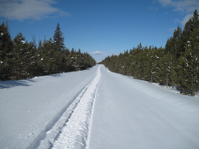
Under mostly cloudy skies, a light band of snow works into the region as I type. Current temperatures register in the teens and low 20's and southwest winds are generally light, blowing just 10-20 mph even along the high peaks. With a couple inches of light fluff stacking up yesterday, storm totals since Wednesday add up to nearly 24" of snow. Late March riding and turning conditions are about as good as they get, especially on mid elevation, wind sheltered slopes.
More Uinta weather network info is found here. Simply click on the Western Uinta tab.
For today-
Expect cloudy skies with occasional snow showers early this morning, though it should clear up after sunrise, with partly cloudy skies expected by late morning. High temperatures climb into the low to mid 30's and southwest winds remain well behaved, blowing 15-25 mph along the high peaks.
Futurecast-
Unsettled weather slides through the region late Tuesday and Wednesday. And whilst storm totals are still being sorted through, confidence for a solid, midweek reset seem reasonable.
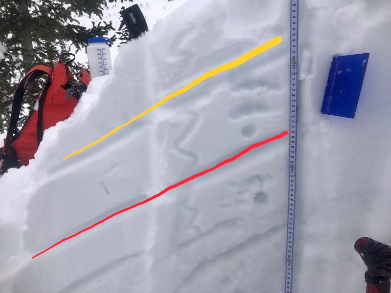
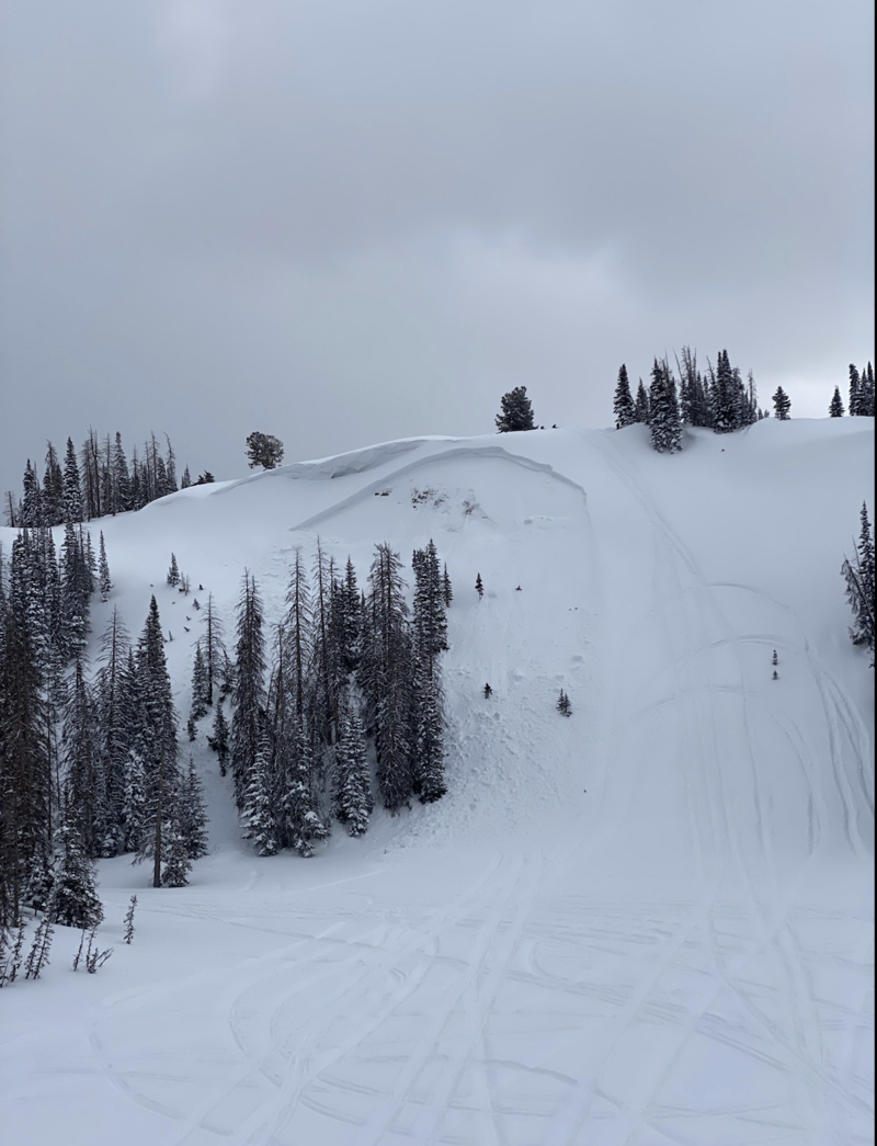
Avy snow-pro, educator, and all around snow dood extraordinaire, Andy Nassetta, took a hot lap up Mirror Lake Highway yesterday and the image above illustrates recent storm snow layering. Here's his take on the layering... "the upper portion of the snowpack at 10600' on an ESE slope, with the yellow line indicating HN24 and the red line indicating layer of concern (not terribly concerned). Test results produced ECTN16 down 32cm (red line)." Continuing with... "although avalanche conditions are generally low and green-light, a small slide could surprise you, breaking wider than expected, and catching you off guard. This time of year is when we like to step-out and get into our bigger terrain in the alpine and up high -- right where we would find one of these dragons. Keep your witts about ya, and take care when decision making. Look for the obvious signs of wind-loaded slopes and recent signs of wind-loading." More on Andy's travels found
here. A tale of two different avalanche problems-
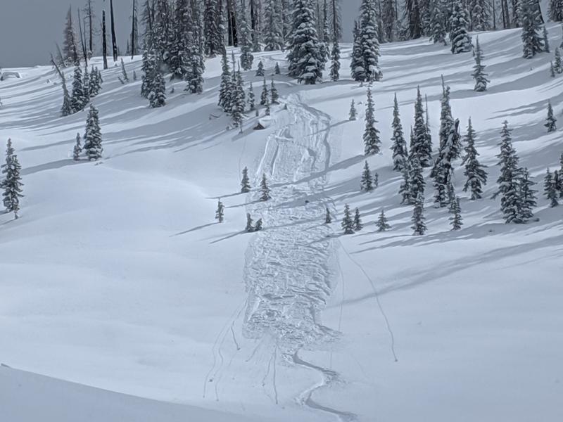
Michael J was out and about over the weekend and steered towards wind sheltered terrain where he found great riding and manageable avy hazard. As a matter of fact, with most of our weekend storm snow falling straight out of the sky, loose snow sluffing is generally the flavor of the day in terrain with these characteristics.
But add a little wind and you've got a much different avalanche on your hands. Big enough to boss you around, slam you into the group of trees below and ruin your day, the slide in the image above was triggered Friday on a steep wind drifted slope near Hoyt Peak.
To view additional trip reports and recent avalanche activity, simply click
here.