March Kicks Off Our Spring Campaign- Donate Now to Support Forecasting

Observation: Mirror Lake Highway

Observation Date
3/29/2020
Observer Name
Andrew Nassetta / Julian Amaral
Region
Uintas » Mirror Lake Highway
Location Name or Route
Soapstone to Haystack Mtn.
Weather
Sky
Broken
Precipitation
Light Snowfall
Wind Direction
Southwest
Wind Speed
Light
Weather Comments
Temperatures were warm from the get-go, headin off from soapstone at 9:30 things were already heating up quickly -- warm than expected. Skies cleared approaching mid-day and as we increased our elevation near 9,000'. There was a light dusting of snow from yesterday on the ride in and began to increase with elevation. Winds were calm in the valley bottoms, and light fro the south, southwest up on the higher ridgelines. As the day progressed, the weather increased, perhaps some mountain weather coming into effect -- with on and off S1 precipitation.
Snow Characteristics
New Snow Depth
4"
New Snow Density
Medium
Snow Surface Conditions
Powder
Damp
Snow Characteristics Comments
Per usual, it was a great day to play the aspects and elevations game. Mid-upper elevation slopes on the north half of the compass were cold and creamy, with the additional HN24. Things up high on the south half of the compass were a bit wonky with some crusts to deal with under the fresh powder. We skied a northeast slope at 9500' at 1100, and noted greenhousing and mid-elevation slopes taking a hit.
All in all skiing and riding conditions were excellent for late March, and travel is good and fat in the Highway 150 Zone.
Avalanche Problem #1
Problem
Wind Drifted Snow
Trend
Decreasing Danger
Problem #1 Comments
Just as Craig mentioned in forecast, although avalanche conditions are generally low and green-light, a small slide could suprise you, breaking wider than exepected, and catching you off guard. This time of year is when we like to step-out and get into our bigger terrain in the alpine and up high -- right where we would find one of these dragons. Keep your witts about ya, and take care when decision making. Look for the obvious signs of wind-loaded slopes and recent signs of wind-loading.
Avalanche Problem #2
Problem
New Snow
Trend
Decreasing Danger
Problem #2 Comments
Loose dry instabilities within the new snow seemed to have settled out, sluffs are running short lengths. In general, the recent snow has bonded well to the old snow surfaces and has provided stable, spring riding conditions.
Comments
Skiing and riding was great for March, and an even better break from the current state of the world. With that in mind, we set-out with a mellow day on the agenda and to keep it conservative. Our objectives stayed in the moderate range, keeping our slope angles between 30-35 degrees, and free of consequences. Weather was quite pleasant in the morning and throughout the early afternoon.
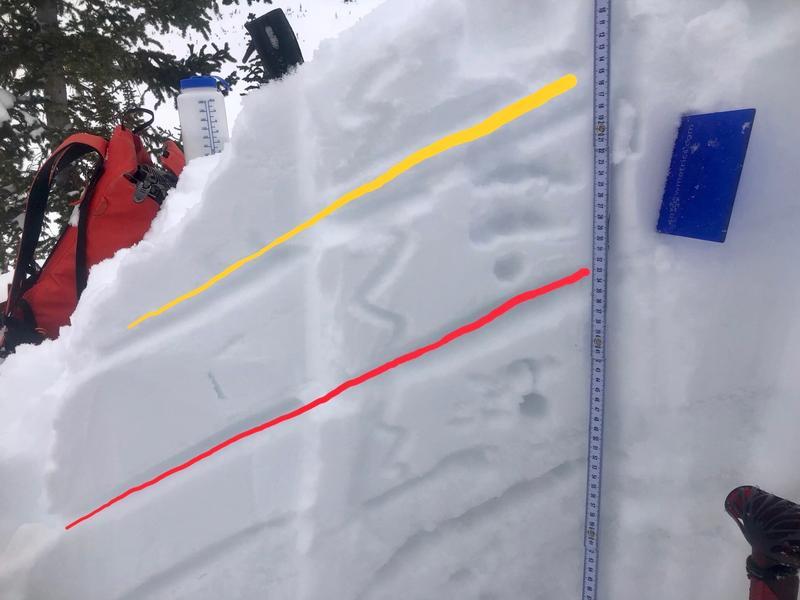
Image 1 -The upper portion of the snowpack at 10600' on an ESE slope, with the yellow line indicating HN24 and the red line indicating layer of concern (not terribly concerned). Test results produced ECTN16 down 32cm (red line).
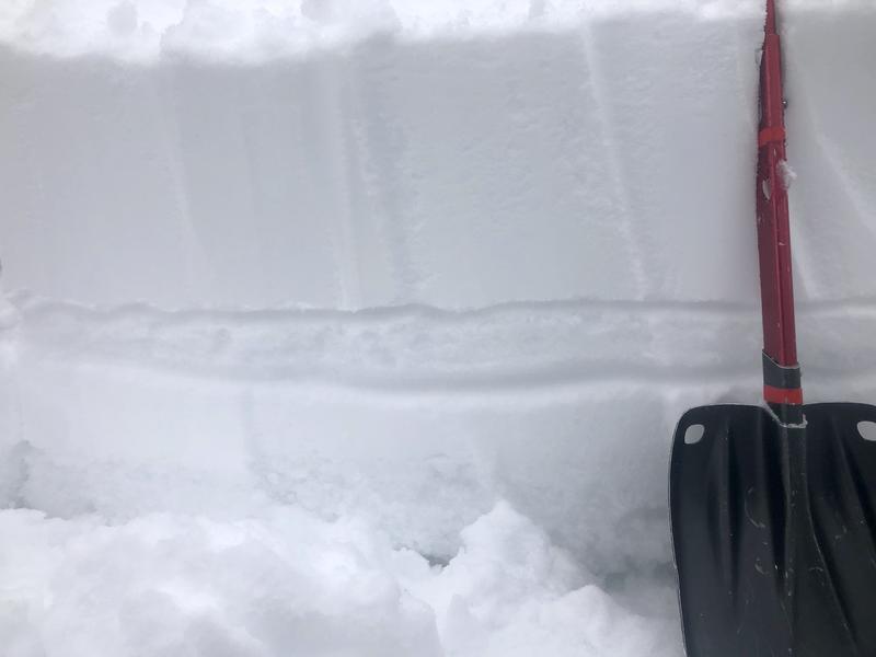
Image 2 - A wind-loaded slope. The transported snow sitting on top of the old surface about a foot down. Same aspect and elevation as image one, but more exposed to the wind.
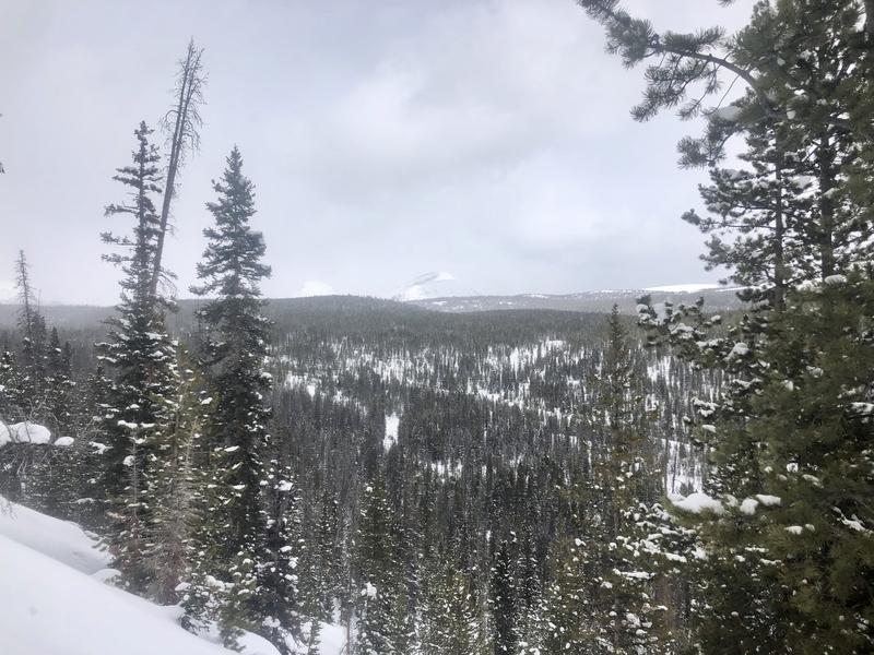
Image 3 - A thin layer of clouds kept the heat in for the greater part of the morning into early afternoon before the weather picked up.
Today's Observed Danger Rating
Low
Tomorrows Estimated Danger Rating
Low
Coordinates