If you rely on the UAC forecasts each day you get out, consider making a donation during our
Spring Awareness Campaign to help us continue providing the avalanche forecasts and education you rely on.
The UAC encourages everyone to follow direction from federal, state, city and county officials. The following is from Joe Dougherty, spokesman for the
Utah Division of Emergency Management:
Though outdoor recreation is still permitted under the governor’s Stay Safe/Stay Home directive, we recommend that people maintain a distance of at least 6 feet.
Be extra cautious to avoid injuries outdoors. We are working with our hospital systems to conserve as much personal protective equipment as possible in case of hospitalizations.
Most outdoor injuries can be prevented. Know the conditions and know your limits so you don’t end up in a hospital.
Currently-
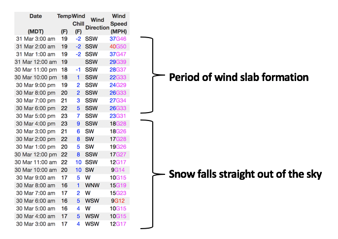
Under mostly cloudy skies, a band of light snow showers slide to the north of our zone as I type, and current temperatures register in the low to mid 20's. The spoiler to recent windless days is the obvious... the winds! Southwest winds increased yesterday afternoon, bumping into the 20's and 30's, and ramped up even further early this morning, now registering 30-50 mph along the high peaks. Late March riding and turning conditions are about as good as they get, especially on mid elevation, wind sheltered slopes.
More Uinta weather network info is found here. Simply click on the Western Uinta tab.
For today-
Expect cloudy skies with occasional snow showers and high temperatures climbing into the low to mid 30's. Southwest winds are gonna be a nuisance, blowing in the 30's and 40's with gusts in the 50's along the high peaks.
Futurecast-
Unsettled weather moves through the region tomorrow with a cold, albeit slightly moisture starved cold front. None-the-less, I think we'll squeeze out a couple inches of snow throughout the day. A break for Thursday and Friday with another shot of storminess on slated for the weekend.
A tale of two different avalanche problems-
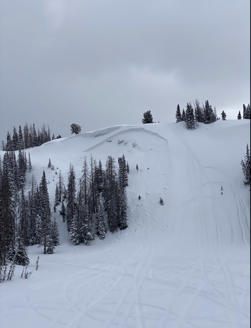
Michael J was out and about over the weekend and steered towards wind sheltered terrain where he found great riding and manageable avy hazard. As a matter of fact, with most of our weekend storm snow falling straight out of the sky, loose snow sluffing is generally the flavor of the day in terrain with these characteristics.
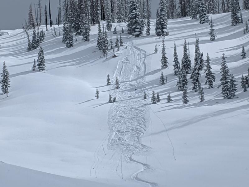
But add a little wind and you've got a much different avalanche on your hands. Big enough to boss you around, slam you into the group of trees below and ruin your day, the slide in the image above was triggered Friday on a steep wind drifted slope near Hoyt Peak.
To view additional trip reports and recent avalanche activity, simply click
here.