Forecast for the Uintas Area Mountains

Craig Gordon
Issued by Craig Gordon for
Tuesday, March 26, 2019
Expect two very different avalanche problems today-
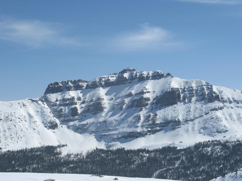
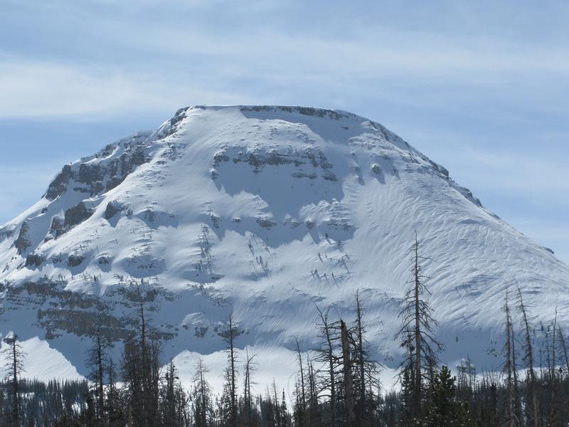
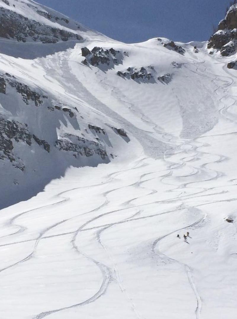
WET SNOW AVALANCHES-
Nearly all aspects and elevations will continue taking on heat today and the danger for WET SNOW avalanches starts out as LOW this morning, but rapidly rises to MODERATE as the day heats up. Human triggered avalanches are POSSIBLE on all steep, sun baked slopes.
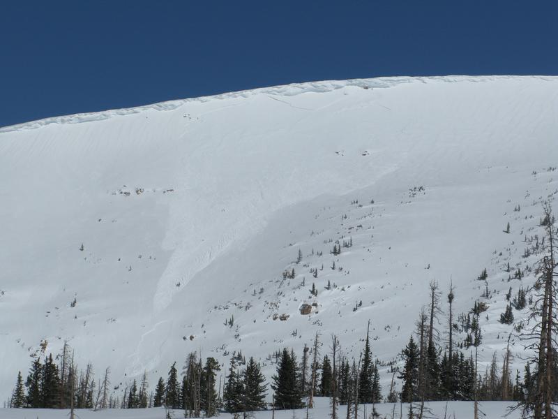
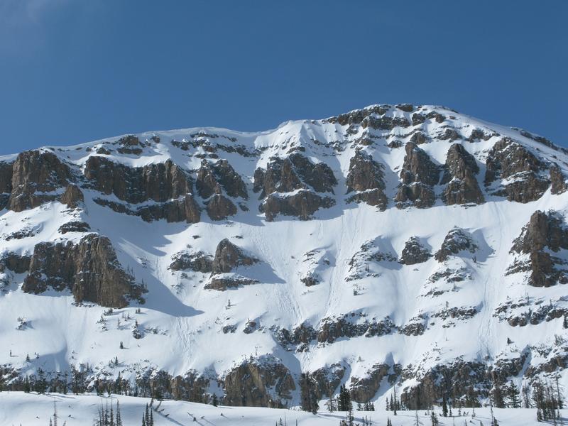
DRY SNOW AVALANCHES-
In the wind zone at and above treeline you'll find MODERATE avalanche danger. Human triggered DRY SNOW avalanches are POSSIBLE on steep leeward slopes facing the north half of the compass. Limited to a small percentage of the terrain available to ride in today, if you're getting into steep, technical terrain facing the north half of the compass remember, there may be a rogue drift or two large enough to boss you around.
Low
Moderate
Considerable
High
Extreme
Learn how to read the forecast here
Special Announcements
We need your help. In an effort to increase awareness and prevent future fatalities we need to reach more people with our daily avalanche forecasts, expand the Know Before You Go program, and increase the number of on-snow avalanche courses. Please consider a donation to the UAC to help us raise $25,000 by April 8. Show your support of the UAC by making a donation HERE
Weather and Snow
Skies remained clear last night, but temperatures only dipped into the low and mid 20's, about 10 degrees warmer than yesterday at this time. Southerly winds blow in the mid 20's along the high peaks. The powder party is just about over as all but the highest north facing terrain took on heat yesterday.
Above is hourly data from Trial Lake (9,945') and Windy Peak (10,662'). To view more regional weather stations click here.
Surreal... the Uinta's are stunningly white. On a go-anywhere-base and a phat Uinta snowpack, riding and turning conditions are about as good as they get.
Recent Avalanches
Downtown Chris Brown found a few stiff wind slabs reactive to his additional weight, breaking about 2' deep and running a surprisingly long distance on the steep, north facing terrain around Reid's Peak yesterday.
On the other side of the compass, I spotted this fresh cornice triggered wind slab early yesterday morning on the steep south facing terrain above the Mirror Lake Highway on Bald Mountain.
Recent trip reports and avy activity found HERE.
Ad
Avalanche Problem #1
Wet Snow
Type
Location
Likelihood
Size
Description
The light density weekend storm snow quickly took on heat yesterday. And like clockwork, steep sunny slopes like the hanging snowfields in the image above, came to life. Today's wet avalanche activity might be tempered somewhat and largely depends on cloud cover and wind keeping the snow surface cool. But as you know, wet avalanche activity is a timing thing and you'll want to stay ahead of the curve and not overstay your welcome. As the day heats up, simply get off of and stay out from under steep sun-exposed slopes. In addition, think about your exit strategy for the end of the end day or if it heats up quicker than you expect, and plan to avoid terrain traps like gullies and road cuts where wet, cement-like avalanche debris can stack up very deeply.
Avalanche Problem #2
Wind Drifted Snow
Type
Location
Likelihood
Size
Description
Limited to upper elevation north facing terrain in the alpine, I bet there's still a wind drift or two lurking on steep, leeward slopes in the wind zone, that'll react to our additional weight. While becoming a little more stubborn overnight, today you'll want to continue looking for and avoiding any fat, rounded piece of snow, especially if it sounds hollow like a drum.
And finally don't forget-
Cornices are ginormous and may break back further than you might expect. You definitely wanna give these large, unpredictable pieces of snow a wide berth and not ruin someones day below by inadvertently knocking a boxcar size piece of snow down on them.
Additional Information
A dry, mild southwest flow prevails through Wednesday, producing mostly sunny skies with temperatures climbing into the upper 40's. Southwest winds gust into the 30's and 40's along the high peaks. A disorganized storm system brings periods of snow and cooler temperatures Thursday into Friday.
General Announcements
The information in this advisory expires 24 hours after the date and time posted, but will be updated by 7:00 AM Wednesday March 27th, 2019.
If you're getting out and about, please let me know what you're seeing especially if you see or trigger and avalanche. I can be reached at [email protected] or 801-231-2170
It's also a good time to set up one of our very popular avalanche awareness classes. Reach out to me and I'll make it happen.
This information does not apply to developed ski areas or highways where avalanche control is normally done. This advisory is from the U.S.D.A. Forest Service, which is solely responsible for its content. This advisory describes general avalanche conditions and local variations always occur.