After a difficult week in February that included four avalanche fatalities, UAC forecasters will host a community debrief to discuss the conditions surrounding these accidents. We will review the weather and snowpack patterns, share observations from the field, and discuss lessons learned. This event will not be live but include time for questions and discussion, with the goal of learning together as a community. Please submit your questions HERE.
Nowcast - Warm temperatures persists, with overnight lows near 35 F° at 11,000', totaling four days without a solid refreeze. Moderate winds averaged 30 MPH overnight from the west at upper elevations, but are now backing off over the past few hours since 0500.
Forecast - It may not be flip-flop weather like yesterday, with an expected high of 45F° at 9,500', but that is still some serious heat! Winds back-off throughout the morning while afternoon clouds move into the region for broken skies by supper time.
Futurecast - We "cool-off"over the next few days, with warming, higher than average temperatures, creeping right back into the region by early this week.
Travel Conditions - North and south side gates are open on HWY-150, plowed from the north to Whitney and from the south to Spring Canyon, and of course SR35 remains open over the pass. Solars are melted out up to 9,000' and many windward slopes are scoured and worked to the dirt.
 Mill Hollow is about the only juice worth the squeeze in terms of travel conditions. Things were so soft yesterday, we had no problem keeping the mountain sled as cool as the fanner, and overall road riding quality was pretty sweet! -- Check out more from our travels and Trev's great write-up found, here.
 I guess sun-cup season came early, and even northerly slopes at 10k' were showing serious effects of the heat wave, ultimately taking a hit on riding and skiing quality. In general, the snow surfaces are extremely variable across the map, and to find the best riding, you have to find smooth snow surfaces.
No new avalanche activity has been reported in the past 24 hours, for recent slides and travel reports from across the range, click below!

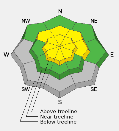
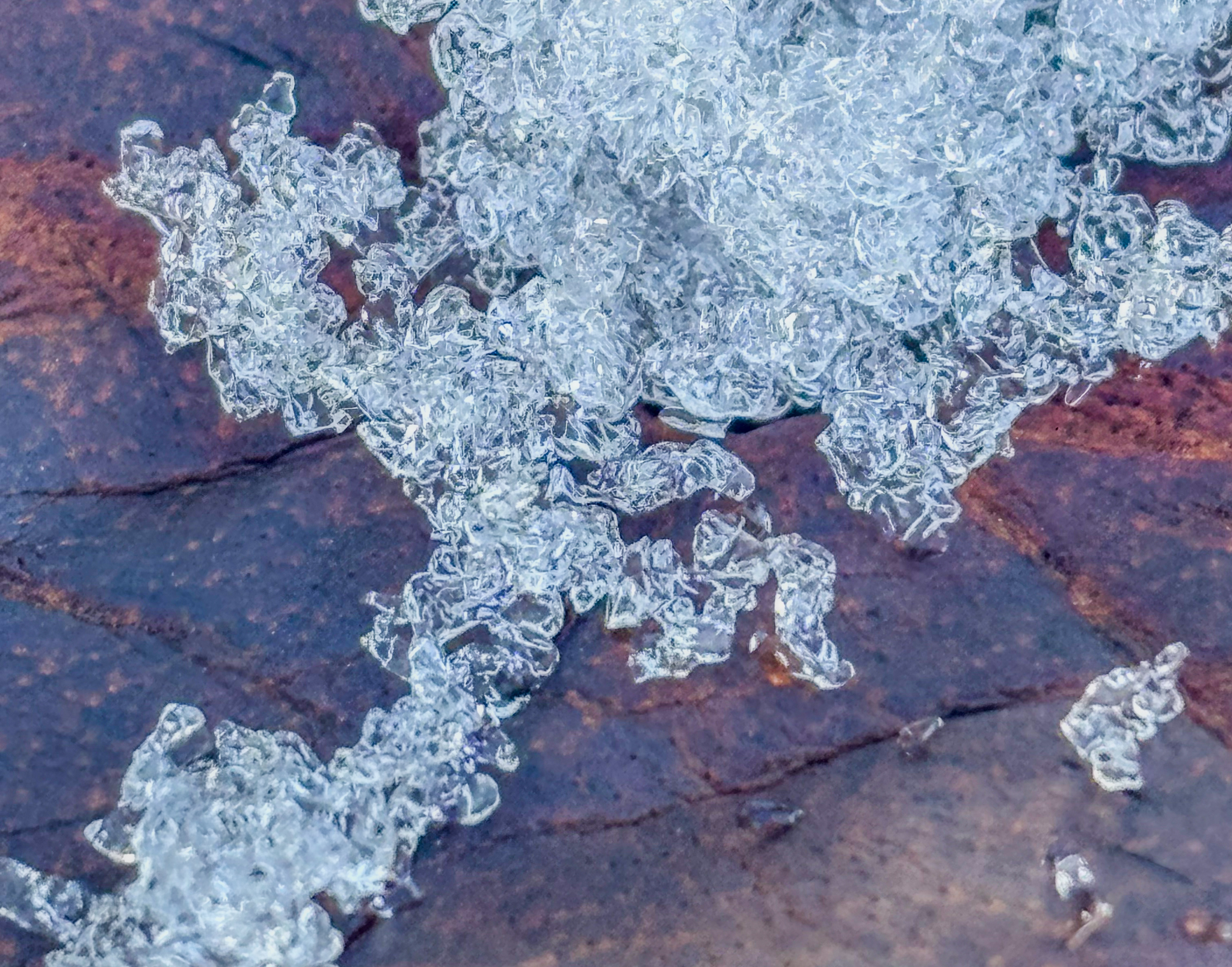 4F+, rounding facets, that are quite moist sit below a dense slab on slopes facing north through east above 10,000'. These snow grains are showing signs of turning the corner, but as Brett "Kowboy" Kobernik says, we can't trust 'em jus yet.


