Forecast for the Uintas Area Mountains

Mark Staples
Issued by Mark Staples for
Sunday, March 10, 2024
Now is a great time to get out and enjoy the beautiful weather and great coverage with a LOW avalanche danger on most slopes.
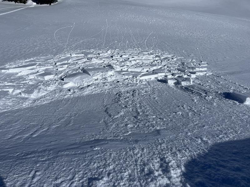
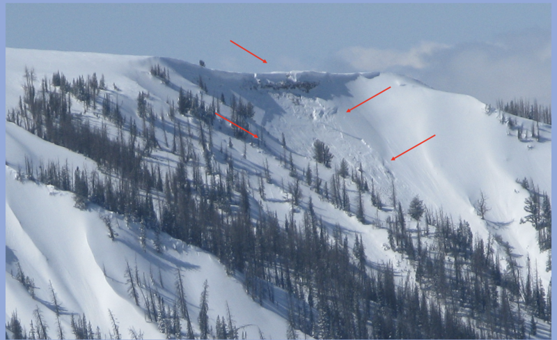
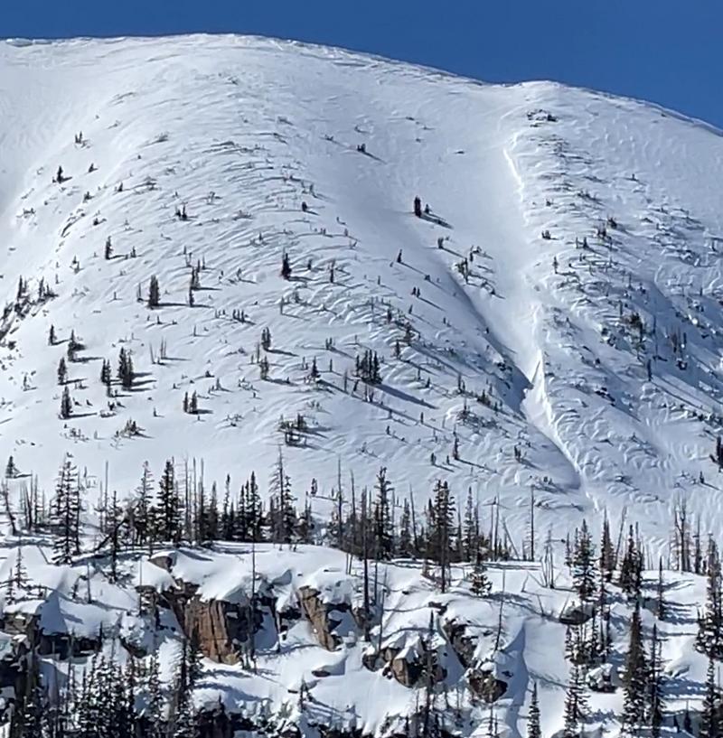
Above treeline the danger is MODERATE where you could still trigger a slab of wind drifted snow but this problem is easy to avoid. Also watch for giant cornices.
Low
Moderate
Considerable
High
Extreme
Learn how to read the forecast here
Weather and Snow
This morning temperatures are mostly in the mid teens F (about 10 degrees warmer than yesterday morning). Winds from the south increased a little bit overnight and at upper ridgelines they are blowing 15-20 mph gusting 25-35 mph.
Today will be another stunning day to be in the mountains. Temperatures will climb to near 40 degrees F, and winds from the south will continue.
Another storm is still on track to bring snow Tuesday night through Wednesday along with some decent south winds. It could deliver 5-10 inches and then skies should clear by next Friday.
Absolutely hero snow! Go anywhere but still plenty soft - on shaded slopes. Southerly slopes are crusty in the early morning and wet by mid morning as things heat up.
Recent Avalanches
On Bald Mountain yesterday, Ted checked a small test slope and was able to trigger a small slab of wind drifted snow about 10" deep and 30' wide.
Craig spotted this avalanche from a falling cornice on Friday. The fact that it didn't trigger a much larger avalanche is a good sign.
Craig describes this giant cornice fall in his video below.

For all Uinta observations and recent avalanche activity click HERE.
Ad
Avalanche Problem #1
Wind Drifted Snow
Type
Location
Likelihood
Size
Description
The most likely avalanche to trigger today will be a slab of wind drifted snow above treeline. Many of these wind slabs likely stabilized during yesterday's warmth, but I bet you could still trigger a few today. Lose a little elevation, and you don't have to worry about this problem.
TREND: decreasing
Photo of above treeline terrain yesterday where you can see how winds moved across the face and drifted snow.
Avalanche Problem #2
Persistent Weak Layer
Type
Location
Likelihood
Size
Description
There is a remote possibility of triggering a deep slide breaking at the ground in upper elevation terrain, but you'd have to get unlucky. Just avoid places where you think there's a good chance of hitting rocks which is where you'd have to be to trigger one of these slides.
I found deep, strong, and stable snow yesterday in the near treeline elevations.
Additional Information
The Uinta weather station network was upgraded this summer and all that real-time info is found HERE. Simply click on "western Uinta" tab and then "weather stations" tab.

We are always looking for snow and avalanche observations or just general riding conditions. So... if you see something, say something. You can reach me directly at [email protected] or 801-231-2170.
Also, if you're looking for more avy education opportunities for yourself, your crew, or your club please don't hesitate to reach out to me and we'll find a presentation, class, or clinic for ya!
General Announcements

Issued at 0700 on Sunday, March 10th this forecast will be updated by 0700 Monday, March 11th, 2024.
This forecast is from the U.S.D.A. Forest Service, which is solely responsible for its content. This forecast describes general avalanche conditions and local variations always occur.