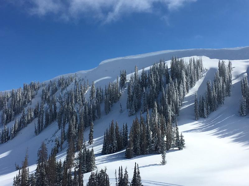
Forecast for the Uintas Area Mountains

Craig Gordon
Issued by Craig Gordon for
Sunday, March 10, 2019
In steep, mid and upper elevation terrain, at and above treeline, you'll find MODERATE avalanche danger. Human triggered avalanches are POSSIBLE on steep wind drifted slopes, especially those facing the north half of the compass and particularly those with an easterly component to their aspect. Any avalanche that breaks into deeper buried weak layers near the ground will result in a deep, dangerous slide.
Lower elevation, lower angle, wind sheltered terrain offers generally LOW avalanche danger.
Low
Moderate
Considerable
High
Extreme
Learn how to read the forecast here
Weather and Snow
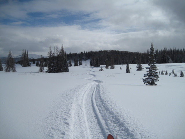
High clouds and a weak storm brought light snow to the region overnight, delivering just an inch or two to the high terrain across the region. Temperatures are in the teens and low 20's. Winds are light, southwesterly, and blow 10-20 mph along the ridges. Riding and turning conditions are about as good as they get, especially in mid elevation, wind sheltered terrain.
Above is hourly data from Trial Lake (9,945') and Windy Peak (10,662'). To view more regional weather stations click here.
Our main man Ted Scroggin found deep, cold, light snow yesterday in the Gold Hill area and reports generally stable conditions. More on Ted's travels and insight here.
Recent Avalanches
Newly formed wind drifts on steep, leeward slopes were the only avalanche game in town yesterday.
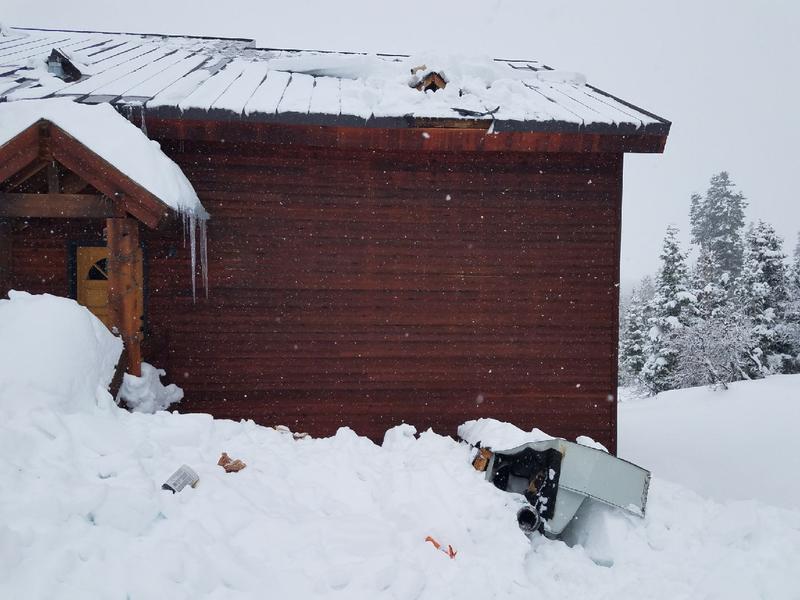
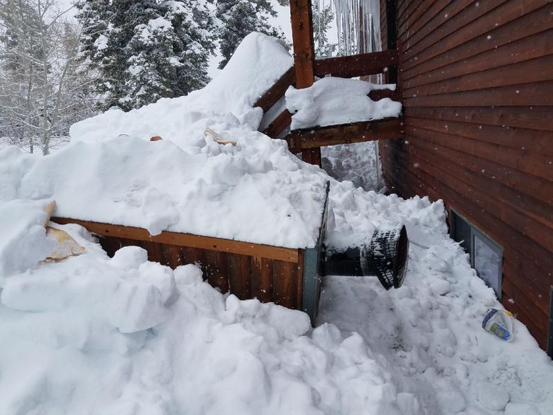
Meanwhile, cabins located in snowbelt mountain communities continue to produce significant, chimney stripping roofalanches .
Recent trip reports and avy activity found HERE.
Ad
Avalanche Problem #1
Wind Drifted Snow
Type
Location
Likelihood
Size
Description
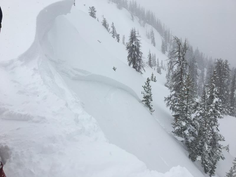
On Thursday, Eastern front avalanche hunters Jason and Dave stomped around Upper Weber Canyon yesterday and found fresh wind slabs forming along the leeward side of upper elevation ridges (image pictured above). Reactive to the additional weight of a person, yesterday's slabs broke 12"-18" deep, failing on a layer of light density snow, and ran a surprisingly long distance. Dave noted.... "given the density of the new snow, the wind slabs were a bit more connected then would otherwise be expected with these wind speeds."
The Uinta's are a big range and while recent storm snow fell straight out of the sky, the light, blower pow is covering up old wind drifts formed on Thursday, making them hard to detect... and that's where it gets a bit tricky. While I think today's avy danger is pretty straight-forward, don't get fooled into thinking fresh, shallow snow instabilities are all you're dealing with. In upper elevation leeward terrain, underneath that fluff, lurks an old drift or two that may break deeper and wider than you might expect. The best way to manage this setup is to simply look for and avoid any fat, rounded piece of snow, especially if it sounds hollow like a drum.
And don't forget-
Cornices are ginormous and may break back further than you might expect. You definitely wanna give these large, unpredictable pieces of snow a wide berth and not ruin someones day below by inadvertently knocking a boxcar size piece of snow down on them
Avalanche Problem #2
Persistent Weak Layer
Type
Location
Likelihood
Size
Description
The days are getting longer, temperatures are slowly warming, overall snow depths are becoming incredibly deep, and the snowpack is getting to its happy place.... as a matter of fact, so am I. We are trending in the right direction and recent snowpack stability tests along with the lack of avalanches failing on weak snow near the ground suggest we're turning the corner. That said... deep dangerous avalanches are becoming harder to trigger. All encouraging news for sure, but we've got to remember there's a lot of terrain that makes up the landscape of the western Uinta range and I'm not entirely convinced all slopes are good to go. The same kind of terrain I avoid early season still gives me the creeps right now. Steep, rocky, technical terrain with a thin, shallow snowpack remains suspect and there's no reason to tug on the dogs tail to see how it reacts, especially with all the other safe riding opportunities out there.
Additional Information
A weak storm system remains over the mountains today and tonight bringing occasional light snow showers with minimal accumulation. High temperatures rise into the low 30's with overnight lows in the 20's. Winds remain light and variable, blowing less than 20 mph. The next storm on tap rolls through the region midweek.
General Announcements
The information in this advisory expires 24 hours after the date and time posted, but will be updated by 7:00 AM Monday March 11th, 2019.
If you're getting out and about, please let me know what you're seeing especially if you see or trigger and avalanche. I can be reached at [email protected] or 801-231-2170
It's also a good time to set up one of our very popular avalanche awareness classes. Reach out to me and I'll make it happen.
This information does not apply to developed ski areas or highways where avalanche control is normally done. This advisory is from the U.S.D.A. Forest Service, which is solely responsible for its content. This advisory describes general avalanche conditions and local variations always occur.