Nowcast - As of 0500 overcast skies in the valley are paired with humid air, and steady temperatures near the 20's°F. At our highest elevations, ridge top winds blow from the west lightly, around 10-15 MPH with gusts into the 20's. Skies remain obscured today as pre-frontal weather rolls into town ahead of a small passage due for the range tomorrow.
Forecast - Expect mild and warm temperatures with scattered snow showers later today. It may not accumulate, but it will be enough to make it feel rugged out there -- And yes, depending upon what elevation you are at, you may see some rain showers if you are below 9,000'. Temperatures keep steady, with a high of 35°F today at the trailheads, while higher elevations keep a bit cooler, closer to freezing. Winds will be tempered and blowing lightly from the west, around 15 MPH with a few gusts into the 20's up high, and look to ramp up later on towards supper time.
Futurecast - Stay hopeful for light snowfall accumulations tomorrow and into the start of the working week, as a few additional inches of snowfall would go a long way for our current conditions.
Travel Conditions - From zero, to hero, then right back to spring-like conditions. You wouldn't know that the Uinta's received nearly 2-3' of snow last week with almost 3" of SWE by the looks of things outta the gate. Many of our trailheads received rain earlier this week and the pack took a hit down low, making travel in and out of riding zones difficult. The price of admission may be worth it for some, and with a few thousand feet of elevation gain and a little adventuring, surfy and spongey riding conditions will be waiting to greet you in protected, north facing terrain.
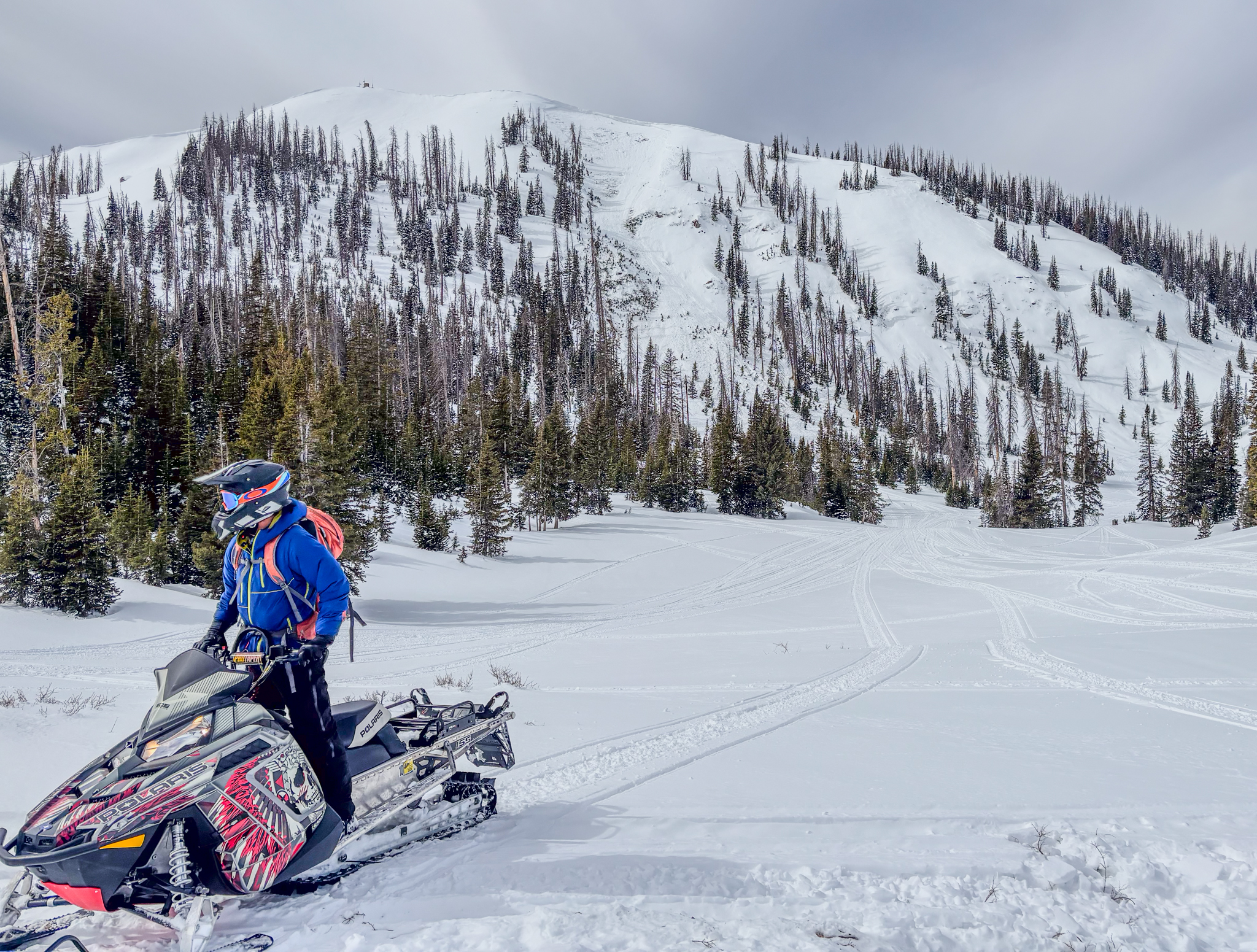 My friend Steve and I were buzzing around yesterday on the South Slope, near Currant Creek and struggled to find quality riding throughout the day below 10,000'. Its a mixed bag of conditions out there with a whole lot of type-two fun to be had!
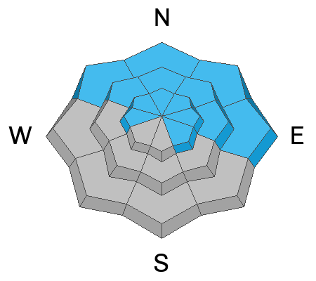
There is no shortage of evidence and recent avalanche activity from across the range. Over the past week and a half we have gone through multiple loading events and avalanche cycles, with most of our significant avalanche activity on aspects facing NW through E, at mid and upper elevations.
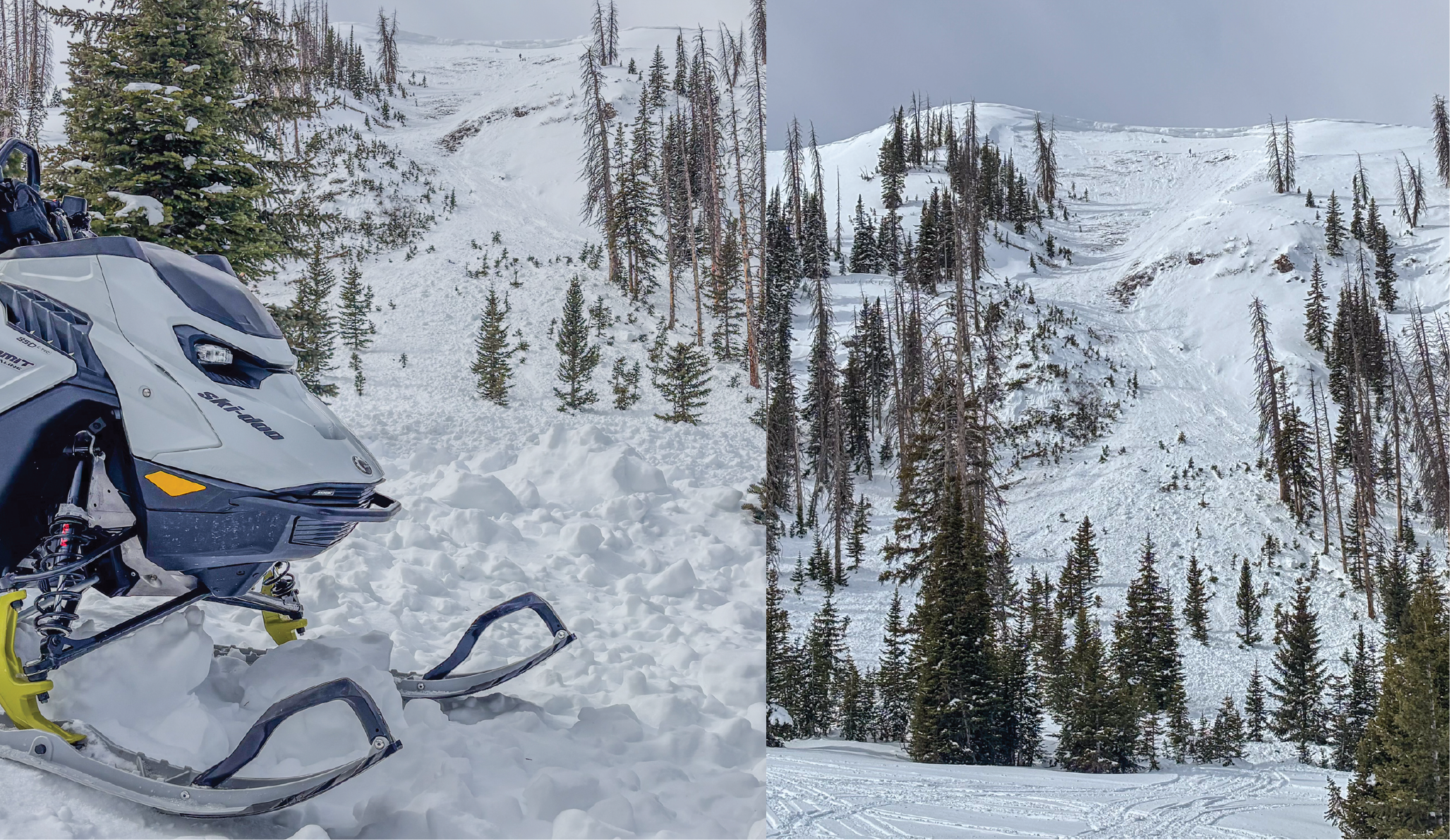
On Currant Creek Peak at 10,700', a large and destructive D2.5 avalanche tore down the northeast chute stacking up a sizable amount of debris full of thigh-thick old timber and chunks as heavy as my Doo itself.








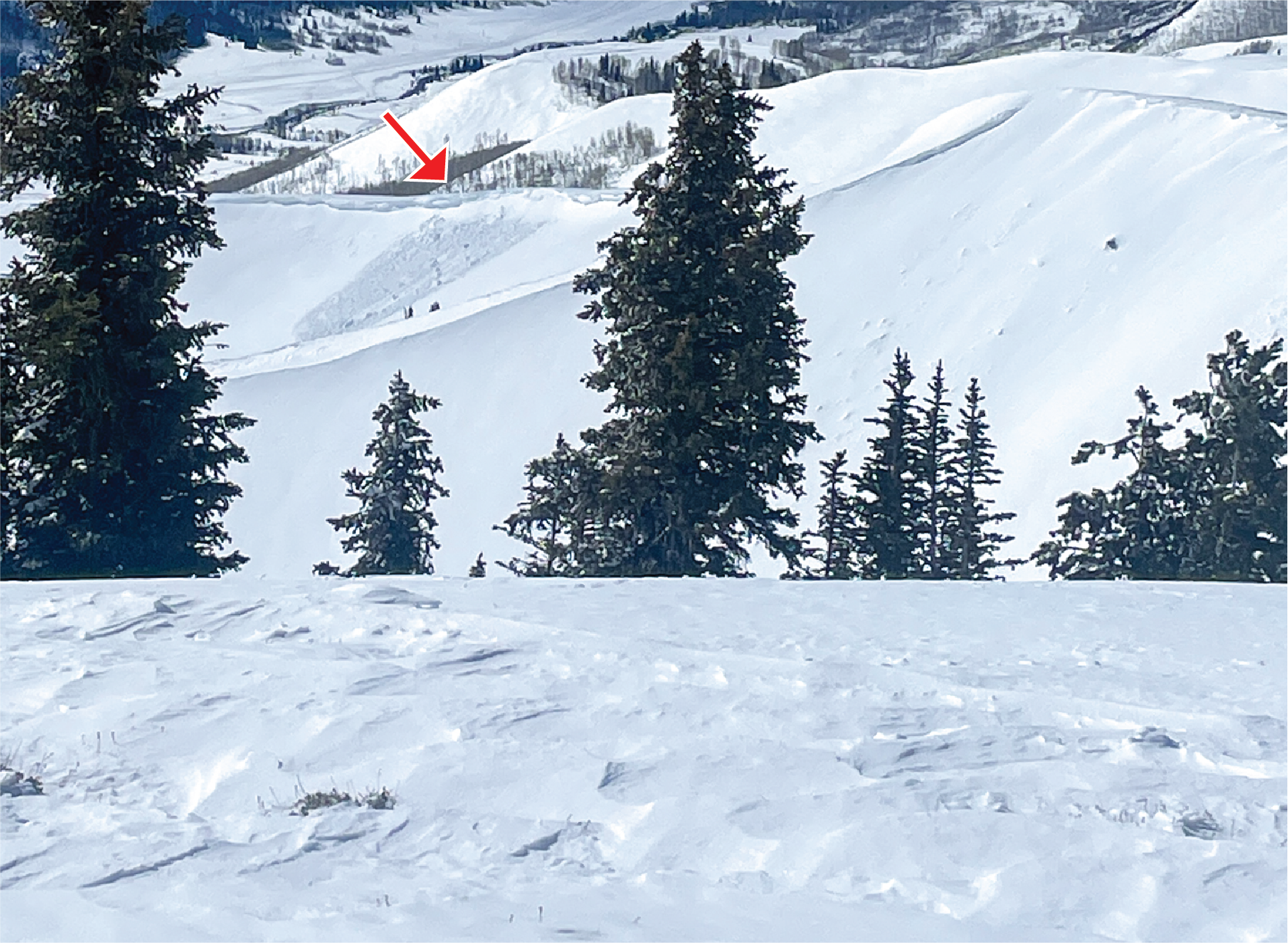
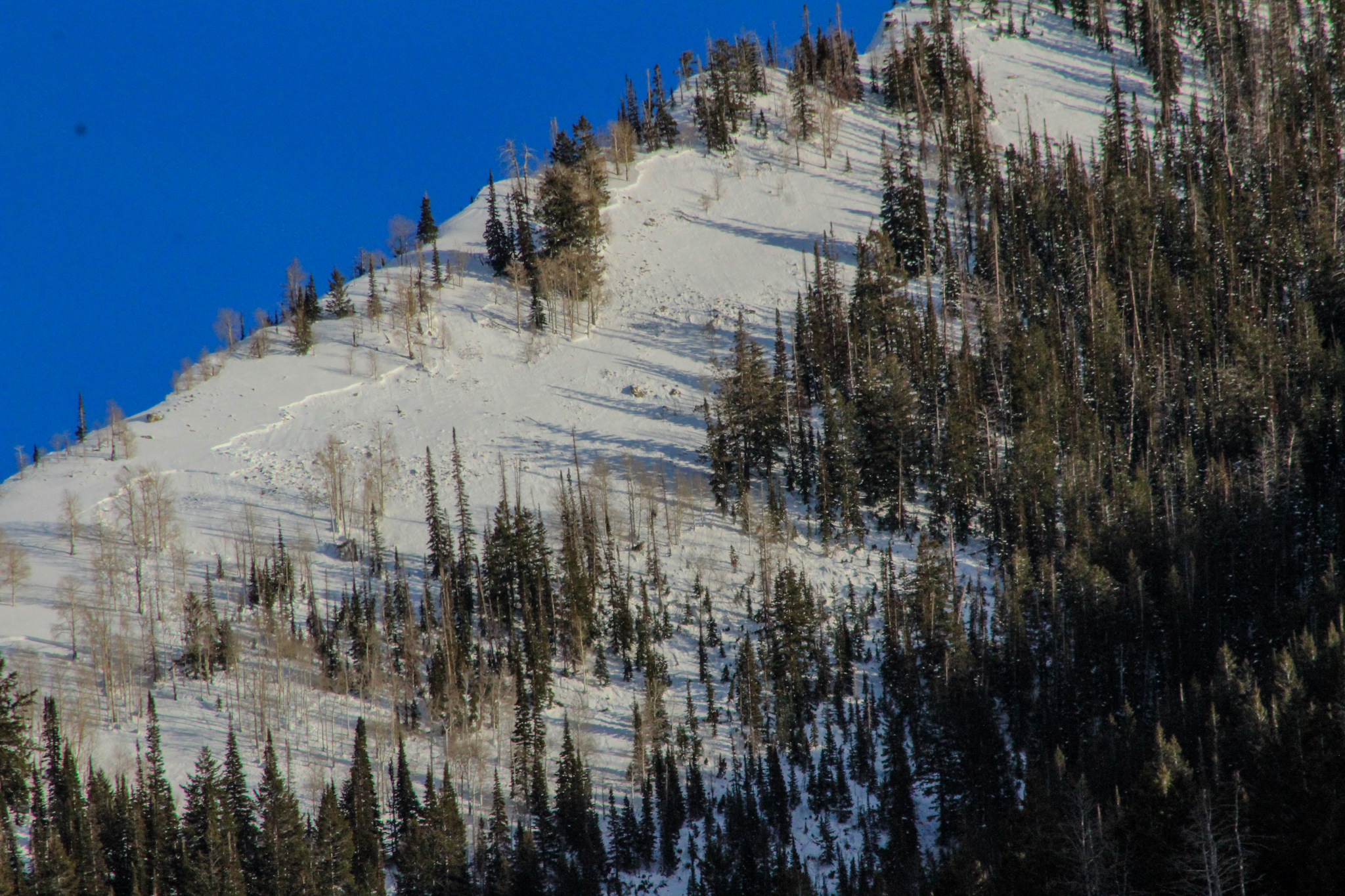 A well-connected persistent slab avalanche that failed in mid-elevations around 9,400' on a WNW slope in Weber Canyon near Shingle Mill Peak.
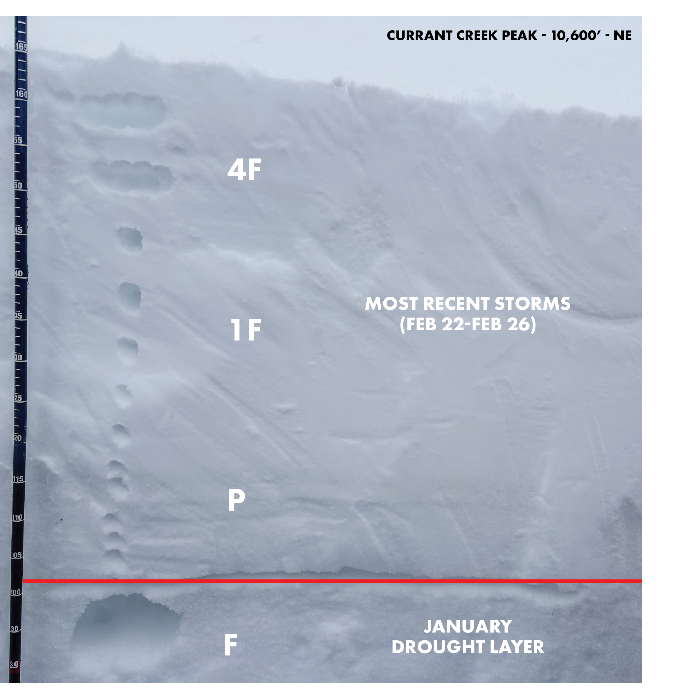 Above is a rough profile from near Currant Creek, where dense and cohesive storm snow from last week has consolidated on top our our JDL, and is now the focus point of our hazard. This maritime-esque slab is no match for our continental faceted weak layer.