UDOT PLANNED AVALANCHE CLOSURES!!

Forecast for the Uintas Area Mountains

Mark Staples
Issued by Mark Staples for
Friday, February 4, 2022
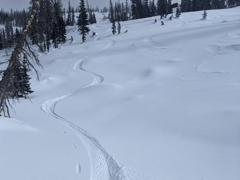
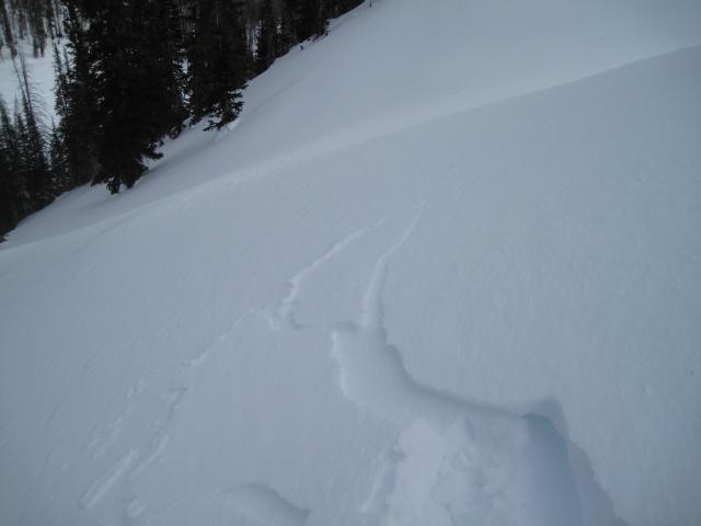
Today the avalanche danger remains LOW on all aspects and elevations. Even though it hasn't snowed in some time, the low avalanche danger and beautiful weather make it a great time to get out and enjoy the mountains and the sunshine with family and friends.
If going into big, committing terrain, consider the consequences of triggering even a very small slide which always remains a small possibility.
Low
Moderate
Considerable
High
Extreme
Learn how to read the forecast here
Weather and Snow
NOWCAST-
Temperatures this morning in most places are a few degrees above 0 F. Winds overnight were blowing 25 mph from the north at upper elevations but have eased a little this morning blowing 15 mph gusting to 20 mph.
FORECAST-
Today will have clear skies and sunshine. A little bit of warmer air will move over the area today and help temperatures rise into the low 20s F. Winds will continue from the north and calm to about 5 mph this afternoon as they slowly shift direction and come from the west.
FUTURECAST-
There will be a few clouds overnight and tomorrow morning as a cold front passes overhead. Otherwise the weekend will be clear and sunny with high temperatures in the 20s F.
There is still some soft snow on wind and sun sheltered slopes as Michael J found yesterday even though its getting harder to find. I spoke with some riders at Soapstone yesterday who have gotten creative and found some interesting low elevation areas to ride where the snow is still soft, but it may require a little exploration to find.

Looking for real-time temps, snow, or wind?
Click HERE and then on the "western Uinta" tab for western Uinta specific, weather station network.
Recent Avalanches
No significant avalanche activity to report; however, Ted noticed some cracking in very shallow and very small drifts yesterday near Whiskey Creek. It's not a cause of much alarm, but something worth noting. When more snow arrives which could be in another week or more, I suspect we'll see a lot more of this.

Click HERE for a list of recent avalanches.
A list of all other observations is found HERE

Your input is vital and we're interested in what you're seeing. Please contribute to this great community resource and go here to fill out an observation.
Ad
Avalanche Problem #1
Normal Caution
Type
Location
Likelihood
Size
Description
What does "Normal Caution" mean? It means there is no specific avalanche problem to watch for, and we mainly need to take the normal actions which include: carrying avalanche rescue gear, only exposing one person at a time to avalanche terrain, and considering the consequences of a small slide.
Since mountain travel always has some hazards, it's worth watching for them and considering ways to limit exposure to those hazards. In terms of avalanches, there could be a few shallow, and thin wind drifts that formed yesterday to watch for because they could knock you off your feet. Look for smooth, rounded, and pillowly textures to the snow surface and avoid these pockets. Many slopes above treeline have very hard snow, and most south facing slopes have a hard ice crust on them. The main hazard on these slopes on skis, boards, or a sled is sliding downhill and not being able to stop.
Additional Information
While we're waiting patiently for winter to return from its hiatus, take a few minutes and visit one of our beacon parks and test your rescue skills. Ted installed a Beacon Basin at the Bear River Trailhead and there's another park found at the northeast corner of the Nobletts Trailhead.
Your observations are important, so please let me know what you're seeing... click HERE and contribute to this amazing community based program
General Announcements
The information in this forecast expires 24 hours after the day and time posted, but will be updated by 07:00 tomorrow.
Before it gets too crazy, now is the time to book an avalanche awareness presentation for your group, club, or posse. You can reach me directly at 801-231-2170 or [email protected]
This forecast is from the U.S.D.A. Forest Service, which is solely responsible for its content. This forecast describes general avalanche conditions and local variations always occur.