Forecast for the Uintas Area Mountains

Andrew Nassetta
Issued by Andrew Nassetta on
Monday morning, February 3, 2025
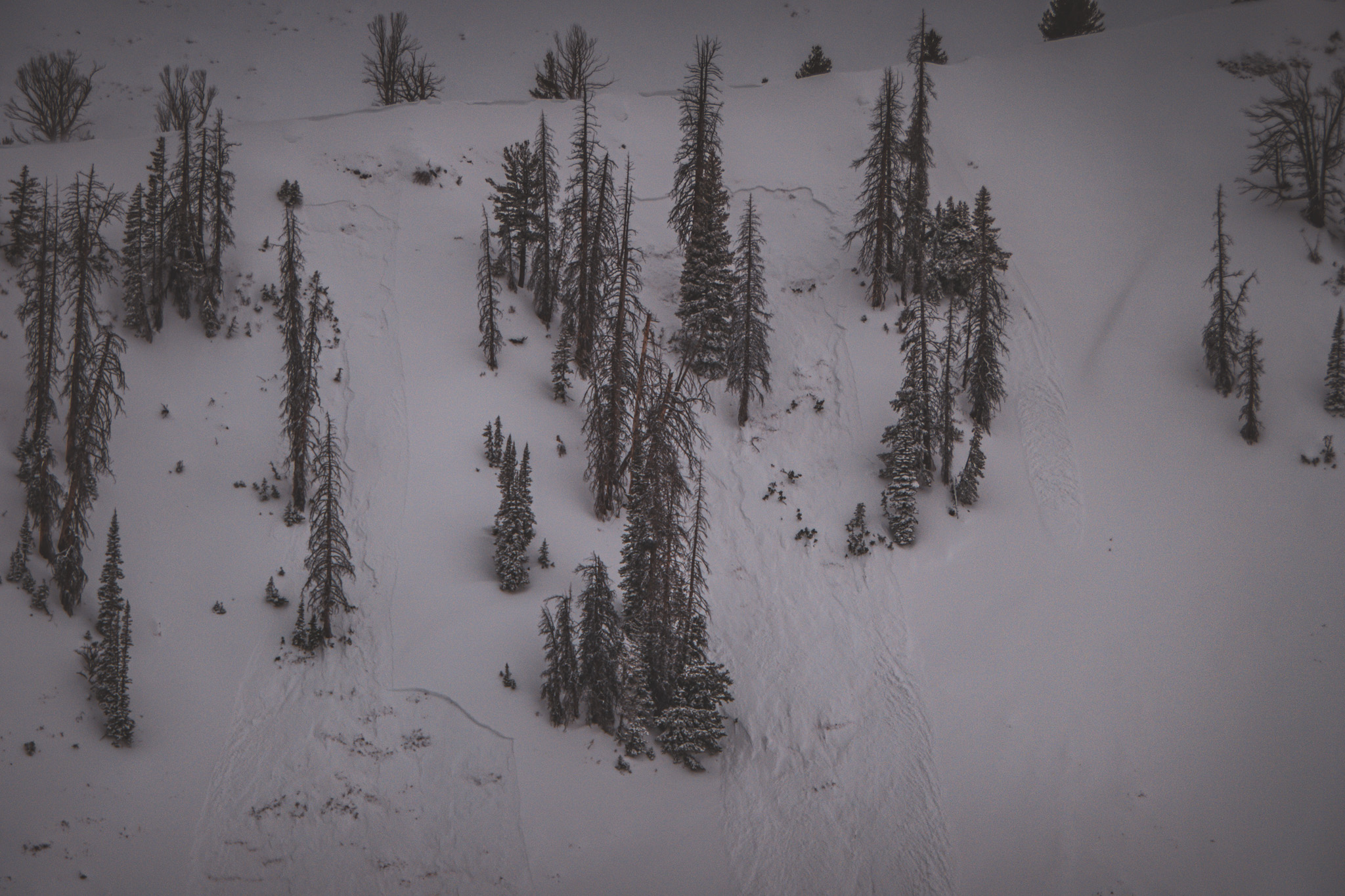
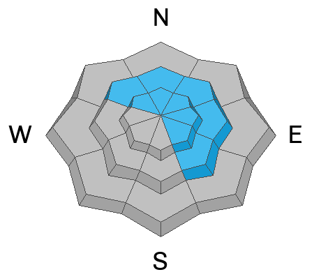
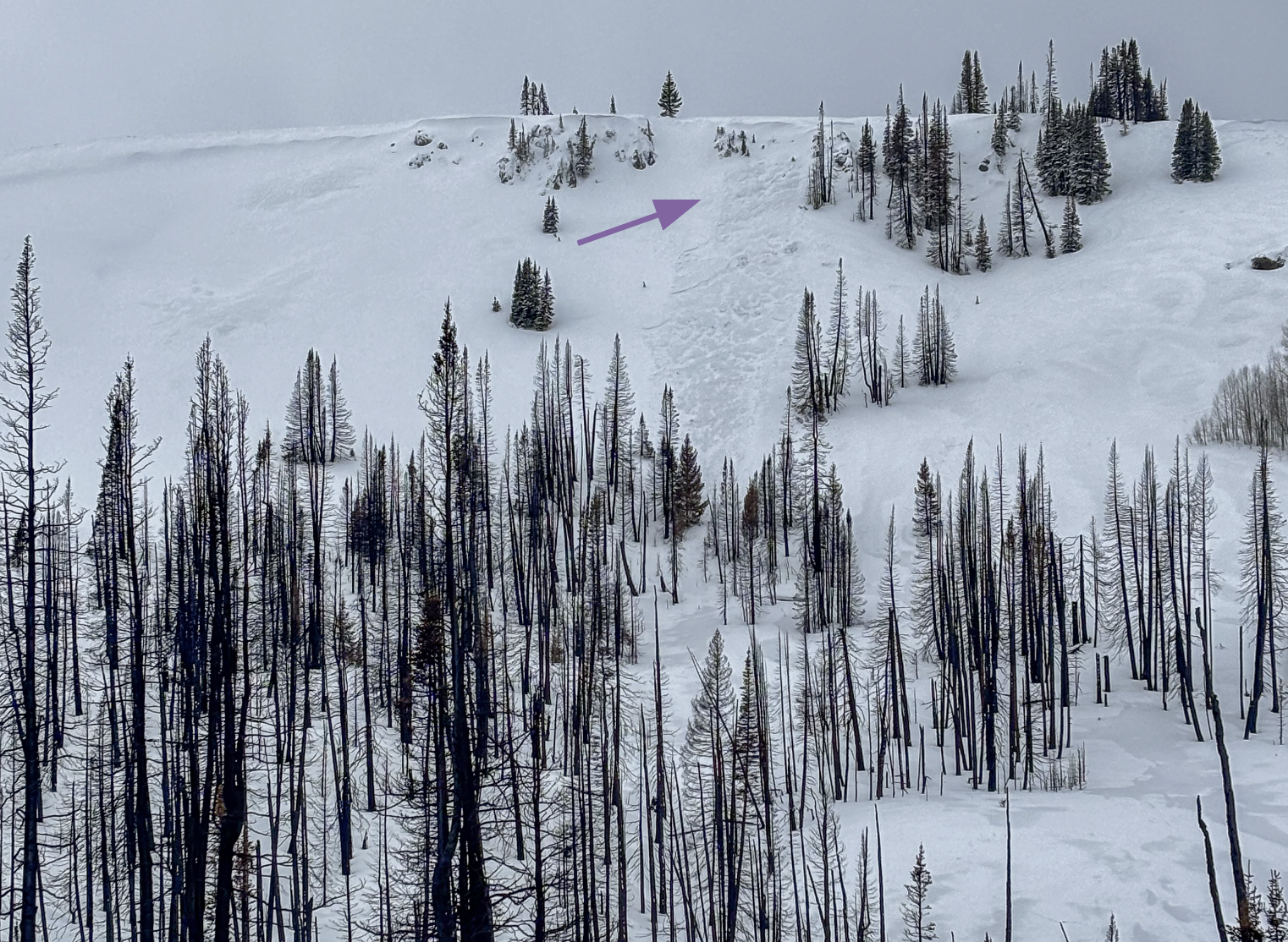
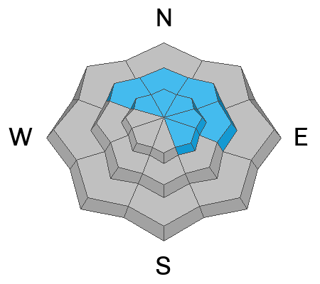
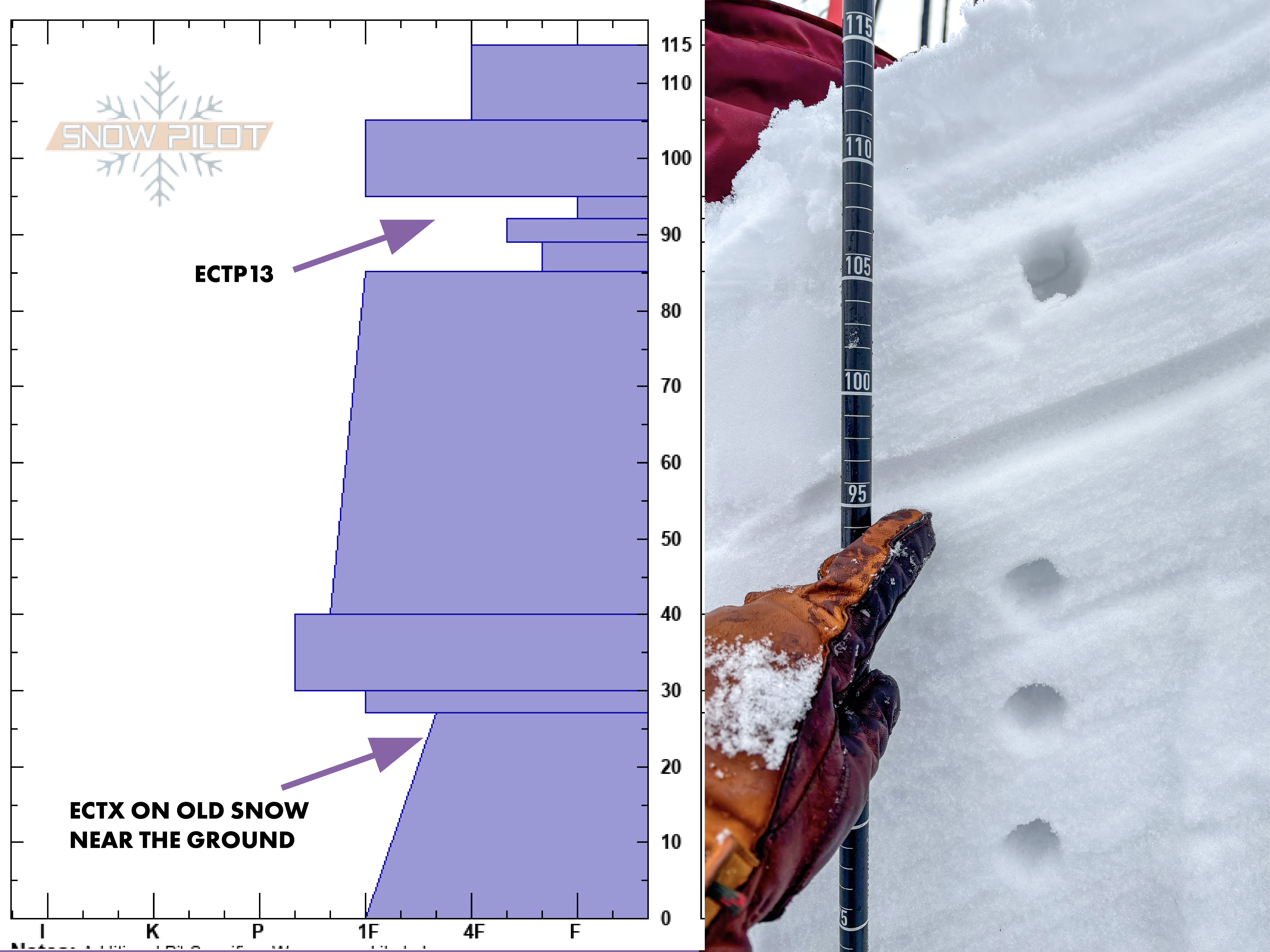
Today’s avalanche hazard is MODERATE overall at upper elevations facing northwest through southeast. It is POSSIBLE to trigger a stiff wind-drift up to 2’ deep that has the potential to break into weaker, faceted snow that is buried in upper and lower portions of the snowpack.
Low
Moderate
Considerable
High
Extreme
Learn how to read the forecast here
Weather and Snow
Nowcast
Since Friday night, the range scooped up 6-12" of snow with up to 1.4" of water with lots of variability in depth depending on your travels. Skies are gray and overcast this morning as temperatures at 9,000’ are reading in at 30℉. Winds are moving from the southwest and have been consistently blowing in the 20’s and 30’s, with gusts pushing 50 MPH at upper elevations.
Forecast
Temperatures will be unseasonably warm today, and winds will continue in theme from the southwest blowing in the 20’s and 30’s, with gusts into the 40’s at times up high.
Futurecast
The next shot of snow slides in on Wednesday, and looks active through the rest of the week.
Recent Avalanches
Avalanches reported yesterday were failing within the new and wind-drifted snow on a variety of old snow surfaces including recently buried near surface facets.
As always, gain more intel and info via obs, avalanches and trip reports from across the range and beyond, here!
Thanks Bo, for the great photo of the recent storm snow failing on weak faceted snow from mid-January that is now buried -- More info here.
Ad
Avalanche Problem #1
Wind Drifted Snow
Type
Location
Likelihood
Size
Description
Heavy snow and strong winds have created dense wind-drifts on upper elevation, leeward slopes that in many places lay atop faceted snow buried 6-10" beneath the surface. Today's drifts will be stubborn in nature and big enough to injure, bury or kill us. If I have to expose my crew or myself to the hazard we do so one at a time, and always keep eyes on eachother.
Looking upslope at a leeward, east facing slope where a wind-drift avalanched naturally. A sure sign that I can trigger them as a rider on my sled, skis or board.
Avalanche Problem #2
Persistent Weak Layer
Type
Location
Likelihood
Size
Description
It's still possible for us to trigger an avalanache 2-3' deep into old, weak, faceted snow as well as newly buried facets about 1' beneath the surface. The likelihood of triggering tweak snow near the ground has gone down significantly over the past month, but with the additional 1"+ of SWE that fell this weekend we want to pay attention to where these avalancehs are failing.
The photo above from a hole on mid-elevation, east facing terrain shows the most recently buried near surface facets.
General Announcements
We are always looking for snow and avalanche observations or just general riding conditions. In the meantime reach out to us with questions, concerns, or if you see anything in your travels! Contact us directly through the info below:
This forecast is from the U.S.D.A. Forest Service, which is solely responsible for its content. This forecast describes general avalanche conditions and local always may occur. This forecast was issued on Monday, February 3rd at 05:00AM and expires 24 hours after it was issued.