Forecast for the Uintas Area Mountains

Craig Gordon
Issued by Craig Gordon on
Tuesday morning, February 24, 2026

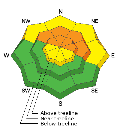
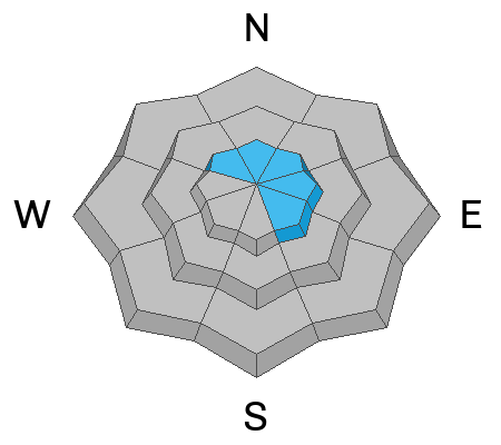
Today, you'll find CONSIDERABLE avalanche danger in steep, mid and upper elevation polar terrain. Failing on faceted snow in the mid portion of our snowpack, breaking 2'-4' deep and a couple football fields wide, human triggered, tree snapping avalanches are LIKELY.

Our current avalanche problem child isn't going away to tennis camp anytime soon, but that's not gonna stop me from riding. In fact, I'm gonna have a blast today steering my rig towards low-ish angle, polar slopes, free of any overhead hazard... done, done, and done :)

Low
Moderate
Considerable
High
Extreme
Learn how to read the forecast here
Weather and Snow

Nowcast - A storm system waiting in the wings, ushers in mostly cloudy skies, whilst temperatures begin their day in the mid 20's °F. Stout winds blow 20-30 mph from the west and southwest near the high peaks. No new snow since last weeks Herculean storm, though cold settled powder is found on low angle, wind sheltered terrain, but the solars have taken on heat and are generally crusty and yeah, kinda smoked.

Forecast - A warm, wet storm slides through the region later this morning, bringing a round of dense, heavy snow, kicking in right around suppertime. Winds blowing from the west and southwest, ramp into the 30-50 mph range along the ridges, with gusts in the 70's near the high peaks. It'll be mild, with temperatures climbing into the mid 30's °F. Or if you're like me and a big fan of William Thomson, I like keeping it simple and doing the quick conversion in my head... 276.483° Kelvin... now that's a language I can I understand. In other words... it's gonna be mild!

Futurecast - Expect a couple inches of dense snow overnight, continuing for the morning commute. Nothing like the City That Never Sleeps is experiencing right now, just a thick coat of white paint in the 4"-8" range. Snow continues for Wednesday with a little cooler air sliding in that should bring our storm totals to nearly 10" of snow with about an 1" of H2O. Clearing for Thursday with a warming trend on tap for the weekend. Another storm slated for late Sunday.

Travel Conditions - After six weeks of teaser snowfall, finally, the Uinta's got absolutely clobbered and the recent storm is nothing short of colossal. Riding conditions have gone from April-esque to mid-winter in the span of a work week. Low elevations solars are already taking a hit from the sun and heat, while mid elevation polars invite easier travel and some light riding. I know you're looking for winter, so gain some elevation and get up high where it's looking white and the riding is phat.

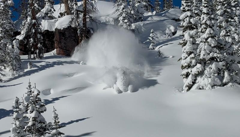
Insert snorkel... deploy periscope. Alden Gile doin' all the right stuff this weekend from inside the white room. In addition, quality riding was found yesterday in the Haystack Zona.

Recent Avalanches

No shortage of avalanche activity across the range, and the Uinta community sure got after it this weekend. Multiple natural and human-triggered slides were observed and reported across the range with a few close-calls along the way.

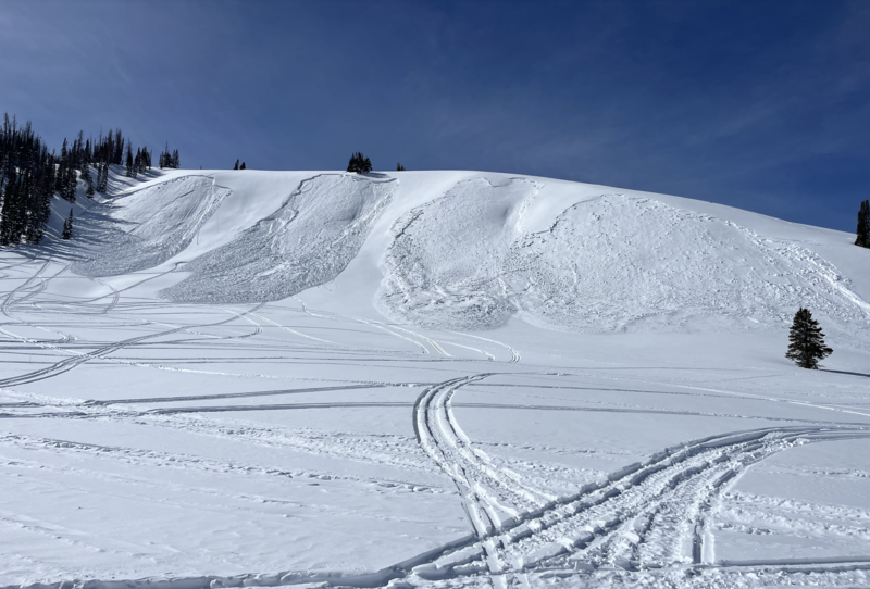
Please excuse our appearance during the remodel... it seems like all our storm snow avalanched in Upper Chalk Creek's, Wally World yesterday afternoon... trigger undetermined.

Avalanche Problem #1
Persistent Weak Layer
Type
Location
Likelihood
Size
Description

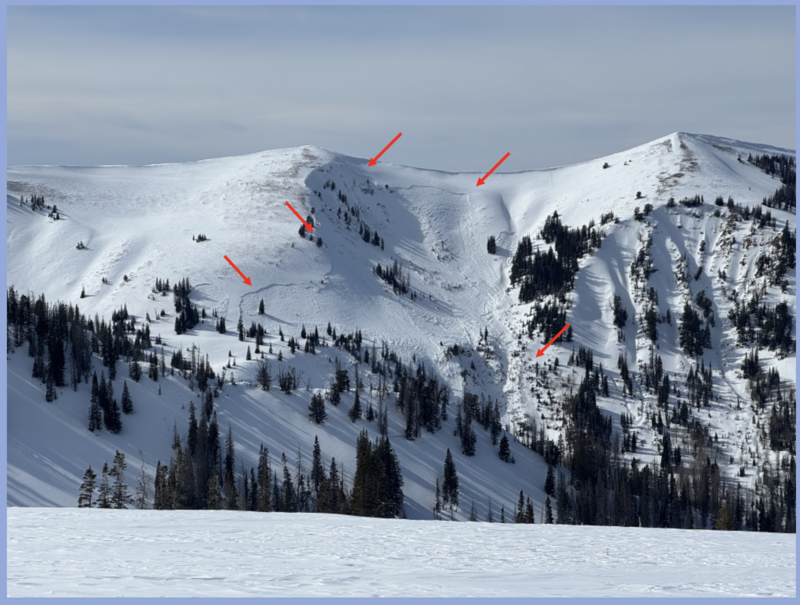
Ted visited the Humpy Drainage yesterday and noted these recent sled triggered slides in terrain that fits our bulls-eye profile.

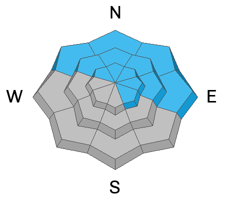
From tip to tail, polar aspects at all elevations, harbor our most recent problem child, the well preserved and aptly named January Drought Layer (JDL). This faceted snow is extremely weak, and teeters on the edge with last weeks colossal storm... 2'-3' of snow and up to 3" of SWE, in some areas across the range.

Here's where it gets tricky... left to it's own devices the snowpack will slowly heal, eventually becoming comfortable in its own skin. But when we roll along and suddenly knock the legs out from underneath, we provoke todays persistent slab avalanche problem, instantly bring it back to life, and crash the entire roof down on top of us. Making the problem more severe is and any slide triggered will be large, up to 4' deep, and break hundreds of feet wide across the slope, connecting the dots and blowing through terrain feature like trees and rock outcrops.

When I think of bullseye terrain where I could trigger a dangerous slide I'm thinking low on the slope where a warehouse full of snow hangs above me... places like Currant Creek Peak, Heber Mountain, Mill Hollow, Wolf Creek Bowl, or Humpy Creek come to mind. I'm also thinking about cut-banks, gullies, and small terrain features that we usually don't consider twice about playing on, but our current set-up is deceiving and this terrain fits the mold.
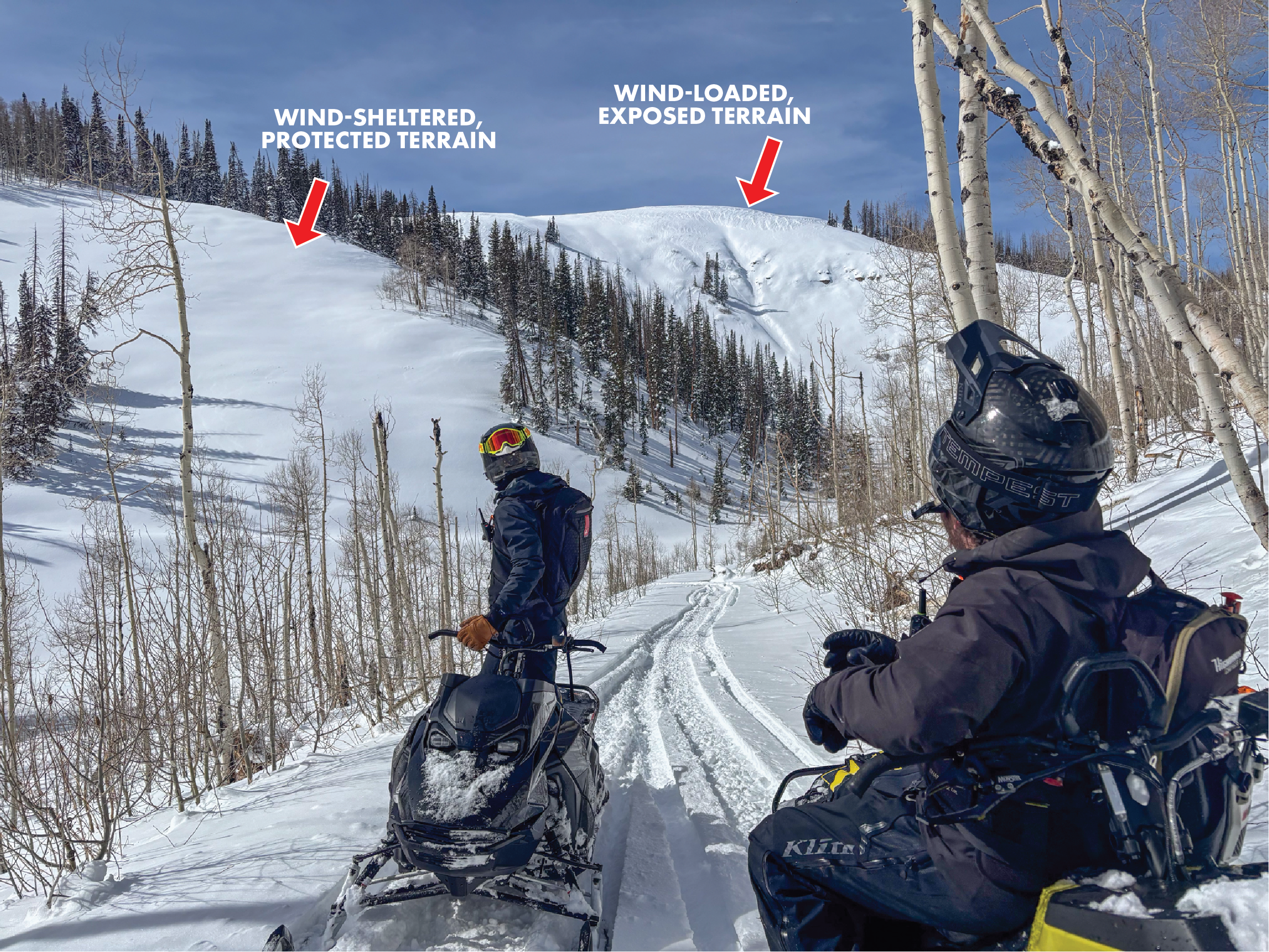
We typically would view the slope on the right as being more intimidating, and scary when it comes to avalanches, but the slope on the left is where our greatest concern lays... protected, wind-sheltered terrain is where a majority of our human-triggered avalanches are occurring and snowpack is most reactive.


Avalanche Problem #2
Wind Drifted Snow
Type
Location
Likelihood
Size
Description

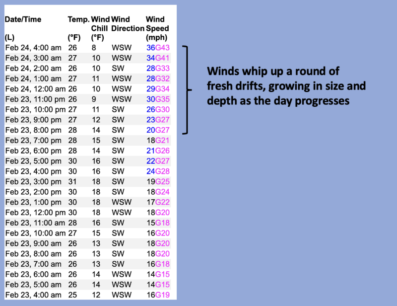
Windy Peak (10,662') illustrates the overnight uptick in wind velocity.

Predictably breaking at or below our skis, board, or sled, a handful of shallow, fresh wind drifts dot the north half of the compass. Lose the wind... you lose the problem.

Additional Information

Join the UAC for the first "Stay and Play Avalanche Course" at Bear River Lodge in the Uintas, March 19th-22nd. This course is designed for snowmobilers by snowmobilers, where you will learn avalanche rescue, riding skills, and how to survive in the backcountry. Come enjoy all the luxury offerings at Bear River Lodge and improve your skills along the way.

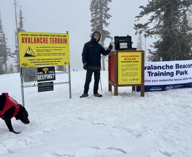
Our Avalanche Rescue Training Park is set-up and located at the top of Wolf Creek Pass, SR-35, and is waiting for you to come take it for a spin! Open up the control unit, flip a few switches, and dial in your avalanche rescue skills with this roadside attraction!

General Announcements

We have some upcoming classes and events that we'd be stoked to see you at -- Please reach out with any questions and check out below for more details!

We are always looking for snow and avalanche observations or just general riding conditions. Reach out to us with questions, concerns, or if you see anything in your travels! Contact us directly through the info below:

This forecast is from the U.S.D.A. Forest Service, which is solely responsible for its content. This forecast describes general avalanche conditions, and local variations always occur. This forecast was issued on Tuesday, February 24th at 0400 and expires 24 hours after it was issued. We'll update this information by 07:00 AM tomorrow.