UDOT PLANNED AVALANCHE CLOSURES!!

Forecast for the Uintas Area Mountains

Craig Gordon
Issued by Craig Gordon for
Wednesday, February 22, 2023
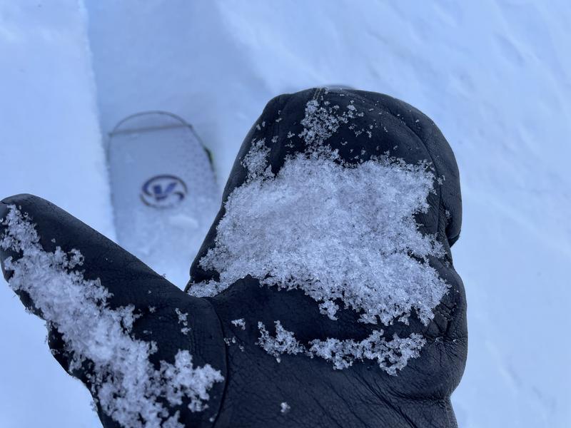
The landscape changed overnight as did the avy danger-
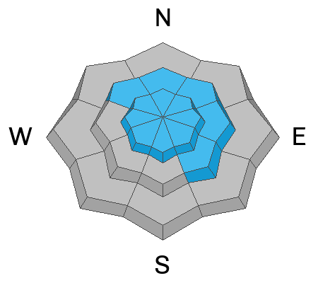
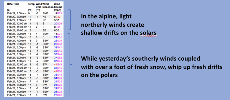
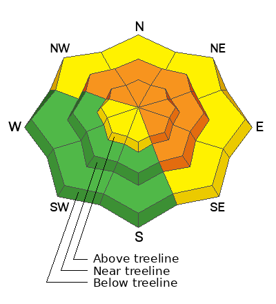
In both mid and upper elevation terrain, but more pronounced in the wind zone at and above treeline, you'll find CONSIDERABLE avalanche danger on steep, wind drifted slopes. Fresh drifts are gonna be touchy and human triggered avalanches LIKELY, especially in terrain facing the north half of the compass, particularly on slopes with an easterly component to their aspect. Recent winds also whipped up fresh drifts on upper elevation southerly slopes in the alpine and penetrated low elevation shady slopes. In terrain with these characteristics, you'll find MODERATE avalanche danger and human triggered avalanches are POSSIBLE on steep slopes with recent deposits of wind drifted snow.
You exit strategy is easy... more predictable avalanche danger exists as you lose elevation or switch aspect to mid and low elevation southerlies where you'll find generally LOW avalanche danger.

Low
Moderate
Considerable
High
Extreme
Learn how to read the forecast here
Weather and Snow
Nowcast- A solid storm materialized overnight for the eastern front, delivering 12" of snow with .80" H2O in the high country and it's equally as deep near our trailheads. In either case... it's light, it's blower, and it's in your face. Temperatures register in the teens and are falling as cold air filters into the region. Winds switched to the north and northeast right around the turn of the new day and blow in the 20's near the high peaks. Riding and turning conditions went from zero to hero overnight and yes... it'll be over-the-hood and over-the-head this morning!
Forecast- Snow continues through about midday, becoming more showery as the day progresses. Storm totals should be in the 18" range. Winds are gonna be variable, but should eventually veer to the west and may increase into the 30's later today. Temperatures dip into the single digits and then crater into negative territory overnight.
Futurecast- A break in the action for Thursday while the next storm slides to the southern half of the state to round out the work week.
Our storm churns away for a couple more hours this morning before shifting east.
Huge thanks for all the great obs streaming in from the eastern front. Even more detailed trip reports and recent obs are found HERE.
Recent Avalanches
No significant avalanche activity to report, but if ya wanna geek out, click HERE to track this years slide activity throughout the range.
Ad
Avalanche Problem #1
Wind Drifted Snow
Type
Location
Likelihood
Size
Description
Above is a 24 hour data dump from Windy Peak (10,662') showing trends in wind speed, direction, and duration.
Winds have been all over the map, and coupled with fresh snow, create widespread and more connected wind drifts. Remember.... recent strong winds deliver fresh drifts not only lower downslope than you might expect, but also cross-load terrain features like chutes and gullies. In either case, today's drifts are gonna be touchy and have the potential to knock you off your feet, producing an unexpected ride downhill. This is an easy avalanche dragon to avoid... simply look for and steer clear of fat, rounded pieces of snow, especially if they sound hollow like a drum.

Avalanche Problem #2
New Snow
Type
Location
Likelihood
Size
Description
As additional storm snow continues piling up it teeters on the balance and will react to our additional weight. Steep snow covered slopes at all elevations get in on the act, so that means new snow avalanches are possible in our foothills and near our trailheads. The good news... new snow instabilities generally stabilize and become comfortable in their own skin in short order.
Additional Information
Note to self... whilst not widespread, on Saturday, we found surprisingly weak, sugary Near Surface Facets forming on super sheltered, low and mid elevation polars. Could be a pockety, sleeper elevation band with today's additional storm snow.
Weather stations-
And... rime events have severely crippled the Uinta weather station network. I'm working to get it back up and running, but a few stations are found HERE (click weather stations, and then on the Western Uinta tab)
Observations-
Your observations are important, so please let me know what you're seeing... click HERE and contribute to this amazing community-based program
General Announcements
Issued at 03:17 on Tuesday February 22nd, this forecast expires 24 hours after the date and time posted, but will be updated by 07:00 Thursday February 23rd 2023.
Before it gets too crazy, now is the time to book an avalanche awareness presentation for your group, club, or posse. You can reach Craig directly at 801-231-2170 or [email protected].

This forecast is from the U.S.D.A. Forest Service, which is solely responsible for its content. This forecast describes general avalanche conditions and local variations always occur.