Forecast for the Uintas Area Mountains

Craig Gordon
Issued by Craig Gordon for
Monday, February 20, 2023
More snow and wind on the way, bumps todays avalanche danger to MODERATE on steep, leeward slopes, especially in the wind zone. Pockety and just starting to get big enough to knock us off our feet, today we'll wanna be on the lookout for and avoid, fresh wind drifts above treeline which can catch us by surprise, especially if we're tagging big terrain with equally big consequences.

Low
Moderate
Considerable
High
Extreme
Learn how to read the forecast here
Weather and Snow
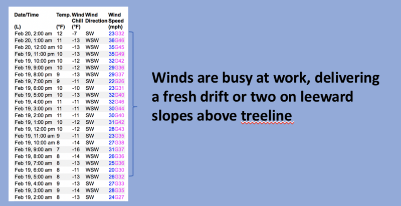
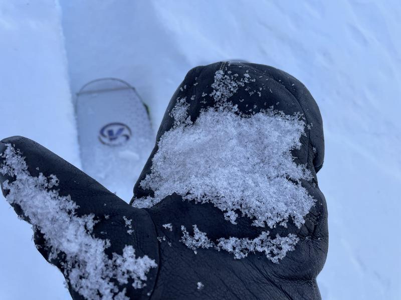
Nowcast- Clouds stream in from the northwest and temperatures register in the teens and low 20's, a few degrees warmer this morning than yesterday at this time. West and southwest winds worked the night shift and have blown steadily in the 20's and 30's for the past 24 hours. Yesterday's storm delivered 4" of ultra, low density fluff and riding conditions are beginning to come around, but there's a lot of bottom feeding. Low angle shady slopes are your best bet to avoid feeling the scratchiness underfoot.
Forecast- Look for mostly cloudy skies, temperatures rising into the upper 20's, along with light snow showers that stack up an inch or two of snow. Westerly winds are gonna be a nuisance, humming into the 40's along the high ridges.
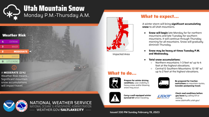
Futurecast- A proper Utah storm is in the queue and slated to roll into the region Tuesday afternoon. Winds crank and heavy snow develops overnight, as a strong cold front slams into the state and the band plugs into a stack of Marshall amps. Expect a few feet of snow and a few inches of water before things wind down early Thursday.
The graphic above depicts an active pattern developing for the upcoming week.
Huge thanks for all the great obs streaming in from the eastern front. Even more detailed trip reports and recent obs are found HERE.
Recent Avalanches
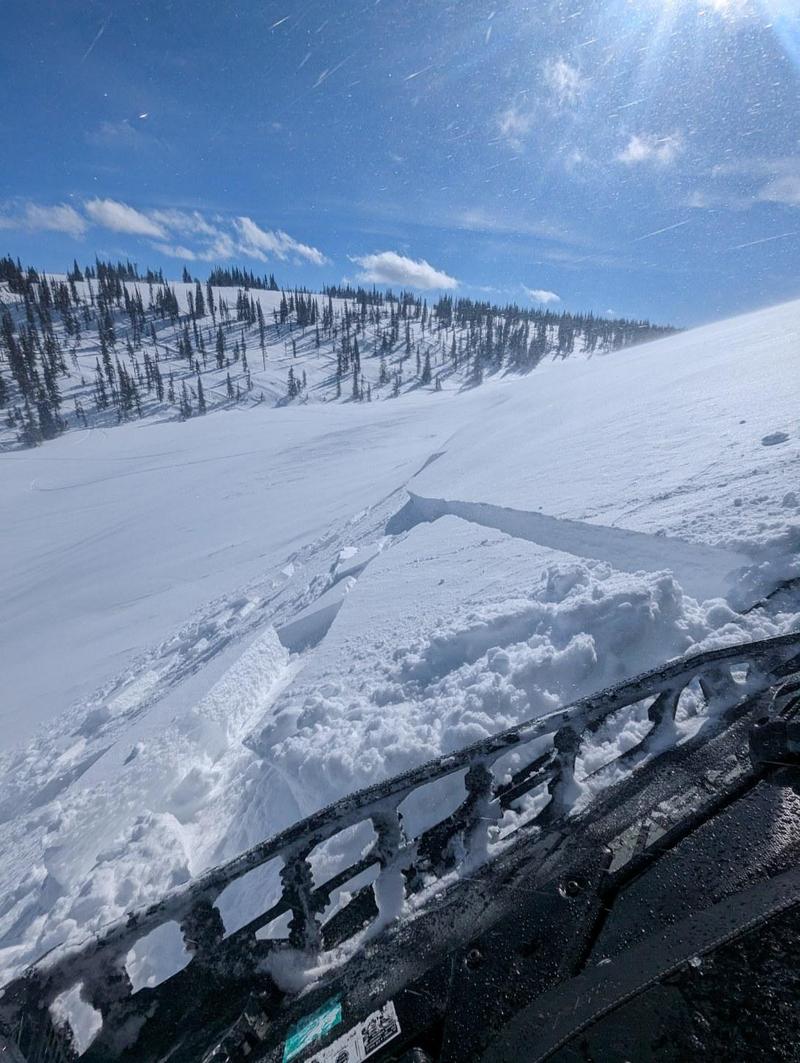
Yesterday, Joey Manship and his crew found very shallow, yet sensitive, fresh drifts along the leeward side of upper elevation ridges.
No significant avalanche activity to report, but if ya wanna geek out, click HERE to track this years slide activity throughout the range.
Ad
Avalanche Problem #1
Wind Drifted Snow
Type
Location
Likelihood
Size
Description
Above is a 24 hour data dump from Windy Peak (10,662') showing trends in wind speed, direction, and duration.
A few inches of fresh snow coupled with strong winds, form a shallow wind drift or two, that can react to our additional weight. Not widespread and limited to the leeward side of ridges and around terrain features like chutes or gullies, remember to look for and avoid rounded pieces of snow, especially if they sound hollow like a drum.

Additional Information
Note to self... whilst not widespread, on Saturday, we found surprisingly weak, sugary Near Surface Facets forming on super sheltered, low and mid elevation polars. Could be a sleeper elevation band with the upcoming storms.
Weather stations-
And... rime events have severely crippled the Uinta weather station network. I'm working to get it back up and running, but a few stations are found HERE (click weather stations, and then on the Western Uinta tab)
Observations-
Your observations are important, so please let me know what you're seeing... click HERE and contribute to this amazing community-based program
General Announcements
Issued at 03:33 on Monday February 20th, this forecast expires 24 hours after the date and time posted, but will be updated by 07:00 Tuesday February 21st 2023.
Before it gets too crazy, now is the time to book an avalanche awareness presentation for your group, club, or posse. You can reach Craig directly at 801-231-2170 or [email protected].

This forecast is from the U.S.D.A. Forest Service, which is solely responsible for its content. This forecast describes general avalanche conditions and local variations always occur.