Forecast for the Uintas Area Mountains

Issued by Craig Gordon on
Saturday morning, February 1, 2020
Saturday morning, February 1, 2020
Heads up-
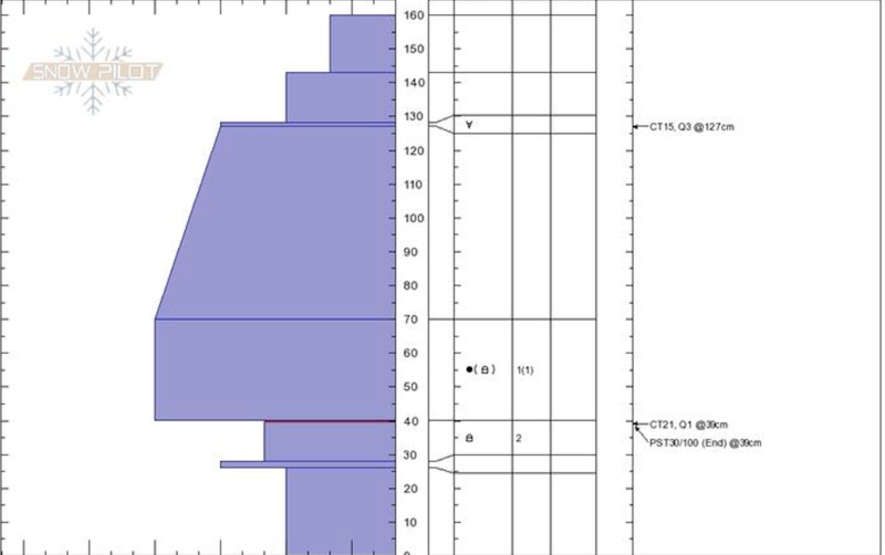
Today's warm temperatures may help to reactivate buried weak layers in our snowpack that have been dormant for several weeks.
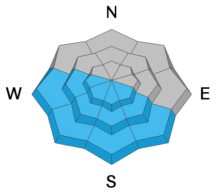
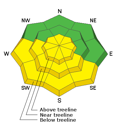
In the wind zone at and above treeline, steep, wind drifted slopes offer MODERATE avalanche danger and human triggered avalanches are POSSIBLE. Lose a little elevation and you lose most of that problem.
While more the exception than the rule, human triggered avalanches breaking into deeper, buried weak layers remains a distinct possibility. Usual suspects include- steep, rocky, upper elevation terrain, especially slopes exhibiting a thin, shallow snowpack. Remember- any slide that breaks to old snow will immediately ruin your day.
The avalanche danger will rise to MODERATE on steep, sunny slopes as the day progresses and human triggered damp sluffs and slides become possible with daytime heating.
Wind sheltered, low and mid elevation slopes with no steep terrain above or adjacent to where you're riding offers LOW avalanche danger and human triggered avalanches are UNLIKELY.
Low
Moderate
Considerable
High
Extreme
Learn how to read the forecast here