Forecast for the Uintas Area Mountains

Issued by Craig Gordon on
Tuesday morning, December 28, 2021
Tuesday morning, December 28, 2021
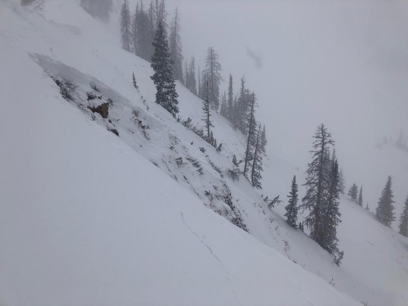
Heads up, nothing has changed... it's the real deal. Please think about your terrain choices and the potentially deadly consequences of triggering an avalanche today-
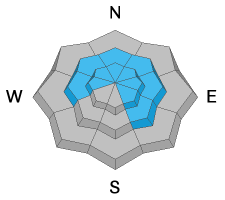
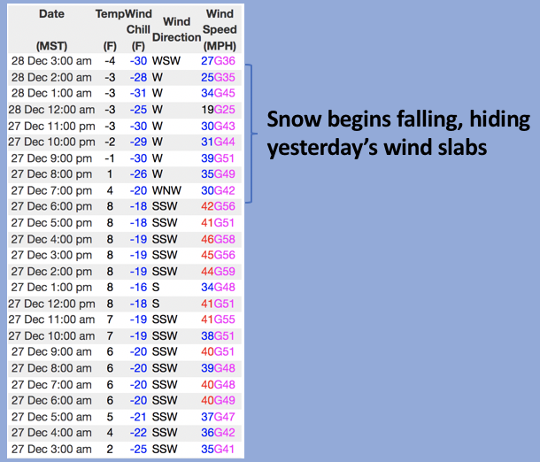
Very dangerous avalanche conditions exist near and above treeline in the western Uinta's where the avalanche danger is HIGH. Both natural and human-triggered avalanches are likely. Very dense, heavy snow combined with strong winds has overloaded our fragile snowpack. Below treeline, human triggered avalanches are likely, and the avalanche danger is CONSIDERABLE.
Here's your exit strategy- there's plenty of safe, low angle terrain, but the key to avoiding avalanches is to avoid being on, under, or anywhere near slopes steeper than 30 degrees, especially those facing the north half of the compass.
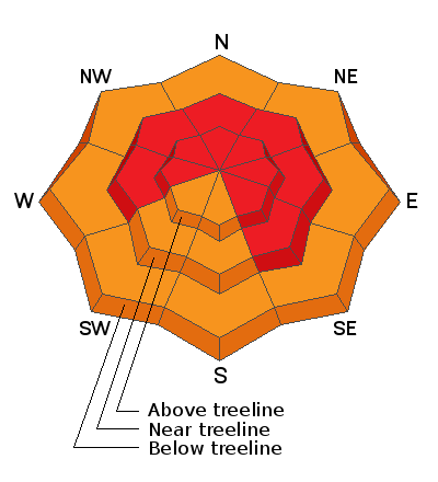
Low
Moderate
Considerable
High
Extreme
Learn how to read the forecast here