Join us at our 2nd Annual Blizzard Ball

Forecast for the Uintas Area Mountains

Craig Gordon
Issued by Craig Gordon on
Friday morning, December 20, 2024
I know you're looking for LOW avalanche danger and you came to the right place, because both human triggered and natural avalanches are UNLIKELY on all aspects and all elevations in the western Uinta's today. Remember- low danger ain't no danger, so if you're stepping into big terrain, carefully evaluate your objectives and think of the consequences of triggering even a small slide that could knock you off your feet and reveal a myriad of season ending obstacles like stumps, rocks, or deadfall.
Low
Moderate
Considerable
High
Extreme
Learn how to read the forecast here
Special Announcements
Tonight... please join DPS, the UAC, and Gnarly Nutrition for a fun night of Avalanche Jeopardy. That’s right… a real live Avalanche Jeopardy game in the City of Salt hosted by well-known athletes and high-profile mountain folk, along with some boots on the ground, salt of the earth riders and sliders thrown in to keep us all honest. Click here for all the deets.
Now is a great time to dial in your safety gear including putting fresh new batteries in your beacons! Local shops across the state will be handing out free Batteries for Beacons now until February 1, 2025. All you need to do is fill out a quick survey and grab the AAA or AA batteries you need to keep your beacon fresh this season. Find participating shops and more info here.
Weather and Snow
Nowcast-
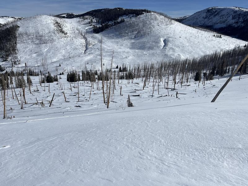
Even with clear skies overhead it's downright balmy this morning as most ridgetop weather stations report temperatures in the low 30's while a few outlying trailhead locations dip into the mid 20's. Southerly winds blow 20-25 mph near the high peaks. It's a mixed bag out there and it's been a slow start to winter with settled snow depths averaging just about 2' across the range. Riding and turning conditions are acceptable, but tread lightly, there's no shortage of buried treasures lurking just below the snow surface.
Forecast-
Look for mostly sunny skies with high temperatures climbing into the mid 40's... yeah, that's record breaking territory. Southerly winds remain well-behaved, blowing in the low to mid 20's near the high peaks. Expect clear skies overnight with lows dipping into the low 30's.
Futurecast-
Clear skies, warming temperatures, and light winds are on tap through Sunday. A weak, brush-by brings light snow and a shallow coat of white paint to the Uinta zone Sunday night into Monday morning. A colder system is slated to slide by on Christmas Day, with a decent refresh... perhaps 4"-8" of snow. The pattern looks active for Christmas through New Years. We'll keep ya posted on this developing story.
Ted was on the east side visiting Mill Creek Wednesday and reports... "Early season conditions with only about 20" or so once I got into the Mill Creek drainage. Much of the south facing terrain is very thin to no snow at all."
Recent Avalanches
It's been quiet on the eastern front with the last avalanche reported 120 hours ago, or 5 days... if you do the day thing.
Read more obs from across the range, here
Thanks to y'all for the info... please keep those letters and cards coming :)
Ad
Avalanche Problem #1
Normal Caution
Type
Location
Likelihood
Size
Description
Even though the avalanche danger is generally LOW, there's a couple of considerations moving forward-
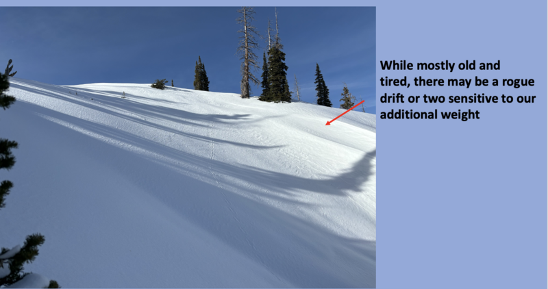
First... more the exception than the rule, there may be a rogue wind drift or two sensitive to our additional weight, especially in the alpine above treeline. Be on the lookout for red flags like cracking and steer clear of fat, rounded pillows of snow. Consider avoiding drifted areas in the wind zone today and seek out wind sheltered terrain where coverage and riding are a bit more reasonable and the avy hazard is generally low.
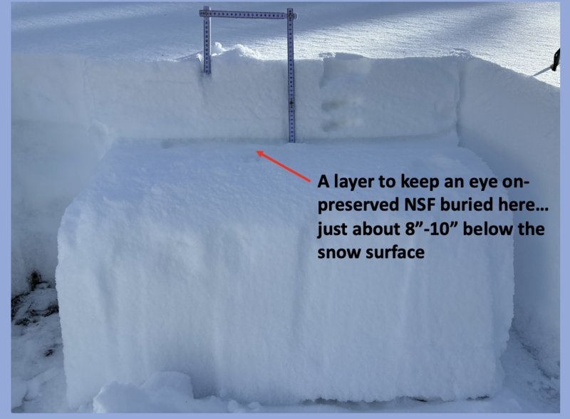
Second... last weeks series of little storms buried a sugary layer of near surface facets (NSF), capping and preserving this very delicate and notoriously tricky weak layer. Mostly dormant and not much of a player at the moment, but something to keep an eye on once it starts storming again.
General Announcements
Additional Information
The Uinta weather station network was upgraded this summer and all that real-time info is found here. Simply click on the "Western Uinta" tab and then the "Weather Stations" tab to find all your weather needs.
We are always looking for snow and avalanche observations or just general riding conditions. So... if you see something, say something. You can reach our team directly by contacting: Craig at [email protected], 801-231-2170, or Andrew at [email protected], or 860-460-8142.
General Information
This forecast is from the U.S.D.A. Forest Service, which is solely responsible for its content. This forecast describes general avalanche conditions and local variations always occur. This forecast was issued on Friday, December 20th at 03:30 AM and expires 24 hours after it was issued. We will update the forecast by 0700 AM tomorrow. But, in the meantime reach out to us with questions, or if you see anything in your travels.