Forecast for the Uintas Area Mountains

Mark Staples
Issued by Mark Staples for
Saturday, December 2, 2023
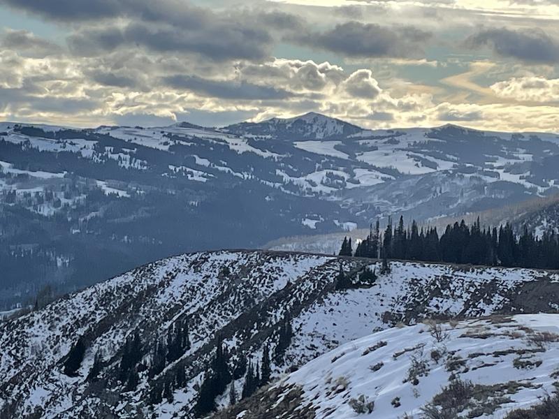
It's great to see snow finally stacking up in the Uintas, but coverage still remains thin and travel is limited.
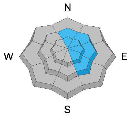
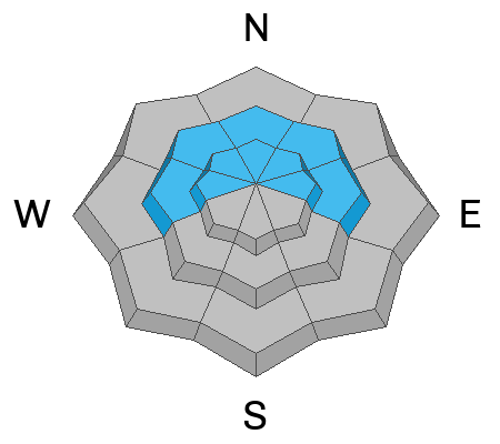
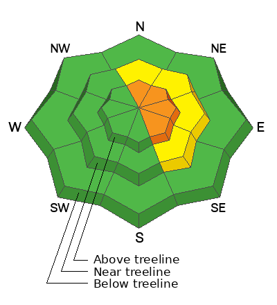
The avalanche danger today is CONSIDERABLE above treeline and MODERATE near treeline on north through southeast facing slopes from strong WNW winds that transported the 6-8 inches of new snow into drifts that should be easy to trigger today.
With such thin snow still, the main threat of avalanches is being pushed downhill and hitting rocks, logs, etc.
Low
Moderate
Considerable
High
Extreme
Learn how to read the forecast here
Special Announcements
The 5th Annual Avalanche Awareness Week is December 3-10. The week's goal is to save lives through activities that promote avalanche awareness, education, and safety. We have a variety of events around the state. Find an event near you.
Weather and Snow
Temperatures overnight and this morning are in the low to mid teens F. They will remain cold today and maybe rise a little this afternoon to around 20 degrees F when slightly warmer air arrives.
Winds are the main story. They picked up overnight and are raking the high peaks 40-50 mph from the WNW. At lower ridgelines, winds increased and are blowing 15-30 mph from the WNW. Winds should ease some today but then really pick up again and blow even stronger tonight.
Total snowfall since yesterday has been 6-8 inches (0.3-0.4" of water). Snowfall will continue today but should snow heavier tonight. The National Weather Service issued a Winter Storm Warning and expects 3-7 inches of snow today with 10-16 inches tonight.

Typical snow cover at many trailheads prior to this weekend's storm (Photo: T. Scroggin)

Looking from Duchesne Ridge south towards Currant Creek Peak.
Recent Avalanches
There have been no reported avalanches in the Uintas yet this season.
Ad
Avalanche Problem #1
Wind Drifted Snow
Type
Location
Likelihood
Size
Description
The main avalanche issue today will be 6-8 inches of low density snow that was blown around by increased winds overnight. Shallow slabs of wind drifted snow should be easy to trigger today.
Avalanche Problem #2
Persistent Weak Layer
Type
Location
Likelihood
Size
Description
Prior to this weekend's storm, the fledgling snowpack in the Uintas ranged from 6-18 inches deep and became very weak and faceted except on southerly facing slopes.
Last night's 6-8 inches of light snow with 3-7 inches falling today shouldn't be enough of a load or enough of a cohesive slab to cause avalanches on the persistent weak layer of old, faceted snow underneath. The situation may change tonight and tomorrow with more snow and denser snow falling.
General Announcements
Additional Information
  • It’s never too early to start thinking about avalanches. Here are a few things to consider doing:
  • Learn online. We have over 5 hours of free online learning at the Know Before You Go Website
  • Check out the upcoming in-person Know Before You Go events HERE
  • Sign up for an on-snow class
  • Check out the UAC's education progression HERE
  • Get your avalanche rescue gear ready for winter. Put fresh batteries in your transceiver and update the firmware. Inspect your shovel and probe. Get your airbag backpack ready by possibly doing a test deployment and updating the firmware if it is an electric version or getting your canister refilled if it's not electronic.
Issued at 0700 on Saturday, December 2 and will be updated by 0700 Sunday, December 3, 2023.
This forecast is from the U.S.D.A. Forest Service, which is solely responsible for its content. This forecast describes general avalanche conditions and local variations always occur.