Check out our Holiday Auction - Sign Up for the Utah Snow and Avalanche Workshop (USAW)

Forecast for the Uintas Area Mountains

Mark Staples
Issued by Mark Staples on
Friday morning, December 1, 2023
Here we go! A storm is at our doorstep and it's time to start building the snowpack.
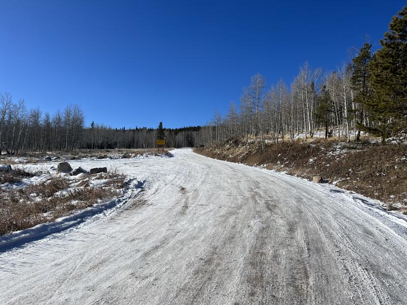
The avalanche danger today is LOW in the Uintas. Travel is limited with about 6-18 inches of snow on the ground while most trailheads have no snow.

Conditions will be changing rapidly this weekend and the danger will be increasing.
Low
Moderate
Considerable
High
Extreme
Learn how to read the forecast here
Special Announcements
The 5th Annual Avalanche Awareness Week is December 3-10. The week's goal is to save lives through activities that promote avalanche awareness, education, and safety. We have a variety of events around the state. Find an event near you.
Weather and Snow
This morning it's cold and calm with temperatures mostly in the low teens F and hardly any wind.
The National Weather Service has issued a Winter Weather Advisory for the Western Uinta Mountains for Friday through Monday morning. 10-20 inches of snow should fall with 50 mph winds.
The following is paraphrased from the weather discussion from the SLC office of the NWS which is always a great source of detailed weather info:
This weekend's storm has three parts with the first wave bringing widespread snowfall this afternoon. The second wave brings more snow Friday night into Saturday morning with the coldest temperatures of the storm. There should be a lull on Saturday. The third wave brings snow mostly on Sunday, but it will also have warmer temperatures that should cause rain in valleys and denser snow in the mountains. Snowfall will end sometime Sunday night or early Monday morning.
Typical snow cover at many trailheads (Photo: T. Scroggin)

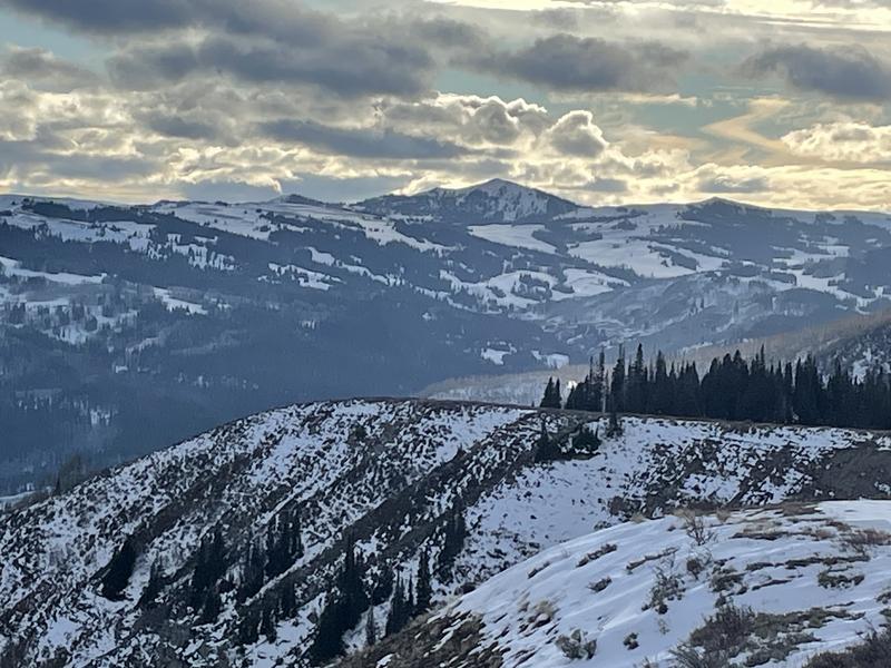
Looking from Duchesne Ridge south towards Currant Creek Peak.
Recent Avalanches
There have been no reported avalanches in the Uintas yet this season.
Ad
Avalanche Problem #1
Persistent Weak Layer
Type
Location
Likelihood
Size
Description
Clear cold nights have changed the existing snow in the Uintas to become very weak and faceted on northerly facing slopes while sunny days have melted snow on southerly facing ones.
Currently there is no avalanche threat because the fledgling snowpack is just the weak layer. In order to get avalanches, there needs to be a slab of snow on top of it, and that slab will begin forming this weekend.
General Announcements
Additional Information
  • It’s never too early to start thinking about avalanches. Here are a few things to consider doing:
  • Learn online. We have over 5 hours of free online learning at the Know Before You Go Website
  • Check out the upcoming in-person Know Before You Go events HERE
  • Sign up for an on-snow class
  • Check out the UAC's education progression HERE
  • Get your avalanche rescue gear ready for winter. Put fresh batteries in your transceiver and update the firmware. Inspect your shovel and probe. Get your airbag backpack ready by possibly doing a test deployment and updating the firmware if it is an electric version or getting your canister refilled if it's not electronic.
Issued at 0700 on Friday, December 1 and will be updated by 0700 Saturday, December 2, 2023.
This forecast is from the U.S.D.A. Forest Service, which is solely responsible for its content. This forecast describes general avalanche conditions and local variations always occur.