Forecast for the Uintas Area Mountains

Craig Gordon
Issued by Craig Gordon on
Tuesday morning, December 17, 2024
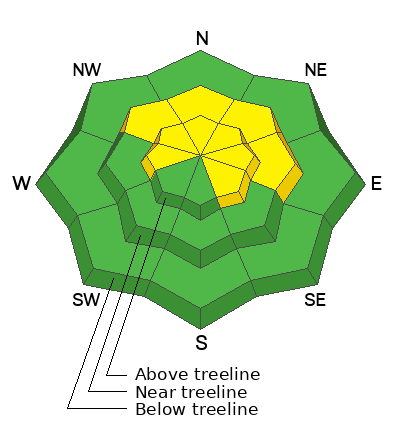
Mid and upper elevation terrain offers MODERATE avalanche danger today. Human triggered avalanches breaking several feet deep are POSSIBLE, especially on steep, wind drifted slopes facing west through southeast.
Heads up… it remains a little tricky out there because we may still be able to trigger an avalanche from a distance, or remotely, meaning... we don’t even have to be on the slope in order to knock the legs out from under it. My exit strategy is to tone my slope angles down a notch or two and seek out low angle, wind sheltered terrain without any overhead hazard, or steep slopes above me.
Low
Moderate
Considerable
High
Extreme
Learn how to read the forecast here
Weather and Snow
Nowcast-
Near the high peaks, southwest winds bumped into the 30's and 40's overnight, ushering in a band of thickening clouds and a few scattered snow showers. It'll feel balmy for mid December with temperatures registering in the mid and upper 20's. It's been a slow start to the winter with settled snow depths averaging just about 2' across the range. Riding and turning conditions are acceptable, but tread lightly, there's no shortage of buried treasures lurking just below the snow surface.
Forecast-
A weak storm veers to our north, though we may stack up a trace or if we're lucky, even a couple traces of snow. Winds shift to the west and northwest and decrease as the day wares on. Temperatures remain mild with highs reaching into the 30's while overnight lows under clearing skies dip into the low 20's.
Futurecast-
High pressure builds midweek and homesteads through the weekend, delivering mostly sunny skies, light winds and warm temperatures. Computer models suggest a hint of a pattern change around Christmas. We'll keep ya posted.
Recent Avalanches
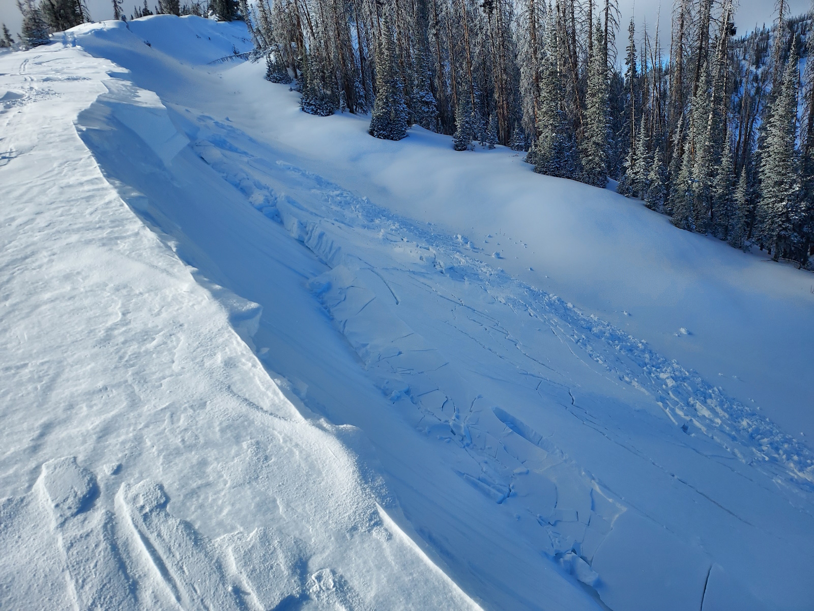
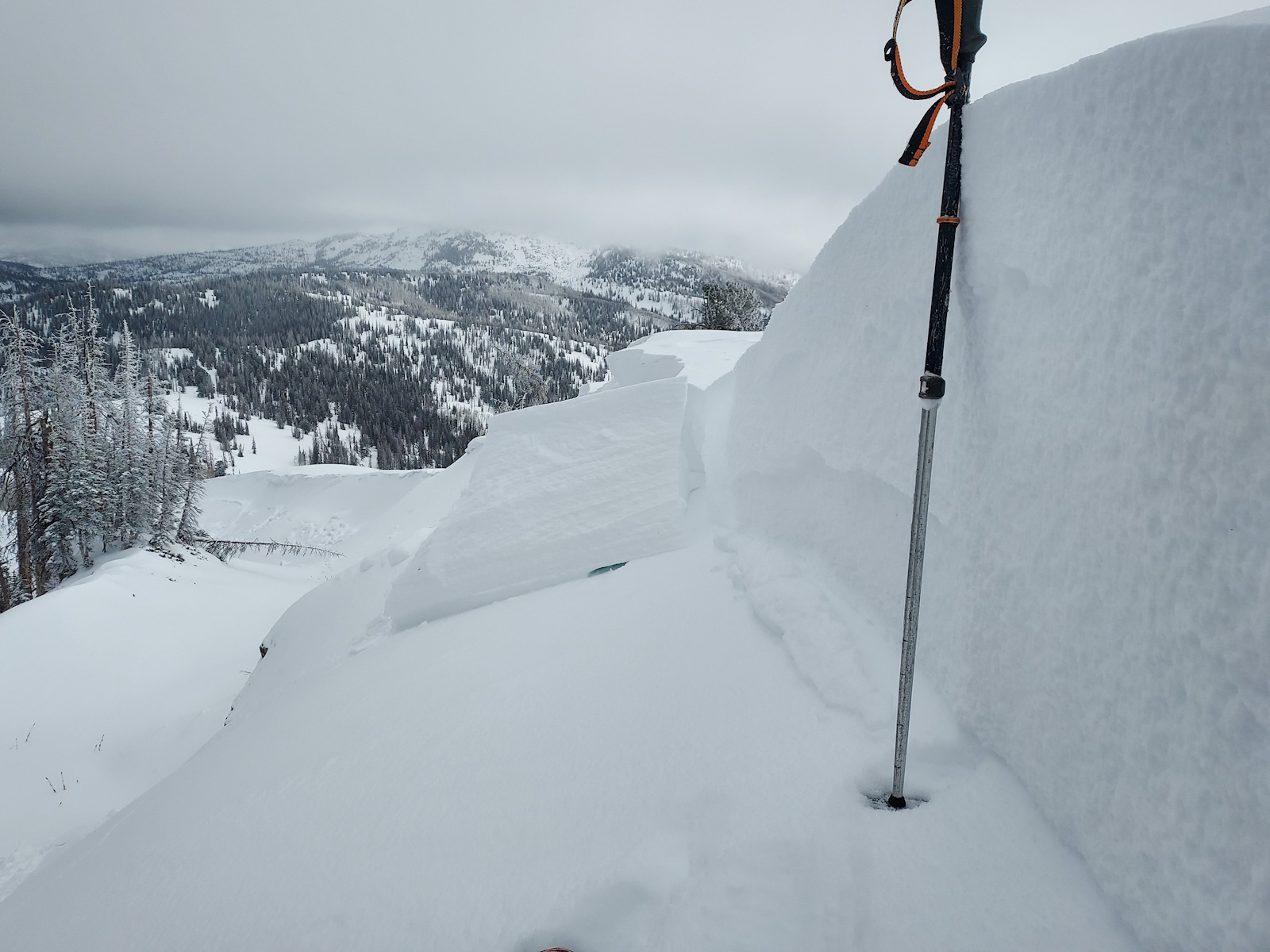
Michael J was in the Hoyt Peak hood Sunday and remotely triggered small, yet hard wind drifts, resting on weak, old, faceted snow. These avalanches were specific to steep slopes, in the wind zone, and fit the characteristics of today's avalanche hazard.
See more from Michael and across the range, here -- Thanks to MJ for the great photos!
Ad
Avalanche Problem #1
Wind Drifted Snow
Type
Location
Likelihood
Size
Description
Recent winds blowing from the south and southwest stripped snow from windward slopes and loaded steep, leeward slopes facing northwest through the southeast, especially in the windzone, above treeline. And although not quite as reactive as the past few days, I suspect if you were looking to trigger an avalanche you could find a pocket or two in the alpine. And remember... today's avalanches may break deeper and wider than you might expect and could easily knock you off your feet and take you for a body bruising ride through rocks, stumps, or deadfall.
Be on the lookout for red flags like recent avalanches, cracking and collapsing, or whoomphing sounds, and steer clear of fat, rounded pillows of snow. Consider avoiding drifted areas in the wind zone today and seek out wind sheltered terrain where coverage and riding are best and the avy hazard is generally low. ... done, done, and done :)
A northwest facing slope at 9,700' on Hoyt Peak where a stiff wind drift was triggered Sunday.
Avalanche Problem #2
Persistent Weak Layer
Type
Location
Likelihood
Size
Description
The snowpack didn't get walloped by the weekend storm, but it's weak and I don't necessarily trust it. The good news... there's plenty of low angle slopes out there where we can ride safely today and not trigger a slide. The bad news... there's not a lot of obvious red flags, but don't let the lack out avalanche activity lure you into steep terrain today. It's a long winter and we're just getting started. So, let's do our homework and practice a little patience, because right now, steep slopes facing the north half of the compass are guilty until proven otherwise.
General Announcements
Additional Information
The Uinta weather station network was upgraded this summer and all that real-time info is found here. Simply click on the "Western Uinta" tab and then the "Weather Stations" tab to find all your weather needs.
We are always looking for snow and avalanche observations or just general riding conditions. So... if you see something, say something. You can reach our team directly by contacting: Craig at [email protected], 801-231-2170, or Andrew at [email protected], or 860-460-8142.
General Information
This forecast is from the U.S.D.A. Forest Service, which is solely responsible for its content. This forecast describes general avalanche conditions and local variations always occur. This forecast was issued on Tuesday, December 17th at 03:30 AM and expires 24 hours after it was issued. We will update the forecast by 0700 AM tomorrow. But, in the meantime reach out to us with questions, or if you see anything in your travels.