Sign Up for the Utah Snow and Avalanche Workshop (USAW) on December 7th!

Forecast for the Uintas Area Mountains

Craig Gordon
Issued by Craig Gordon on
Tuesday morning, November 29, 2016

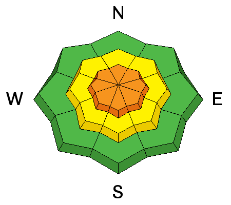
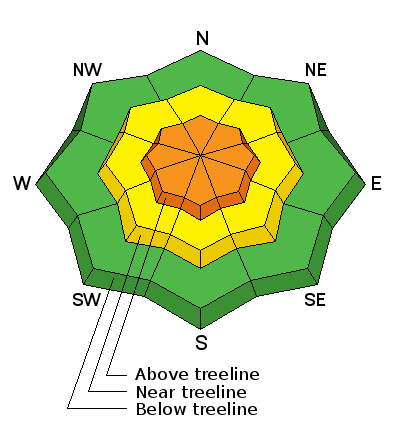
In the wind zone, at and above treeline, the avalanche danger is CONSIDERABLE today. Human triggered avalanches are likely, especially on steep, wind drifted, shady slopes facing the north half of the compass. Any avalanche breaking into old snow will be deep and dangerous.

At mid elevations you'll find MODERATE avalanche danger and human triggered avalanches are possible on steep slopes with recent deposits of wind drifted snow.

The avalanche danger on low elevation slopes is generally LOW.
Low
Moderate
Considerable
High
Extreme
Learn how to read the forecast here
Special Announcements

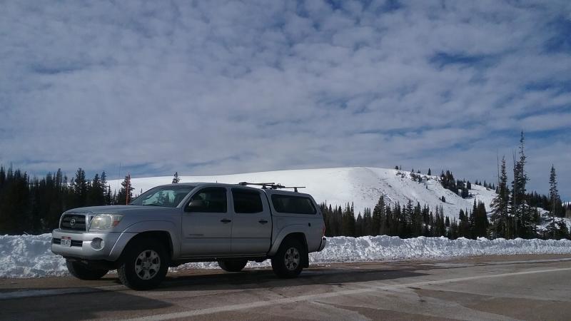
Heads up- Wolf Creek Pass is snowpacked and access to avalanche terrain is relatively easy. Remember... just cause you can see your rig from a ridgeline doesn't necessarily make the terrain any safer and triggering even a small slide this time of year will reveal stumps, rocks, and general nastiness, easily ruining your day or perhaps your season.

Weather and Snow

Skies are partly cloudy, temperatures in the low teens, and northerly winds are humming along the ridges in the 25-35 mph range. The storm is winding down, but in the past 24 hours we picked up an additional foot of very light density, cold smoke. Total snow depths are in the 24"-36" range and while it's still pretty thin out there, this latest round of snow is going to make travel a bit easier.

Real time wind, snow, and temperatures for the Uinta's are found here.

Recent Avalanches

Visibility has been limited throughout the storm, so no new avalanche activity to report.

Ad
Avalanche Problem #1
Wind Drifted Snow
Type
Location
Likelihood
Size
Description

Throughout the storm, winds have been all over the place and today you'll find no shortage of fresh wind drifts, especially along the leeward side of upper elevation ridges and around terrain features like chutes and gullies. Fat and rounded in their appearance, today's wind drifts are gonna be reactive to the additional weight of a person and may break deeper and wider than you expect. Remember... snow cover remains thin and any slide triggered today has the possibility to uncover stumps, rocks, or deadfall, resulting in an unexpected and traumatic ride.

Avalanche Problem #2
Persistent Weak Layer
Type
Location
Likelihood
Size
Description

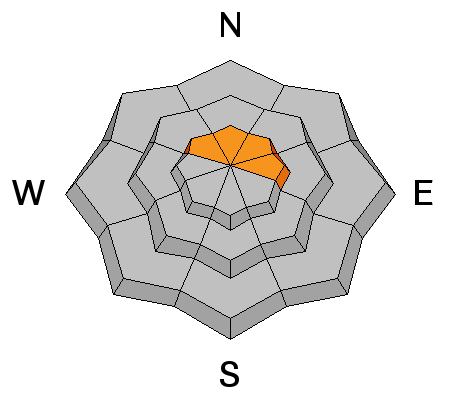
In general, we're off to a good start in the Uinta's and our weak snow issues are isolated to a handful of upper elevation slopes facing the north half of the compass... think of places like Murdock Bowl which retained snow from late September. While making up a small portion of the terrain available to ride in, if your travels take you into steep, upper elevation, north facing terrain, remember that any avalanche you trigger has the possibility of breaking into old snow, creating a deep, dangerous slide. With all the great riding out there why even pull on the dogs tail? Practice some patience, avoid those slopes, and carve deep trenches on the sunny slopes.

Additional Information

Today we can expect partly cloudy skies, temperatures barely rising into the upper teens, and northerly winds blowing in the 30's and 40's along the high peaks. Skies clear out tonight and temperatures crash to near zero. Wednesday should be slightly warmer with another small storm delivering a couple inches of snow for Thursday.

General Announcements

Remember your information can save lives. If you see anything we should know about, please participate in the creation of our own community avalanche advisory by submitting snow and avalanche conditions. You can call me directly at 801-231-2170, email [email protected]

The information in this advisory is from the US Forest Service which is solely responsible for its content. This advisory describes general avalanche conditions and local variations always occur.

The information in this advisory expires 24 hours after the date and time posted, but will be updated on Wednesday November 30th.