Donate to Our Spring Campaign or Bid on our Spring Auction to Support Forecasting

Forecast for the Uintas Area Mountains

Craig Gordon
Issued by Craig Gordon on
Saturday morning, November 23, 2019
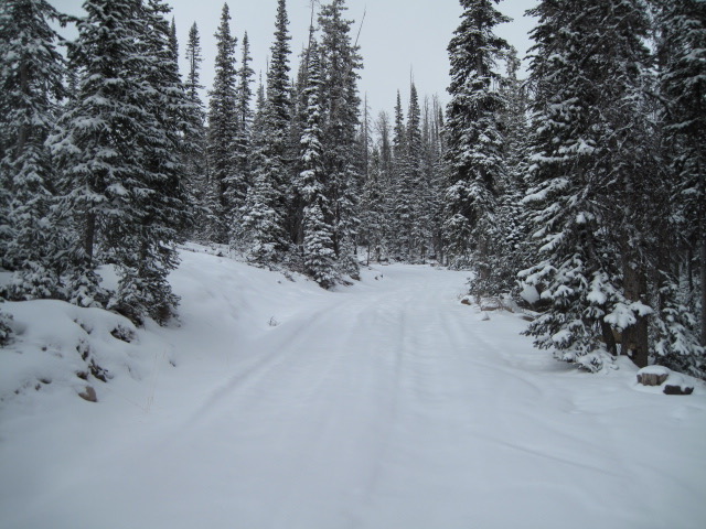
Hitting rocks and stumps is the biggest hazard right now. And....
JUST 'CAUSE YOU CAN SEE YOUR RIG PARKED BY THE SIDE OF THE ROAD NEAR BALD MOUNTAIN OR WOLF CREEK PASS DOESN'T NECESSARILY MAKE THE SLOPE YOU CHOOSE TO RIDE MORE SAFE
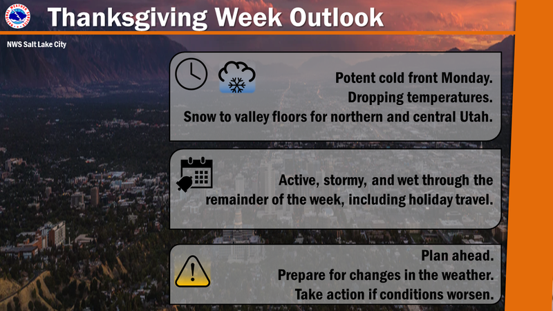
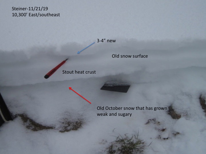
I'm cautiously optimistic a change in the weather pattern is in our future and the storm track becomes more active next week. Currently, there's hardly enough snow to recreate on and I'm not issuing an avalanche danger rating. However, once it does start snowing and blowing, weak, sugary, basal snow on upper elevation slopes facing the north half of the compass will come to life and those are gonna be the slopes to avoid.
Low
Moderate
Considerable
High
Extreme
Learn how to read the forecast here
Special Announcements
The First Annual Avalanche Awareness Week is December 2-7
We have a week full of fun and educational events planned. Check out the schedule here.
As part of your early season tune-up, consider taking an avalanche class. We have lots of avalanche education classes listed already, from Know Before You Go to Companion Rescue to our Backcountry 101. Click on the Education menu on our webpage for a full list of classes from the UAC and other providers. Check out the Know Before You Go eLearning program for free, online, avalanche classes.
Please join me on Friday Dec. 13th at 6:30 for a free avalanche awareness presentation in partnership with Wasatch County SAR. It's guaranteed to be entertaining, informative, and I'll share safety tips that allow you to rip powder safely and come home to your families at the end of the day.... pretty good deal... huh?
Huge thanks to Mike Poulsen and all the crew at Tri-City in partnership with Polaris for the continued support they offer the UAC. Here, Mike hands the keys of two loaner sleds over to Mark and Craig for the 2019-2020 winter season.
Weather and Snow
Skies cleared overnight and temperatures cooled into the teens and low 20's. Northerly winds ramped up late last night and currently blow in the mid 20's and 30's along the high peaks. No new snow has fallen in the past 24 hours and the midweek storm was a bust for us, only stacking up 3-4" of heavy, dense snow in the high country.
The weekend looks sunny and warm with highs reaching into the mid 30's. Northerly winds blow in the 20's along the ridges. Looks like a pattern change is on tap. A fast moving cold front brings a quick shot of snow to the area on Monday, with a cool and unsettled pattern continuing for much of the remainder of the upcoming week.
Above is 24 hour weather data from Windy Peak (10,662') and Chalk Creek (9,169')
Click here for more real time Uinta winds, temperatures, and snow depth.
There's hardly enough snow to recreate on just yet, but you can gently move around on rock free meadows and roads.
Recent Avalanches
No new avalanche activity to report
Ad
Avalanche Problem #1
Persistent Weak Layer
Type
Location
Likelihood
Size
Description
Upper elevation slopes facing the north half of the compass harbor weak, shallow, old snow left over from early season October storms. This makes for a potentially dangerous setup once winter decides to return from its hiatus.
Here's the problem... this terrain is the only game in town and this is exactly the type of terrain where you could trigger an avalanche that may break a bit deeper and wider than you might expect. Remember, even a small slide will reveal obstacles hidden under the thin facade of our early season snowpack, resulting in a season ending injury if you get raked over stumps, rocks, or deadfall.
Our main man Ted Scroggin, spun a quick lap near Mirror Lake Highway yesterday and stomped around the Camp Steiner environs. Above is a quick pit showing a simple, yet problematic snowpack once it does start snowing or blowing in earnest. More on Ted's travels an insight here.
General Announcements
I'll refresh this information by 7:30 AM Sunday Nov. 24th with a weekend update and once the snow begins to fly in earnest, this forecast will be updated each day by 7:30 AM.
If you see or trigger an avalanche or just wanna let me know what you're seeing you can reach me directly at 801-231-2170
It'll be a minute or two before we're riding, but while you're waiting....
This is a great time of year to schedule one of our free avy awareness presentations.
You can email me directly [email protected]