Join us at our 2nd Annual Blizzard Ball

Forecast for the Uintas Area Mountains

Nikki Champion
Issued by Nikki Champion on
Wednesday morning, November 16, 2022
Overall, we are off to a great start and avalanches are generally unlikely. However, with a few days of elevated winds and last week's snow available for transport, I'd still be on the lookout for stubborn wind drifts on upper-elevation slopes and terrain features that allow for drifting snow, like ridgelines, sub-ridges, and gullies. Step out cautiously and continue practicing safe travel by avoiding steep, upper-elevation terrain, especially slopes facing the north half of the compass.
A few things to remember:
  • Triggering any avalanche regardless of its size can produce serious trauma even if it doesn't bury you because the snowpack is so thin.
  • Hitting rocks and stumps is a real danger. Don't end your season before it starts with an injury from hitting one of these obstacles.
  • Early-season avalanches are a real possibility. It doesn't matter if you are hiking, hunting, skiing, etc., be prepared with the correct rescue gear and a partner.

We will be issuing intermittent updates and publishing backcountry observations as they arrive. When we begin regular forecasts, we will begin issuing avalanche danger ratings.
Low
Moderate
Considerable
High
Extreme
Learn how to read the forecast here
Special Announcements
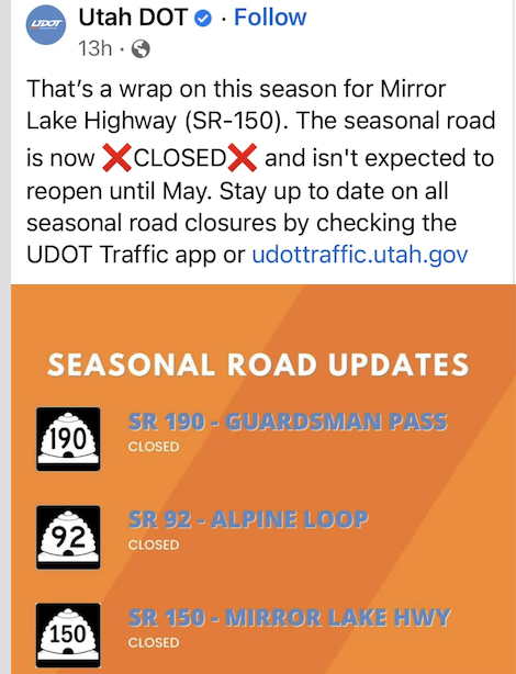
Mirror Lake Highway is closed for the season. SR-35 (Wolf Creek Pass) remains open.
Weather and Snow
This morning, the skies are mostly clear. Mountain temperatures are currently in the single digits F. Over the last 12 hours, the north-northeasterly winds have averaged 15-25 mph at mid-elevations, with some gusts above 40 mph at the uppermost elevation.
Today, skies will remain clear and temperatures should climb into the upper teens F. Winds will remain north-northeasterly averaging 10-20 mph at mid-elevations with gusts up to 30 mph at the highest ridgelines.
Looking ahead, high pressure should remain over the area for most of the week bringing clear skies and cold temps. Some precipitation could come in closer to the weekend.

Yesterday, I got out in the Wolf Creek Pass Zone. You can find the full observations HERE. Right now we are seeing a wide variety of snow surfaces, including surface hoar (flat crystals 3-5 mm, needles 3 mm) and soft snow in non-wind-affected areas, and a thin wind crust in wind-affected areas. We are also beginning to see complex layering within the snowpack. With dry weather on the horizon this complex, yet shallow snowpack has begun to weaken under the cold/clear skies through a process known as “faceting”. While this wouldn't immediately be a concern, once we get a large load of snow on top of it, the weak faceted snow will become a weak layer.
This upcoming period of dry weather will be a great opportunity to take note and begin mapping the variability and surfaces that are currently covering the range, as that will soon enough become the base of our snowpack for the season.
Large surface hoar near Wolf Creek Pass.

Folks have been getting out, and looking at terrain find their insightful observations and trip reports are found HERE.
Recent Avalanches
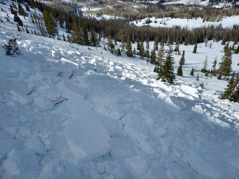
On November 12th, Micheal J remotely triggered a sizeable piece of snow in the NW-facing bowl of Wolf Creek. Breaking 16" deep x 200' wide, the hard wind slab broke on a thin layer of faceted snow formed 11/3, right before the big storm.
Find Micheal J's thoughts and more information on this slide HERE.
Ad
Avalanche Problem #1
Wind Drifted Snow
Type
Location
Likelihood
Size
Description
So far we are off to a great start, and in most places, the current snowpack is generally stable, and triggering an avalanche is unlikely. However, winds have been elevated throughout this past week and may remain gusty this coming weekend. This means small pockets of stubborn wind drifts are possible along upper-elevation ridgelines. Pay attention to any signs of wind-drifted snow such as rounded or pillow-shaped features. Remember, even a small avalanche can be deadly in consequential terrain.
Continue to take the normal precautions which always include exposing one person at a time to avalanche terrain so that the rest of your group is available to perform a rescue if an avalanche happens. Be prepared with your rescue gear through your training or in a class.
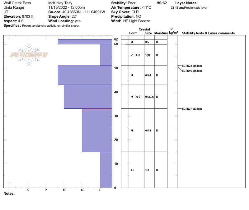
November 15th Field Day, finding weak snow both mid-snowpack and on the ground. Find full observation HERE.
Snowpilot from November 15th Field Day.
Additional Information
And we've been super busy this summer upgrading the western Uinta weather station network and this real-time info is found HERE (click weather stations, and then on the Western Uinta tab)
Your observations are important, so please let me know what you're seeing... click HERE and contribute to this amazing community-based program
General Announcements
Before it gets too crazy, now is the time to book an avalanche awareness presentation for your group, club, or posse. You can reach Craig directly at 801-231-2170 or [email protected].

This forecast is from the U.S.D.A. Forest Service, which is solely responsible for its content. This forecast describes general avalanche conditions and local variations always occur.