Donate to the 2024 Spring Campaign to help rebuild the UAC website.

Forecast for the Uintas Area Mountains

Craig Gordon
Issued by Craig Gordon for
Thursday, January 27, 2022
In general, you'll find LOW avalanche danger throughout the range and human triggered avalanches are unlikely. Is LOW danger... NO DANGER? Of course not... so, if you're getting into steep, technical terrain think about your exit strategy beforehand, consider the consequences of triggering even a small slide, and have a solid game plan in place prior to sending a big, committing line.
Low
Moderate
Considerable
High
Extreme
Learn how to read the forecast here
Weather and Snow
NOWCAST-
A dry cold front slides through the region early this morning, knocking temperatures into the single digits, and bumping northwest winds into the mid 20's along the high peaks. Tuesday's surprise storm went a long way to cushion old tracks, tired surface snow, and suncrusts. Avoid bottom feeding by steering your snow rig to mid elevation, wind sheltered, low angle terrain facing the north half of the compass and you're gonna be rewarded with a smooth ride.
FORECAST-
A few high clouds drift through the area this morning, but those should dissipate as the day wares on. West and northwest winds blow in the 20's and 30's and temperatures climb into the upper 20's.
FUTURECAST-
High pressure and warming temperatures round out the work week and linger through the weekend. Our potential weather change for early next week looks a bit more uncertain. We'll have a better feel in the next day or two.

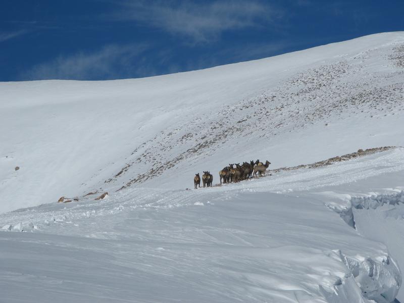
My field day plans and ridge access got shut down yesterday by this crew of locals traipsing along the high ridges.

Looking for real-time temps, snow, or wind?
Click HERE and then on the "western Uinta" tab for western Uinta specific, weather station network.
Recent Avalanches
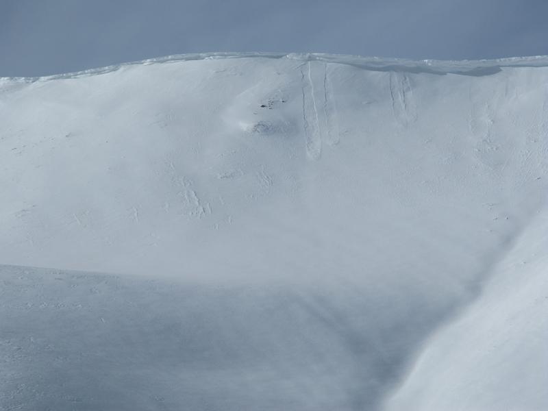
While manageable in size and depth, yesterday, a handful of new snow sluffs were reported on steep slopes throughout the range.

Click HERE for a list of recent avalanches.
A list of all other observations is found HERE

Your input is vital and we're interested in what you're seeing. Please contribute to this great community resource and go here to fill out an observation.
Ad
Avalanche Problem #1
Normal Caution
Type
Location
Likelihood
Size
Description
It's often said the snowpack is a lot like people and right now the pack is trending towards the mid portion of its life span. In most cases it's fat (but in a good way :), happy, and getting comfortable in its own skin, but more importantly it's grown solid, predictable, and reliable. What this means for us is... the snowpack is stable, there's no shortage of "Green Light" terrain, and it's time to take advantage of Low avalanche danger.
A couple things to keep in mind as we start stepping into big, committing terrain-
  • Recent west and northwest winds created dense, hard drifts on upper elevation leeward slopes and around terrain features like chutes and gullies.
  • Take a minute and carefully evaluate each steep slope on an individual basis
  • Consider the consequences of triggering an avalanche and remember that even a small slide that knocks you off your feet, board(s), or sled can instantly ruin your day.
Additional Information
While we're waiting patiently for winter to return from its hiatus, take a few minutes and visit one of our beacon parks and test your rescue skills. Ted installed a Beacon Basin at the Bear River Trailhead and there's another park found at the northeast corner of the Nobletts Trailhead.
Your observations are important, so please let me know what you're seeing... click HERE and contribute to this amazing community based program
General Announcements
The information in this forecast expires 24 hours after the day and time posted, but will be updated by 07:00 Friday January 28th.
Before it gets too crazy, now is the time to book an avalanche awareness presentation for your group, club, or posse. You can reach me directly at 801-231-2170 or [email protected]
This forecast is from the U.S.D.A. Forest Service, which is solely responsible for its content. This forecast describes general avalanche conditions and local variations always occur.