Forecast for the Uintas Area Mountains

Issued by Craig Gordon on
Saturday morning, January 18, 2025
Saturday morning, January 18, 2025
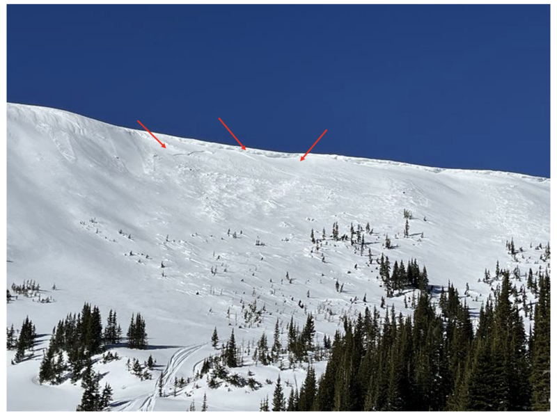
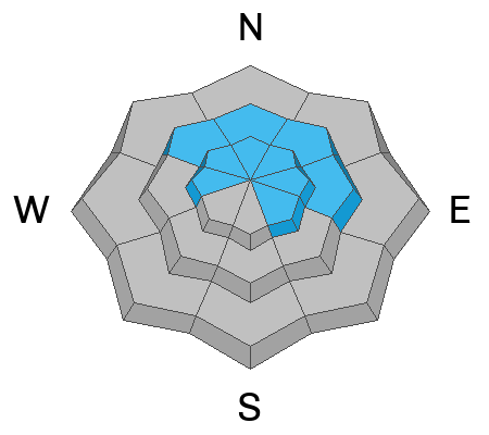
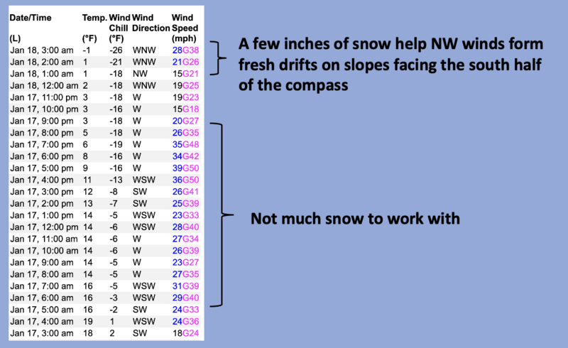
MODERATE avalanche danger continues today at and above treeline. Becoming pockety and harder to initiate, human triggered avalanches, breaking deeper and wider than you might anticipate are still POSSIBLE, especially in the wind zone on slopes facing northwest through north through southeast. In the more straight-forward and predictably manageable category... a few inches of storm snow coupled with strong winds delivers a round of fresh drifts on steep leeward slopes and human triggered wind slabs are also POSSIBLE, especially in terrain with an southerly component to its orientation.
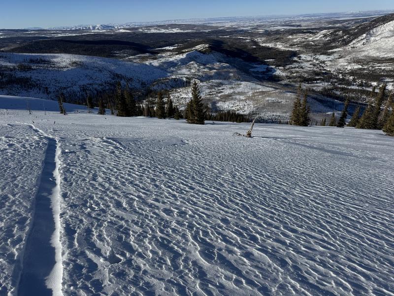
LOW avalanche danger is found in wind sheltered terrain particularly at lower elevations, like near our trailheads.

Low
Moderate
Considerable
High
Extreme
Learn how to read the forecast here