March Kicks Off Our Spring Campaign- Donate Now to Support Forecasting

Forecast for the Uintas Area Mountains

Craig Gordon
Issued by Craig Gordon on
Friday morning, January 17, 2020
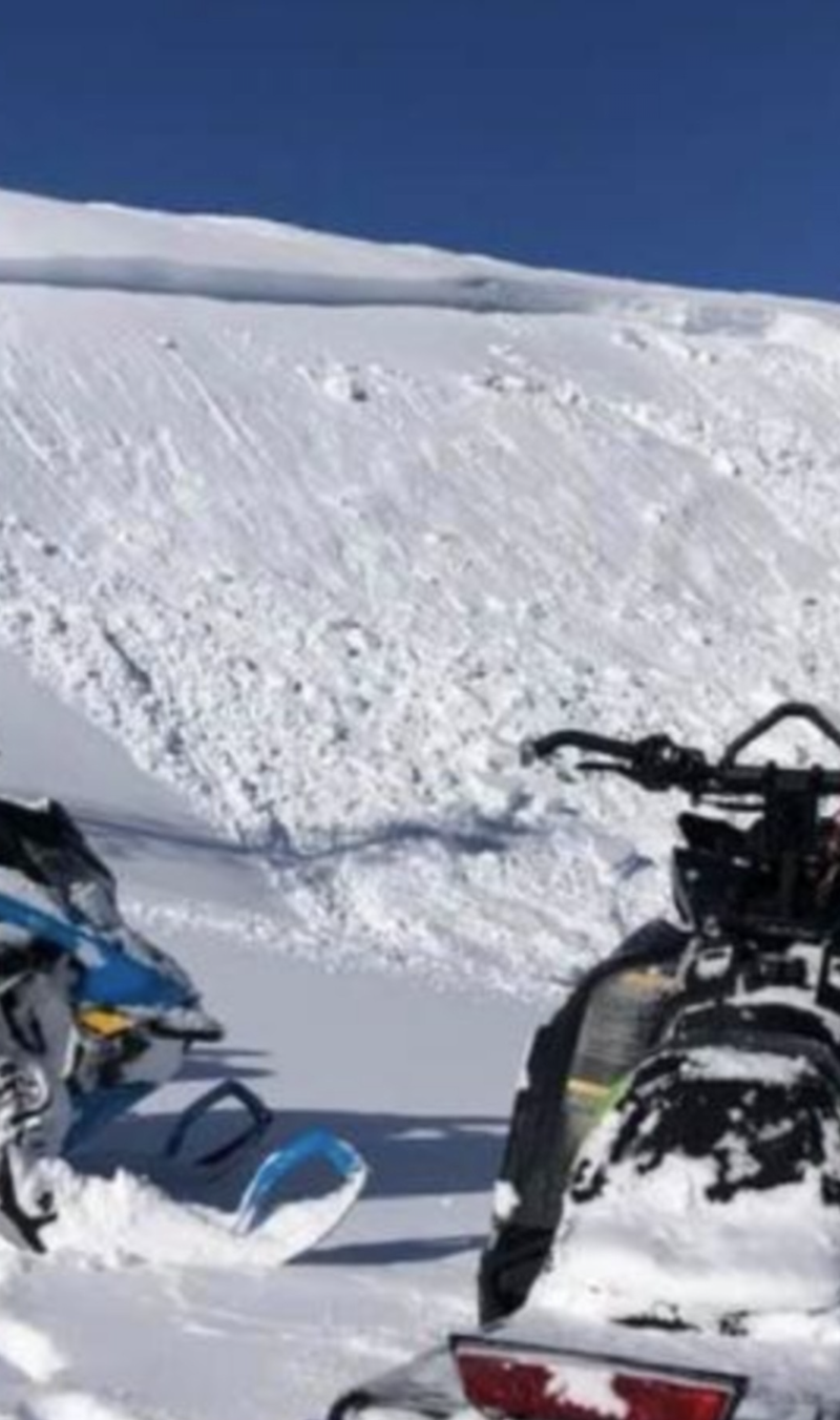
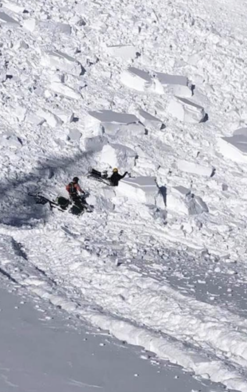
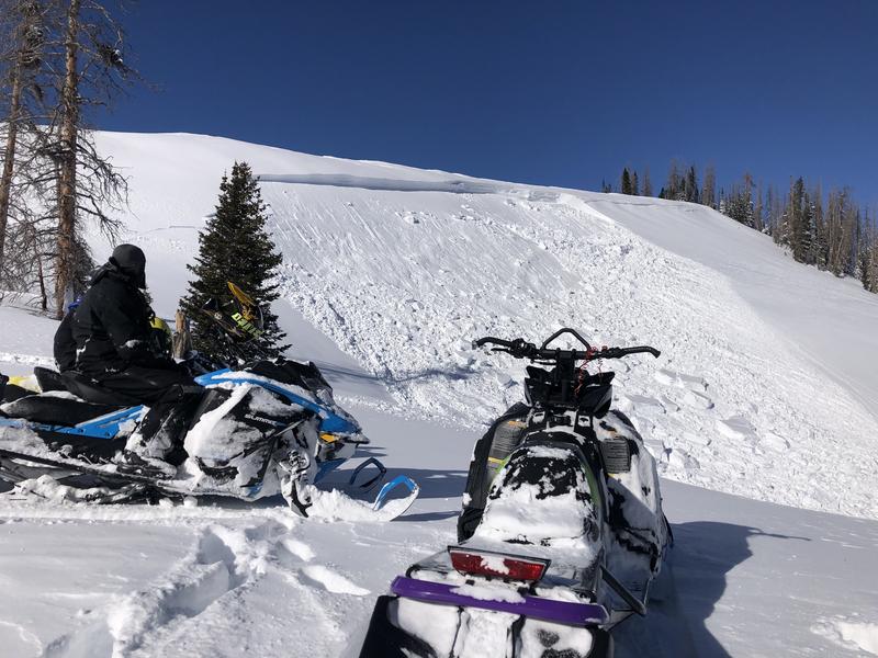
Heads up... we've got the perfect setup for avalanches to break on weak snow near the ground, resulting in a dangerously large slide that will instantly ruin your day.
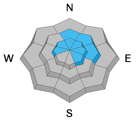
In upper elevation terrain in the wind zone, deceptively tricky avalanche conditions exist on steep, wind drifted slopes, especially those with an easterly component to its aspect. You'll find CONSIDERABLE avalanche danger in terrain with these characteristics and human triggered avalanches are LIKELY.
In addition, winds drifted snow onto steep, leeward, mid elevation slopes where a MODERATE avalanche danger exists and human triggered avalanches are POSSIBLE. Once triggered, today's drifts may break deeper and wider than you might expect.
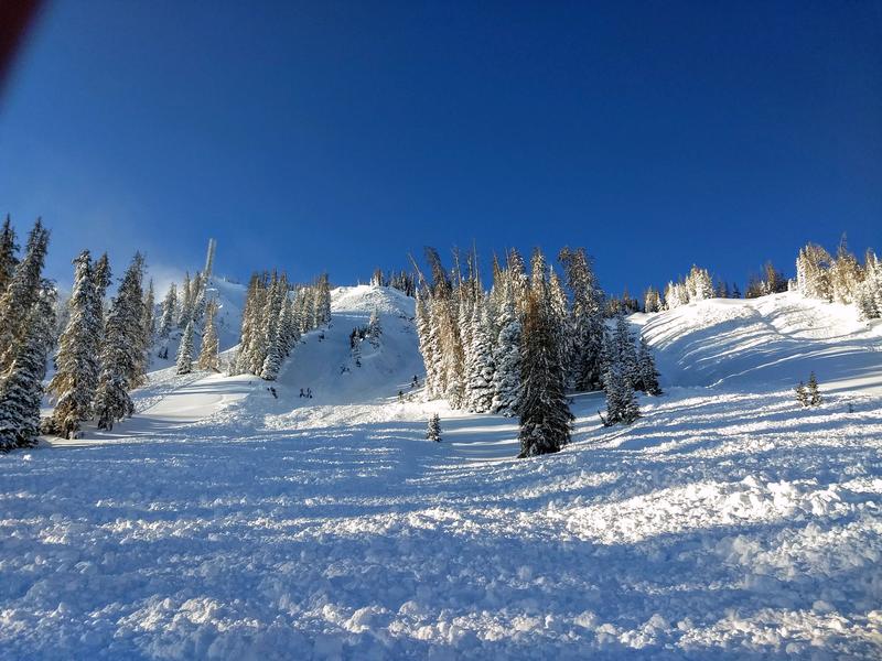
Your exit strategy-
Head to wind sheltered, low and mid elevation slopes or you can have a blast carving deep trenches in big open meadows
Low
Moderate
Considerable
High
Extreme
Learn how to read the forecast here
Weather and Snow
Currently-
Skies are mostly cloudy with temperatures in the teens and low 20's. However, southerly winds continue to steal the headlines, humming along the high ridges at 35-50 mph. Riding and turning conditions are gonna be hit or miss. Recent winds and warm temperatures had their way with our light powder, but you can still find soft settled snow on mid and low elevation wind sheltered slopes... or simply wait a few hours, get some chores done, and head out after today's storm snow stacks up.
Uinta weather network info is found here. Simply click on the Western Uinta tab.
For today-
There's a sharp cold front on our doorstep this morning and we should see snowfall develop in the next couple hours. Temperatures quickly cool through mid morning with several hours of snow squalls. We might see 6" of snow stack up before snowfall tapers off later today.
Futurecast-
A break in the active pattern is slated for this weekend providing mostly sunny skies, light winds, and warming temperatures.
Recent Avalanches
It's been a busy time on the eastern front with multiple human triggered slides reported since Wednesday.
Breaking overnight-
From Wolf Creek yesterday... rider was climbing, the slope shattered, he attempted to turn out of the slide, but got knocked off his sled. Both sled and rider where partially buried, but there were no injuries and lucky, everyone came out unscathed.
AND THESE LARGE SLIDES WERE TRIGGERED WEDNESDAY-
This is a big slide on the north side of Humpy Peak at about 10,600' in elevation. Triggered by the 5th rider on the slope, the avalanche broke 3'-5' deep, 1000' wide, and failed on weak snow near the ground. Lucky there was only one person on the slope, the group had eyes on their partner, and at the end of the day, everyone comes to home to their families. More details found here.
Meanwhile on the south end of the range near Blind Stream, riders found touchy conditions and reported... "Biggest avalanche we have seen in this area. We knew avalanche danger was high so we were being careful but triggered this one side-hilling down low on the hill."
To view additional trip reports and recent avalanche activity, simply click here.
Ad
Avalanche Problem #1
Wind Drifted Snow
Type
Location
Likelihood
Size
Description
The most in-your-face avalanche problem for today are fresh wind drifts.
Fact is, winds have blown in the 40's and 50's for days and they ramped up again yesterday and overnight. In addition, they've been all over the map, loading terrain in unusual locations and depositing snow further down-slope than we usually expect to see. Yep... winds changed the landscape and have created tricky avalanche conditions. With all the great riding right now there's no reason to pull on the dogs tail today, because once initiated, today's drifts will break deeper and wider than you might expect, creating a slide that quickly gets out of hand. Your best bet for avoidance is to simply steer clear of any fat, rounded piece of snow, especially if it sounds hollow like a drum.
Avalanche Problem #2
Persistent Weak Layer
Type
Location
Likelihood
Size
Description
Recent storm snow, water weight, and winds formed a dense, connected slab on the leeward side of upper elevation ridges. All of this additional weight stresses weak layers buried in the snowpack, bringing them back to life... and these layers are WOKE!
But here's the problem... while the region experienced a widespread natural avalanche cycle, much of the evidence is missing. Nearly all the crowns and slide paths filled back in from Tuesday nights wind. So you won't see one of the biggest clues to avalanches and of course, that's avalanches! Making matters more complicated is that some slopes have adjusted to the big two week storm and are good to go, while others just wait for us to roll along and knock the legs out from underneath. And here's the danger... once initiated, often low on the slope, avalanches have a distinct possibility of breaking much deeper and wider than you might expect.
Additional Information
Thanks to the generous support of our Utah ski resorts and Ski Utah, we have discount lift tickets available. All proceeds support the UAC. Get your tickets HERE.
Get one of these cool t-shirts to support the UAC and other avalanche centers across the U.S. INFO
General Announcements
The information in this forecast expires in 24 hours, but will be updated by 7:00 AM Saturday Jan. 18th.
This forecast is updated daily by 7:00 AM.
In the mean-time, if you see or trigger an avalanche or just wanna let me know what you're seeing you can reach me directly at 801-231-2170
It'll be a minute or two before we're riding, but while you're waiting....
This is a great time of year to schedule one of our free avy awareness presentations.
You can email me directly [email protected]
The information in this forecast is from the US Forest Service which is solely responsible for its content.